
Carnarvon National Park Map Geoscience Australia
$16.95
2 in stock
Description:
Carnarvon National Park Map Queensland Geoscience Australia NOW PRINT ON DEMAND on the Premises
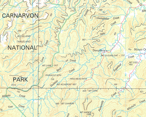
This map depicts the complete National Park at 1:250 000 scale (200 kilometres east to west and 93 kilometres north to south) and an enlargement of the Mount Moffatt and Carnarvon Gorge Section at 1:100 000 scale (55 kilometres east to west and 26 kilometres north to south).
Both maps contain natural and constructed features, including road infrastructure, foot tracks, vegetation, hydrography, contours (1:250 000 interval 50m and 1:100 000 interval 20m), localities and administrative boundaries.
ISBN 9314231000427
Read More
You may also like…
-
Carnarvon 1-250,000 Topographic Map
$15.95 – $30.95Select options This product has multiple variants. The options may be chosen on the product page -
Carnarvon 1-1,000,000 Topographic Map Geoscience Australia
$16.95 – $28.95Select options This product has multiple variants. The options may be chosen on the product page