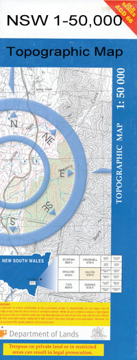
Baan Baa 1-50,000 NSW Topographical Map
$16.95
Description:
Baan Baa 8836-N 1-50,000 scale NSW Topographical map is used for Walking, 4WD, Fishing, Camping, Motorcycle, both On and Off Road, Gold Prospecting and for those simply going for a family weekend drive.
Topographical maps show not only Contours of the Terrain but also Walking Tracks, Sealed and Unsealed Roads, Rivers, Creeks, Lakes, Historical Point of Interest, Old Mine Sites and National and State Park areas.
 We can Now LAMINATE and fold your map for $12.00. Just click on the image and add to the Trolley
NOW AVAILABLE PRINT ON DEMAND
Locations within this Map
Greylands Belah Park Green Hills Springfield Belleview Glenelg West Haven Willarah Canilta Bowhills Rosewood The Myals Garrowen Claremont Ardmana Riverstone Wilga Trevalian Rockdale Mayfield Merilong Dal Blair Kurrawombi Longsight Burragarrium Belarah Burrawarna Park Box Flats Rosneath Bollol Westport Yarranabee Avondale Ulomo Mander Glenkeith The Bulga Leytonstone Tulla Mullen Allambie Denisdale Arlington Caloola Baconnoc Kobi Towri Nindethena Glenrob K-Dale Dunvegan East View Lynford Strathmore Chepy Hornsbie Blairmore Curracabah Booroomin Hillandra Southend Wynella Sunnyside Hamel Glenmore Hillview Baan Baa Baan Baan Baa Creek Baan Baa Public School Baan Baa Railway Station Baan Baa Tank Antonio Adams Well Bibblewindi Creek Bibblewindi State Forest Bohena Bore Box Flat Creek Box Flat Gully The Branch Creek Brigalow Bulga Hill Cowallah Cowalah Bore Cowallah Creek Curracubah Curracubah Creek Dangar Dead Bullock Creek Eather Spring Garlands Crossing Goona Goona Creek Gorman Hardys Spring Carlynne Creek Carlyon Dead Bullock Gully East Branch of Sandy Creek Kuhners Camp Kurrajong Creek Little Sandy Creek Nuable Parkes Pidgree Creek Pidgery Creek Pilliga East State Forest Pilliga National Forest Pine Creek Mount Pleasant Creek Plumbs Well Reedy Gully Rocky Dam Sandy Creek Spring Creek Staffords Well Tooley Creek Tooley Gully Tulla Mullen Creek Tuppiari Creek West Branch of Sandy Creek White Willala Yaraman Yaraman Creek Yellow Spring Creek Duck Creek Bohena Maules Creek Kihi Creek Borah Creek
| Name: | Baan Baa |
| Publisher: | New South Wales Government |
| Scale: | 1:50000 |
| Latitude Range: | 30° 30.0′ S – 30° 45.0′ S |
| Longitude Range: | 149° 30.0′ E – 150° 0.0′ E |
| Datum: | GDA 94 |

