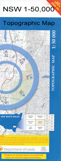
Bundemar 1-50000 NSW Topographic Map
$16.95
Description:
Bundemar 8534-S 1-50,000 scale NSW Topographical map is used for Walking, 4WD, Fishing, Camping, Motorcycle, both On and Off Road, Gold Prospecting and for those simply going for a family weekend drive.
Topographical maps show not only Contours of the Terrain but also Walking Tracks, Sealed and Unsealed Roads, Rivers, Creeks, Lakes, Historical Point of Interest, Old Mine Sites and National and State Park areas.
 We can Now LAMINATE and fold your map for $12.00. Just click on the image and add to the Trolley
NOW AVAILABLE PRINT ON DEMAND
Locations within this Map
Kulkine Tarella Tekoona Waigani Avalon Kenmuir Winnabri Hayfield Roping Pole Cow Plain Clairdon Innisfail Tralee The Wilgas Wilona Yuronah Kamilardy Ferndale Stud Park Methalibah Bundar Narroweena Yugilbar Bringa Bundijoe Merlwood Yungundi Kywong Glenwood Fernehurst Boonoon Myroora Wealla Riverview Wylinkra Old Bundemar Mirrawonga Lindley Ellengerah Bundemar Gleneve Glen Lossie Milpa Woodlea Brooklyn Wambianna Sheldons Eiraban Ashvale Meigunyah Wilgamar Maranoa Cardew Kickabil Mullah Gillawarrina Bowen Park Wemabung Merrinong Crillee Kookoora Burrinbar Karamea Macquarie View Tarara Narau Glenton Glenara Gowan Brae Pine View Cadadgan Oaklee Eastern Hill Dellwood Gordon Park Edithville Launel Springbank Warriston Rosewood Gin Gin Kelvin Grove Toobaroo West Toobaroo North Wambool Goonalara Dranane Drinane Beltona Lanley Dale Goburn Barooga Weemabah Wambool Roslyn Mandalay Parkdale Strathavon Buena Vista Tarthra Kirrawah Coboco Bugabada Carrigan Cobboco Coobocor Waterhole Crooked Creek Cuddil Creek Cuddil Dam Emogandry Euloon Cowal Gin Gin Creek Gin Gin Weir Goulburn Creek Greenhide Swamp Kickabil Junction Leechs Creek Long Plain Creek Mullah Cowal Old Coner Waterhole Old Man Creek Paddys River Pint Pot Gully Trangie Aerodrome Trangie Landing Ground Willow Tree Camp Cowal Drinane Public School Bundijoe Creek Bundijoe Creek South Ferndale Kickabil Creek Emogandry Creek
| Name: | Bundemar |
| Publisher: | New South Wales Government |
| Scale: | 1:50000 |
| Latitude Range: | 31° 45.0′ S – 32° 00.0′ S |
| Longitude Range: | 148° 0.0′ E – 148° 30.0′ E |
| Datum: | GDA 94 |

