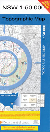
Euabalong 1-50,000 NSW Topographic Map
$16.95 – $31.95
Description:
Euabalong 8131N 1-50,000 scale NSW Topographical map is used for Walking, 4WD, Fishing, Camping, Motorcycle, both On and Off Road, Gold Prospecting and for those simply going for a family weekend drive.
Topographical maps show not only Contours of the Terrain but also Walking Tracks, Sealed and Unsealed Roads, Rivers, Creeks, Lakes, Historical Point of Interest, Old Mine Sites and National and State Park areas.
 We can Now LAMINATE and fold your map for $12.00. Just click on the image and add to the Trolley
NOW AVAILABLE PRINT ON DEMAND
Locations within this Map
Longdale Mount Boorithumble Waddi Ulinbawn Glenloth Garrawilla Scotts Craig Curriedale Euabalong Green Acres Pine Park North Wooyeo Wooyeo Wyuna Park Hyandra Murrin Bend Gurangully Riverglen Gunniguldrie Uabba Doone Woodstock Terrappe Poplars Oceanview The Cedars Glenroy Gum Creek Lake Creek Avalon Ona Vale Murrin Bridge Bingle Bingle Mountain Bimbalingel Waterhole Booberoi Creek Cargelligo Weir Chinamans Lagoon Crowie Creek Curlew Water Deep Creek Eribendery Euabalong Public School Euabalong Racecourse Euabalong West Euabalong West Public School Euabalong West Railway Station Mount Grace Gumbagunda Campbell Lake Carowie Creek Curlew Lake Village of Euabalong Euabalong West Siding Village of Euabalong West Hovell Mountain Lachlan Lake Cargelligo Weir Long Swamp Malki Mallee Mellelea Mallelea Mellelea Loop Mellelea Siding Mount Davidson Mount Torrens Needles Swamp Round Hill Mallee Fowl Faunal Reserve No. 11 Round Hill Nature Reserve The Sheet of Water Shepherds Hill Trigalong Ulalu Ulambong Ulambong Waterhole Warraway Warraway Mountain Websters Mountain Whoey Whoey Mountain Wooyeo Lake Back Whoey Cagellico Ina North Hyandra New South Wales State of New South Wales Round Hill Mallee Fowl Faunal Reserve Number Eleven Mount Warraway Mount Boorithumble Station Murrim Bridge Community The Sheet Water The Curlew Water
| Name: | Euabalong |
| Publisher: | New South Wales Government |
| Scale: | 1:50000 |
| Latitude Range: | 33° 00.0′ S – 33° 15.0′ S |
| Longitude Range: | 146° 0.0′ E – 146° 30.0′ E |
| Datum: | GDA 94 |

