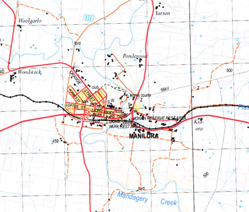
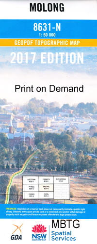
Molong 1-50000 NSW Topographic Map
$16.95 – $31.95
Description:
Molong 8631-N 1-50,000 scale NSW Topographical map is used for Walking, 4WD, Fishing, Camping, Motorcycle, both On and Off Road, Gold Prospecting and for those simply going for a family weekend drive.
Topographical maps show not only Contours of the Terrain but also Walking Tracks, Sealed and Unsealed Roads, Rivers, Creeks, Lakes, Historical Point of Interest, Old Mine Sites and National and State Park areas.
 We can Now LAMINATE and fold your map for $12.00. Just click on the image and add to the Trolley
NOW AVAILABLE PRINT ON DEMAND
Locations within this Map
Kerrs Vale Kalnee Nandillyan Ponds Wolabler Patrician Manildra Molong Back Creek Bald Hill Barton Creek Benya Bocobra Creek Bocoble Creek Bocoble Gap Bocable Gap Bobs Creek Blackfellows Gully Boree Cabonne Boree Hollow Boreenore Creek Boree Nyrang Boree Swamp Borenore Borenore Caves Borenore Creek Borenore Railway Station Box Hill Brays Flat Creek Brays Hill Brays Mountain Brymedura Budgerydickeys Springs Cabonne Camels Hill Cheesemans Creek Coates Creek Cockatoo Gully Copper Hill Crokers Range Cumble Eagle Rock Hill Fairbridge Reserve Fair Hill Farrells Grave Creek Fig Tree Flash Jacks Creek Garra Garra Cemetery Garra Well Goanna Goanna Hill Golden Gully Grail Creek Greentrees Creek Gregra Gumble Gumble Creek Gumble Pinnacle Gumble Scrub Hospital Hill Jacks Creek Jacobs Well Keenans Hill Camels Mount Eagle Rock Town of East Molong Emu Hollow Fairbridge Farm School Garra General Cemetery Garra Public School Goonigal Gregra Public School Guanna Guanna Hill Gumble Public School Jeerabung Kellys Creek Killonbutta Killonbutta Creek Killonbutta State Forest Kingsley Fairbridge Memorial Reserve Little Copper Hill Livingston Hill Livingstone Hill Livingstone Hill Creek Long Cave Lords Gap Lower Cumble Mackeys Creek Mackeys Hill Mackeys Mount The Main Ridge Mandagery Mandagery Creek Village of Manildra Manildra Cemetery Manildra Creek Manildra Public School Manildra Railway Station Manning Spring Creek Manning Spring Swamp Meronburn Molong Central School Molong Railway Station Moss Hollow Creek Moss’s Hollow Creek Mountain Statiion Creek Mouse Hole Creek Mouse-Hole Creek Nandillyan Noahs Ark Range Noahs Ark Ridge Nuggetty Gully Pine Hill Pine Ridge Pinks Creek The Pinnacle St Germains Creek Red Hill Reedy Creek Sandy Creek Sandy Creek Public School Shades Creek Shades Ridge Shingle Ridge Creek Spencers Creek Spencers Gully Spring Creek Sugarloaf Creek Swampy Watercouse The Bogey Flat The Shades Upper Gumble Vale Head Walkers Creek Wallaby Rocks Wattle Creek Wattle Flat Gully Town of West Molong White Flat Wologalong Woologalong Hill Yuranigh Yuranigh Creek Yuranighs Aboriginal Grave Historic Site Bumberry Dirt Hole Creek Dulladerry Dry Creek Dulladerry Creek Burramogong Lagoon Scott Creek Amaroo Railway Station Gregra Platform Jeerabung Railway Station Meranburn Railway Station Pinecliff Station Amaroo Honan Park Emu Creek Mackays Mount Meranburn Pinecliffe Bocobra Larras Lee Dundarbang Barton Mountain Home Calula Creek Boxleigh Goonigal Creek Nyrang Gillgilbury Creek
| Name: | Molong |
| Publisher: | New South Wales Government |
| Scale: | 1:50000 |
| Latitude Range: | 33° 00.0′ S – 33° 15.0′ S |
| Longitude Range: | 148° 30.0′ E – 149° 0.0′ E |
| Datum: | GDA 94 |


