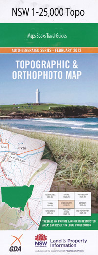
Myall Lake 1-25,000 NSW Topographic Map
$16.95
Description:
Locations within this Map
Watjahra Burraduc Buttaba Fekala Farm Eurobin Park Bibby Harbour The Big Gibber Big Gibber Headland Big Island Blossom Point Bird Island Boolambayte Boolambayte Hill Boolambayte Lake Boolambayte Public School Booloombayt Lake The or Myall Lake Booloombayt Boulders Point Boulders Rock Branch Creek Bridge Hill Brush Creek Brush Gully Bulahdelah Bulahdelah State Forest Bullah Delah Bullah Delah State Forest Caves Hill Clarks Bay Corrigans Bay Corrigans Head Corrigans Island Dairy Point Eurunderee Fig Tree Point Fiona Beach Gnahpeang Goat Island Horse Point Johnsons Beach Johnsons Hill Johnsons Island Kataway Kataway Bay Kataway Hill Koolonock Lamins Point Lemon Tree Point Limestone Hill Little Island Long Point Long Point Bay Lower Boolambayte Lake Mcgraths Mcgraths Bay Mcgraths Hill McGraths Island Mayers Bay Mayers Flat Mayers Point Middle Camp Mill Bay Myall Lake Myall Lakes National Park Neranie Bay Neranie Head Neranie Neranie Sands One Horse Sands Palmers Bay Pats Head Pigeon Point Pretty Flat Bay Rabbit Point Red Hill Reedy Point Russells Bay Russells Island Sheep Island Shelley Beach Shelley Point Shelly Beach Shelly Point Shinglers Creek Simons Point Slide Hill Smiths Hill Stinging Tree Bay Stinging Tree Point Submarine Beach Swan Point Tickerabil Tickerabil Point Tickerabit Toms Hill Tracy Palmer Memorial Lookout Tracys Lookout Upper Boolambayte Lake Violet Violet Hill Violet Hill Passage Wallaby Joes Bay Wamwarra Bay Wares Bay Wears Bay Yagon Yagon Gibber Yagon Gibber Headland Bulls Bay Double Islands Bungarie Bay Bunghery Bungwahl Bungwahl Cemetery Village of Bungwahl or Neranie Bungwahl Public School Burraduc Public School Burrah Burrah Peak Burrah Burrah Point Two Mile Lake The Narrows Henrys Point Mount Chapman Booloombayt Homebush Stokes Hill Wamwarrah Wamwarra Creek Beulah Double Island Boolambayte Creek Booloombayt Creek McGraths Hill Edith Breaker
| Scale: | 1:25000 |
| Latitude Range: | 32° 22.5′ S – 32° 30.0′ S |
| Longitude Range: | 152° 15.0′ E – 152° 30.0′ E |
| Datum: | GDA 94 |
| Approx Print Size: | 0.56m X 1.11m |

