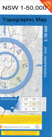
Rankins Springs 1-50,000 NSW Topographic Map
$16.95 – $31.95
Description:
Rankins Springs 8130S 1-50,000 scale NSW Topographical map is used for Walking, 4WD, Fishing, Camping, Motorcycle, both On and Off Road, Gold Prospecting and for those simply going for a family weekend drive.
Topographical maps show not only Contours of the Terrain but also Walking Tracks, Sealed and Unsealed Roads, Rivers, Creeks, Lakes, Historical Point of Interest, Old Mine Sites and National and State Park areas.
 We can Now LAMINATE and fold your map for $12.00. Just click on the image and add to the Trolley
NOW AVAILABLE PRINT ON DEMAND
Locations within this Map
Cowan Lea Kilburnie Bailallie Koomaringa Gladeswood Kia Ora Meringe Wongabah Wyoming Nargoon Iona The Brae Selby Malonga Park Nildesperandum Currageen Wooldale Amherst The Ranch Marungie Craigie Lea Morella Park Invercargill Yaccabri Glenrowan Conapaira Oatlands Park Woronora Lorraine Redlands Cowalla Heatherbrae Wongabulla Uplands Benyule Wattle Vale Wilga Park Wandella Mallala Karimbla Bournbank Banool Naroola Marungi Wirringulla Orita Forest Lodge Benlee Mallee Downs Quondong Park Thorburn Carrigane Yarran Vale Acres Cocoparra Peak View Bundarra Balls Tank Bigwater Dam Black Elephant Hill Bourke Brewers Dam Catherine Park Chinamans Spring Cocoparra Bluff Conapaira East Conapaira East State Forest Conapaira Ridges Conapaira South Conapaira South State Forest Conapaira Tank Conroy Davies Dam Durnans Tank Eight Mile Tank Erigolia Erigolia Cemetery Erigolia Railway Station Five Mile Tank Flagstaff Hill Gap Dam Gap Dam State Forest Grong Grong Railway Station Cocopara Conapaira Spring Coppermine Creek East Cocoparra Range Erigolia Siding Erigolia Tank Lachlan Range State Forest The Long Tank Lower Bigwater Dam Mackintoshs or Mailmans Creek McGruets Tank McNallys Tank Mailmans Creek Mailmans Gap Melbergen Mount Melbergen Melbergen Range Melbergen Ridges Murungie Map Merungi Gap Mud Hut Tank Mudtown Dam Perrignons Tank Pulletop Pulletop Tank Rankins Springs Rankins Spring Rankins Springs Cemetery Rankins Springs Public School Scrubby Range Scrubby Ridge Sims Gap Simms Gap Tabbita Taleeban Station Taleeban Tank Talleban Taleeban The Black Elephant The Bluff The Gap Dam Village of Erigolia Village of Rankins Springs Village of Talgeban Wirringulla Public School Conways Tank Rankins Springs Racecourse Holdup Gate Griffith Arboretum Allen Park Altin Park Cocapara Glenalbyn Brooks Hill Narriah Creek Cocoparra Creek Tabbita Range Cocoparra Range
| Name: | Rankins Springs |
| Publisher: | New South Wales Government |
| Scale: | 1:50000 |
| Latitude Range: | 33° 45.0′ S – 34° 0.0′ S |
| Longitude Range: | 146° 0.0′ E – 146° 30.0′ E |
| Datum: | GDA 94 |

