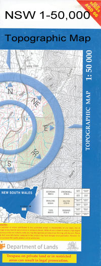
Wamboyne 1-50000 NSW Topographic Map
$16.95 – $31.95
Description:
8330-N Print on Demand
Belle Forest Moora Moora Yarranlea Malua Wilga Vale Goddens Plain Widgeewong Glenview Gilcaster Gleneda Wamboyne Waieda Warradyne Allambie Lilydale Wine Grove Laurel Park Aldersyde Kurragongs Coniston Lakeside Oaklands Hayfield Baaloo Park Thornton Woodland Malvena Lakeview Cowal West Meldrith Westlea Lovedale Hillview Dumfries Hillgrove Bonnie Doone Winnora Mon Repose Melrose Lake Cowal Rose Mead Toora Myola Strathnoon Calooa Yullundry Milly Milly Back Creek Back or Corringle Creek Bena Bena Cemetery Bena General Cemetery Bena Tank Billys Lookout Billys Lookout Creek Billys Lookout Tank Blow Clear State Forest Blow Clear Tank Blow Clear Bimbeen Bimbeen Tank Bogeys Island Bogies Lookout Bolagamy Boogies Island Cadalgulee Clear Ridge Clear Ridge State Forest Corringle Corringle State Forest Cowal Ellerslie Tank Fitzgerald Girdlers Tank Girral Government Tank Kalingan Village of Girral Kalingan Tank Lake Cowal Game Reserve Village of Lake Cowal Lake View State Forest Little Blow Clear State Forest Livingstone Nerang Cowal Panama Panama Range Panama Ridge Pudding Stone Pudding Stone Hill The Rocky Dam Salt and Pepper Tank Sandal Sandy Creek Sharpless Creek Taylors Waterhole Telephone Tank Tullabung Hill Ugalong Ugalong or Upper Bena Dam Ugalong Tank Ungarie Ungarie State Forest Wamboyne Dip Tank Wamboyne Mountain Wamboyne Racecourse Wamboyne Tank Younga Plain Burcher Burcher Public School Village of Burcher Wyrra Siding Wamboyne Siding Burcher Railway Station Corringle Siding Lake Cowal Railway Station Ugalong Dam Upper Bena Dam Mountain Wamboyne Currajong Tank Corringle Station Girrel
| Name: | Wamboyne |
| Publisher: | New South Wales Government |
| Scale: | 1:50000 |
| Latitude Range: | 33° 30.0′ S – 33° 45.0′ S |
| Longitude Range: | 147° 0.0′ E – 147° 30.0′ E |
| Datum: | GDA 94 |
| Approx Print Size: | 0.56m X 1.11m |

