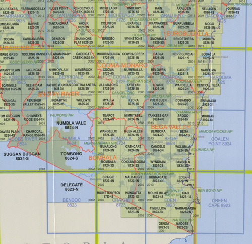
Yankees Gap 1-25,000 NSW Topographic Map
$16.95 – $28.95
Description:
Yankees Gap 8824-4-N 1-25,000 scale NSW Topographical map now print on demand is used for Walking, 4WD, Fishing, Camping, Motorcycle, both On and Off Road, Gold Prospecting and for those simply going for a family weekend drive.
Topographical maps show not only Contours of the Terrain but also Walking Tracks, Sealed and Unsealed Roads, Rivers, Creeks, Lakes, Historical Point of Interest, Old Mine Sites and National and State Park areas.
Locations within this Map
Bega Swamp Bemboka Bemboka Peak Bemboka State Forest Bemboka Walls Black Hill Bronte Brown Mountain Brown Mountain Creek Browns Creek Browns Gully Mount Carpenter Indian Head Mountain Little Brown Mountain Nelson Creek Nimmitabel Flat Numbugga Creek Ooranook Pigeon Box Pigeon Box Mountain Polacks Flat Polacks Flat Creek Pollacks Flat Creek Triggels Hill Walls Flat Warrigal Hill Warrigal Mountain Werriberri Werri Berri White Rock Yankees Flat Yankees Gap Yankeys Gap Werrinook Flora Reserve
| Scale: | 1:25,000 |
| Latitude Range: | 36° 30.0′ S – 36° 37.5′ S |
| Longitude Range: | 149° 30.0′ E – 149° 45.0′ E |
| Datum: | GDA 94 |
| Approx Print Size: | 0.56m X 1.11m |
| Publication Date: | 2013 |


