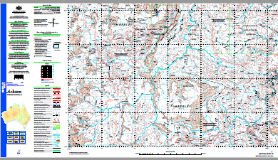
Ashton 1-250,000 Topographic Map GA
Price range: $15.95 through $27.95
Description:
Ashton 1-250,000 Topographic Map Geoscience Australia Print on Demand
Part of the Gibb River Road, see Gibb River Road Map Set for all 6 maps required
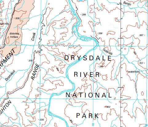
67 Creek Abandon Creek Arnyo Pool Ashton Range Bamboo Creek Bango Creek Banjo Creek Battery Creek Bittern Creek Black Springs Boiga Falls Boundary Creek Buffalo Flat Creek Bullet Paddock Bore Campari Bore Campbell Creek Carson Bore Carson Crossing Carson Escarpment Cheringoomerie Pool Changoola Creek Christella Falls Colochasia Creek Coodimirrie Hill Coucal Gorge Couchman Microwave Repeater Station Couchman Range Crossland Bore Crossland Creek Curlew Creek Damper Creek Dawrra Creek Donkey Creek Doongan Dromaius Creek Drum Creek Drysdale Crossing Drysdale River Drysdale River Aerodrome Durack Elasmias Creek Elasmias Falls Ellenbrae Ellenbrae Creek Euro Gorge Fern Pool Foster Range Gattenhof Hill Gibb River Gnamoongie Creek Granville Creek Green Flat Bore Hair Creek Head Hill Jacks Waterhole Jump Up Swamp King David Creek King Edward Bore Laurie Creek Loomeree Pool Lorikeet Creek Mainroads Creek Maitland Range Mango Springs Mango Springs Creek Marunbabidid Prap Prap Community Meelarrie Creek Meelarrie Waterhole Merringa Spring Miners Pool Mogurnda Creek Moongiyarrie Falls Morgan Falls Mosquito Hills Mount Beatrice Mount Bertie Mount Dorothy Mount Horace Mount Lawley Mud Springs New York Jumpups Old Doongan Creek Old Doongan Outcamp Oogalanoongoo Oomaloo Falls Oombulgurri Paradise Pool Pollard Hill Poonjurra Hill Prap Prap Camp Proudfoot Creek Pseudomys Hills Pussy Creek Rain Creek Rivers Creek Robinsons Bore Rocky Creek Russ Creek Serendipity Creek Sneezing Creek Speedy Creek Surprise Creek Tadarida Creek Tadarida Scarp Tommy Creek Turtle Hole Wades Bluff Watermelon Creek Wax Creek Wongalwarra Pool Wongaroodoo Gorge Woodhouse River Woorakin Creek Worriga Gorge Laudie Creek Ernest River Gardner Plateau Duraek River Mount McCrann New York Jump Ups Misquito Hills
| Name: | Ashton SD5213 |
| Publisher: | Geoscience Australia (Australian Government) |
| Scale: | 1:250,000 |
| Latitude Range: | 15° 00.0′ S – 16° 0.0′ S |
| Longitude Range: | 126° 0.0′ E – 127° 30.0′ E |
| Projection / Datum: | Universal Transverse Mercator, GDA94 |
| Approx Print Size: | 0.44m X 0.67m |
| Publication Date: | 1-Jun-03 |
Read More