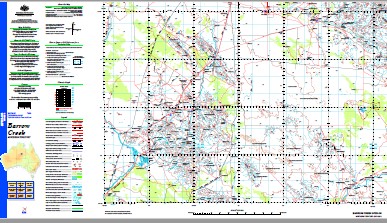
Barrow Creek 1-250,000 Topographic Map GA
Price range: $15.95 through $27.95
Description:
Barrow Creek 1-250,000 Topographic Map GA Print on Demand
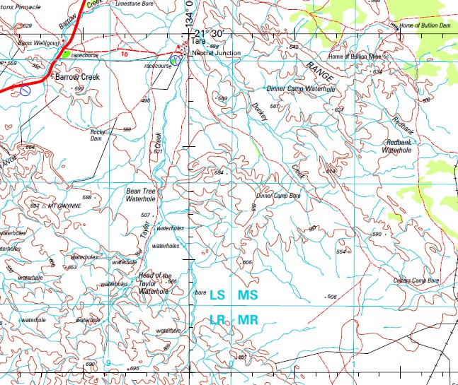
Ali Curung 5 Mile Bore Adnera Bore Adnera Creek Adnera Gap Adnera Waterhole Air Track Bore Alekarenge Pre School Alekarenge School Ali Curung Health Centre Ali Curung Police Station Amelia Creek Amengernterneah Ankweleyelengkwe Annerre Arabulja Waterhole Army Hole Atheley Atnwengerrpe Barrow Creek Barrow Creek Airfield Barrow Creek Cemetery Barrow Creek Telegraph Station Barrow Creek Wayside Inn Bean Tree Waterhole Billies Bore Bloodwood Bore Bluebush Bore Bottom Bore Boundary Bore Bullocky Bore Burns Well Camel Soak Bore Chabalowe Bore Claypan Bore Colters Camp Bore Crawford Bore Crawford Range Dinner Camp Bore Dinner Camp Waterhole Donkey Creek Emu Bore Forster Range Hanson Well Head Of The Taylor Waterhole Hickey Dam Home of Bullion Home Of Bullion Dam Horse Paddock Bore Illeuwurru Illoquara Waterhole Imangara Imperrenth Indaringinya Inkawenyerre Ivy Dam Iylentye Jemelke Jerries Bore Johnsons Waterhole Junction Well Laura Yard Limestone Bore Lurapulla Waterhole Merino Well And Bore Middle Well Millers Workings Millionaires Well Mosquito Bore Mount Gwynne Mount Mann Mount Morphett Mount Nelson Mount Octy Mount Stirling Mount Strzelecki Mount Topps Murray Creek Murray Downs Murray Downs Landing Ground Murray Downs School Nelson Bore Neutral Junction Neutral Junction School New Barrow Bore Ngkwarlerlanem Nine Mile Creek Nine Mile Waterhole No 10 Bore No 11 Bore No 12 Bore No 14 Bore No 18 Bore No 3 Well No 6 Bore No 8 Bore No 9 Bore North Bore Ooralingie Bore Osborne Dam Osborne Range Paddys Soak Well Redbank Creek Redbank Waterhole Rocky Dam Salt Lake City Bore Scrub Cairn Shady Bore Shirley Creek Soapy Bore South East Creek South East Creek Yard Spinifex Bore Spring Bore Spring Range Spring Range Bore Spring Range Waterhole Stapletons Pinnacle Stirling Stirling Creek Stirling Station School Stirling Swamp Stirling Well Tara Tara Health Centre Taylor Creek Taylor Hills Taylor Well Tinfish Well Turkey Flat Dam Watt Range West Dam White Top Wilora Wilora Health Centre Wood Duck Creek Yamba Dam Amella Creek Looga Rockhole Arabulga Waterhole Desert Well Bluebush Well Mount Strzeleki Number Twelve Bore Number Eleven Bore Bullock Well Number Fourteen Bore Home of Bullion Mine Five Mile Bore Fosters Range Beantree Waterhole Hansons Well Merino Well Mount Tops Ooralingle Bore Number Eight Bore Larapulla Waterhole Lurapulla Waterhole
| Name: | Barrow Creek SF53-06 |
| Publisher: | Geoscience Australia (Australian Government) |
| Scale: | 1:250,000 |
| Latitude Range: | 21° 0.0′ S – 22° 0.0′ S |
| Longitude Range: | 133° 30.0′ E – 135° 0.0′ E |
| Projection / Datum: | Universal Transverse Mercator, GDA94 |
| Approx Print Size: | 0.44m X 0.67m |
| Publication Date: | 1-Jun-00 |