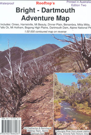
Bright Dartmouth Adventure Map Rooftop
$14.95
Description:
Bright Dartmouth Adventure Map Rooftop
The Highest of the High Country is finally here.
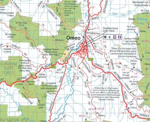
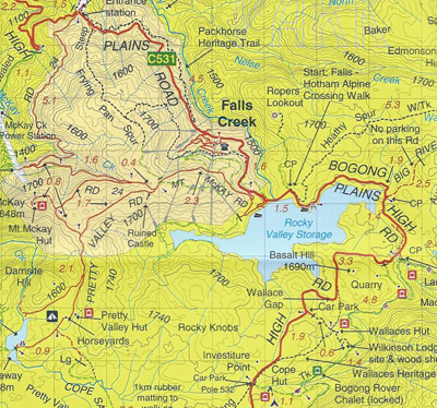
Includes Omeo, Victoria Falls, Dinner Plain, Falls Creek, Mount Feathertop, Falls Creek, Harrietville, Bright, Mount Beauty, Dederang, Mitta Mitta, Lake Dartmouth, Glen Valley, Anglers Rest, Benambra, Mount Beauty, Tarwonga etc.
Pictorial inset on the bush huts of the Bogong – Hotham region Including the following Huts, Wallaces Hut, Spargo Hut, Toms Hut, Deddicks Hut, Westons Hut, Tarwonga Hut, Kelly Hut, JB Plain Hut, Bogong Jack Hut North, Diamantina Hut, Kennedys Hut, Quart Pot Flat Hut, Blairs Hut, Johnsons Hut, Langfords Gap Hut, Cope Hut, mbtg Federation Hut Mt Feathertop, Edmondsons Hut, Mt Wills Fire Tower Hut, Faithful Hut, Ryders Hut.
A 1:50,000 scale Forest Activities Map of the Bogong, Bright & Mount Hotham Region fills the entire reverse side.
Printed on waterproof paper.
Additional product information
| Edition | 2nd Edition |
| Publication date | 2018 mbtg |
| Map Scale | 1:100,000 with 1:50,000 enlargement |
| ISBN | 9781921886287 |