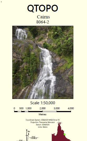
Cairns 1-50,000 Topographic Map
Price range: $15.95 through $27.95
Description:
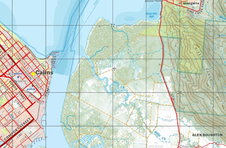
Cairns 1-50,000 Topographic Map Queensland
Locations within this Map
Cairns Yarrabah Admiralty Island Alligator Creek Barron Beach Barron River Bessie Falls Bessie Point Blackfellows Creek Boughtons Creek Brown Bay Brown Creek Bullburra Beach Bungalow Cairns Harbour Cairns North Cassowary Creek Casuarina Point Chinaman Creek Cowley Creek Crowleys Creek Deception Point Ellie Point Falls Creek False Cape Fitzalan Creek Fitzroy Island George Creek Giangurra Gordon Creek Mount Gorton Cape Grafton Grant Hill Green Island Green Island National Park Hamliffe Creek Hills Creek Kappa Creek King Beach Koombal Lily Creek Little Pine Creek Little Turtle Bay Lyons Point Mackey Creek May Peak Mick Creek Mission Bay Murray Prior Range Mount Murray Prior Nares Nisbet Range Oombunghi Oombunghi Beach Oombunghi Creek Palm Beach Picnic Hill Pine Creek Redbank Creek Redden Creek Rocky Island Rolling Bay Sawpit Gully Second Beach Seelee Creek Skeleton Creek Smiths Creek Stafford Point Sturt Cove Sunny Bay Trinity Trinity Inlet Turtle Bay Wahday Creek Wide Bay Wrights Creek Yarrabah Beach Mount Yarrabah Fitzroy Island National Park Gunjurra Island Middle Creek Saltwater Creek Trinity Forest Reserve Aeroglen Cairns City East Trinity Glen Boughton Parramatta Park Portsmith White Rock Cairns Regional Council Bulburra Beach Lumley Hill Cairns International Airport Little Barron River Edge Hill Gribble Point LittleTurtle Bay Yarrabah Aboriginal Community Yarrabah Mission Magazine Creek Senrab Point Woree Firewood Creek Trinity Island Oombunchi Beach White Rock Queerah Wright Creek
| Name: | Cairns 8064-2 |
| Publisher: | Queensland Government |
| Scale: | 1:50000 |
| Latitude Range: | 16° 45.0′ S – 17° 0.0′ S |
| Longitude Range: | 145° 45.0′ E – 146° 0.0′ E |
| Projection / Datum: | Universal Transverse Mercator, GDA 94 |
| Approx Print Size: | 0.56m X 0.56m |