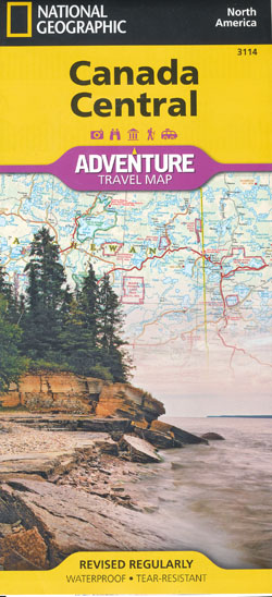
Canada Central Map National Geographic Folded
$26.95
1 in stock
Description:
Waterproof – Tear-Resistant – Travel Map National Geographic’s Canada Central AdventureMap is designed to meet the needs of adventure travelers with its durability and detailed, accurate information. The map includes the locations of cities and towns with a user-friendly index, a clearly marked road network complete with distances and designations for roads/highways, plus secondary routes for those seeking to explore off the beaten path for destinations between Alberta and Ontario. AdventureMaps differ from a traditional road map because of the specialty content they include. Each map contains hundreds of diverse and unique recreational, ecological, cultural, and historic destinations – outside of the major tourist hubs. Whether you are staying in the Polar Bear capital of the world on Hudson Bay, visiting Ontario’s award-winning wine region, or sitting beside a campfire in Algonquin Provincial Park, National Geographic AdventureMaps are the perfect companion to a guidebook, yet far easier to pack!
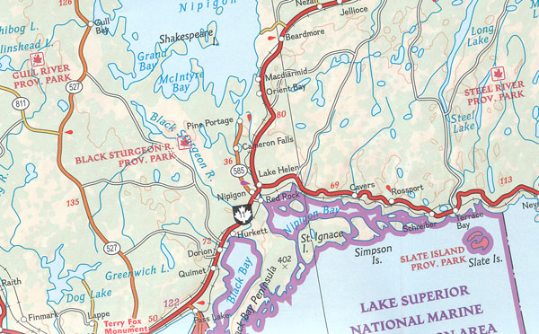
On side one, explore the diverse landscape of Manitoba, bordered by Ontario to the east, the arctic coastline of the Nunavut Territory to the north, and North Dakota and Minnesota in the south. Saskatchewan, where you are never far from lake or river recreational opportunities, lies directly to the west, bordered by the Prairie province of Alberta and Montana. The adventure continues on side two, heading to the extreme north with the untouched Labrador Peninsula and Inuit culture of Nunavut. Cross the James Bay to explore the many provincial parks of Ontario, or journey south to the maple hills and lakes of the Algonquin Upland. The Canada Central AdventureMap is printed in the United States on a durable synthetic paper, making it waterproof, tear-resistant, and capable of withstanding the rigors of international travel.
The map is two-sided and is folded to a packable size of (4.25″ x 9.25″); unfolded size is (26″ x 38″). Travel Tip! Due to the synthetic sheet that AdventureMaps are printed on, you can easily fold the map to a discreet size, showing just the area you’re interested in. Key Features: – Waterproof and tear-resistant – Designed and printed in the U.S.A. – Detailed topography with clearly labeled natural features – Major road networks – Hundreds of points of interest, including the location of provincial parks, UNESCO World Heritage Sites, and ski areas. – Thousands of place names with a detailed index – Important travel aids including airports, rail lines, and other infrastructure – Latitude/Longitude and UTM grids along with a compass rose and scale bars for accurate navigation with compass or GPS Net proceeds from the sale of this map go to support the nonprofit mission of the National Geographic Society. “Sheet Size = 25.50 x 37.75Folded Size = 4.25 x 9.25Scale = 1:2,100,000”
- Published: 28 February 2013
- Format:Sheet map, folded1 pages
- ISBN 13: 9781566956369
- ISBN 10: 1566956366