Cape Town and Surrounds Map Mapstudio
Description:
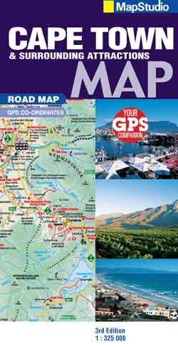
This detailed map of South Western Cape, Overberg and Winelands is at a 1:325 000 scale. Coverage includes Cape Town, west coast, cape Winelands, Stellenbosch, Franschhoek, Paarl, Wellington, Robertson, Hermanus, Breede River Valley, Overberg, Route 43, Boland, Hex River Valley, Swartland, whale route, Route 62. The street maps at a scale of 1:20 000 include coverage of Stellenbosch, Franschhoek, Paarl, Wellington, Hermanus, Somerset West, Strand, Montagu, Robertson, Worcester, Ceres, Tulbagh and Cape Town CBD. The map is perfect for scenic drives within the region.
It provides an index to place names and the big 6 attractions. The map includes an index to wine estates and features places of interest, tourist sites, historical sites, lighthouses, wine estates and wineries, swimming beaches, dive sites, whale watching sites, birding sites, farm stalls, 4×4 trails and hiking trails, memorials, parks, reserves and nature areas, hotels and caravan parks. The map gives tourist friendly text on top sites with historic information. The map shows topography indicating heights and GPS co-ordinates.
| Scale: | 1:325 000 |
| Edition: | 3rd |
| Format: | Folded Map |
| Size: | 250 x 130MM |
| ISBN: | 9781770261075 |