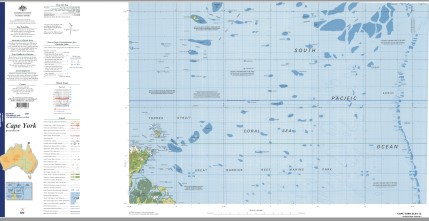
Cape York 1-250,000 Topographic Map
$15.95 – $30.95
Description:
Print on Demand
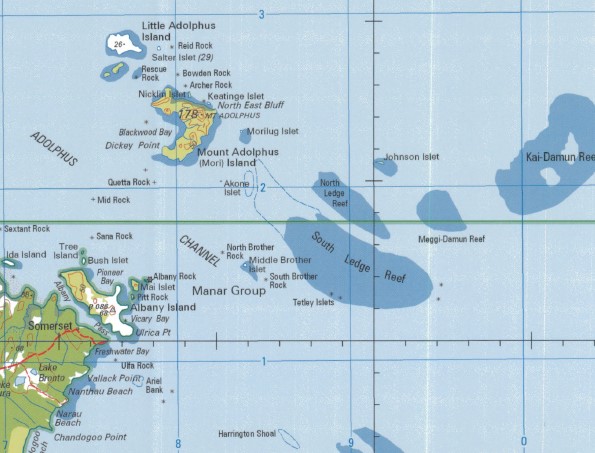
Warraber Ackers Shoal Adolphus Adolphus Channel Akone Islet Albany Island Albany Passage Albany Rock Alpha Rock Archer Rock Arethusa Point Ariel Bank Bay Point Beagle Rock Bet Islet Bet Reef Big Creek Black Rock Blackwood Bay Bowden Rock Mount Bremer Brewis Island Lake Bronto Bungaree Shoals Bush Islet Caldbeck Reef Cambridge Point Campbell Reef Carnegie Range Chandogoo Point Chinera Creek Cliffy Point Coconut Island Congora Beach Lake Congora Cumberland Passage Day Reef Dugong Islet Dutfield Rock Eborac Island Escape River Evans Bay Evans Point Filmer Fly Point Four Fathom Patches Freshwater Bay Getullai Island Half Way Island Harrington Reef Harrington Shoal Harvey Rocks Hibernia Passage Ibis Reefs Ida Island Johnson Islet Keatinge Islet Kennedy Inlet Kilbie Beach Kirkcaldie Reef Lacey Island Linda Reef Little Adolphus Island Long Island Reefs Lowry Islet Mai Islet Melanie Shoal Mew River Mid Rock Middle Brother Moresby Rock Morilug Islet Mount Adolphus Island Muddy Bay Nanthau Beach Narau Beach Newcastle Bay Newman Reef Nicklin Islet Ninepin Rock North Brother North Ledge Panther Shoal Piara Pioneer Bay Pitt Rock Poll Islet Polo Creek Quetta Rock Reid Rock Rescue Rock Rhine Rock Richardson Reef Mount Roma Saddle Island Saldogoo Beach Lake Saldogoo Salter Island Sana Rock Lake Sapaginya Sassie Island Seven Reefs Sextant Rock Seymour Shadwell Peak Shallow Bay Sharp Point Shortland Reef South Brother South Ledge Suarji Island Sue Islet Sue Island Tancred Passage Tern Cliffs Tern Island Tetley Island The Three Sisters Torres Strait Tree Island Triangle Reef Trochus Island Turtle Head Turtle Head Island Turtle Island Ulfa Rock Ulrica Point Vallack Point Veteran Shoal Vicary Bay Vigilant Channel Walker Shoal Lake Wicheura Wyborn Reef York Island Cape York Yule Entrance Womer Cay Jardine River Torres Shire Forbes Head Dickey Point Pinnacle Peak North East Bluff Frederick Point Alfred Point Charlotte Point Ida Point Little Ida Island Osnaburg Point Somerset Point Somerset Bay Bishop Point Stover Bay Somerset Tancred Pass Fly Entrance Nepkem Reef Long Island Sassie Gurigur Reef Sassie Reef Urui Reef Cocoanut Island Parremar Cocoanut Islands Moian Reef Derder Reef Halfway Islet Zuizin Island Pinnace Reef Gray Rocks Hibernia Pass Kodnasem Reef Bet Island Burrar Wreck Shoal Black Rocks Vin Islet Burke Island Suaraji Suaraji Island Kai-Wareg Reef Woiz Reef Gettulai Island Getullai Pole Island Guijar Poll Island Kai-Maituine Reef Meggi-Wareg Reef Maped Reef Meggi-Maituine Reef Beagle Rocks Maped-Au-Kap Reef Meiu Reef Gubmarau Reef Susur Reef Toms Son Bank Au-Masig Reef Dugang Island Dugong Island Wap Reef Bayag Reef Kagar Reef Nigger Head Jardine Rock Nicklin Island Keatinge Island Mount Adolphus Islands Mount Adolphus Mori Blackwood Bank Morilug Morilug Island Johnson Island Kai-Damun Reef Akone Island Akone Point Bush Island Mid Brother Meggi-Damun Reef York Road Fred Point Mai Island Paget Point Tetley Islets Pabaju Seymour Point Kloster Point Albany Pass Port Albany Orpheus Point Lyons Point Roma Flats Z Reef Y Reef Woomera Creek X Reef Kennedy River Jacky Jacky Creek Kennedy Midola River OK Village Riflebird Creek Shadwell Point Tern Islet
| Name: | Cape York |
| Publisher: | Geoscience Australia (Australian Government) |
| Scale: | 1:250000 |
| Latitude Range: | 10° 00.0′ S – 11° 0.0′ S |
| Longitude Range: | 142° 30.0′ E – 144° 0.0′ E |
| Projection / Datum: | Universal Transverse Mercator, GDA94 |
| Approx Print Size: | 0.44m X 0.67m |
| Publication Date: | 1-Jun-09 |


