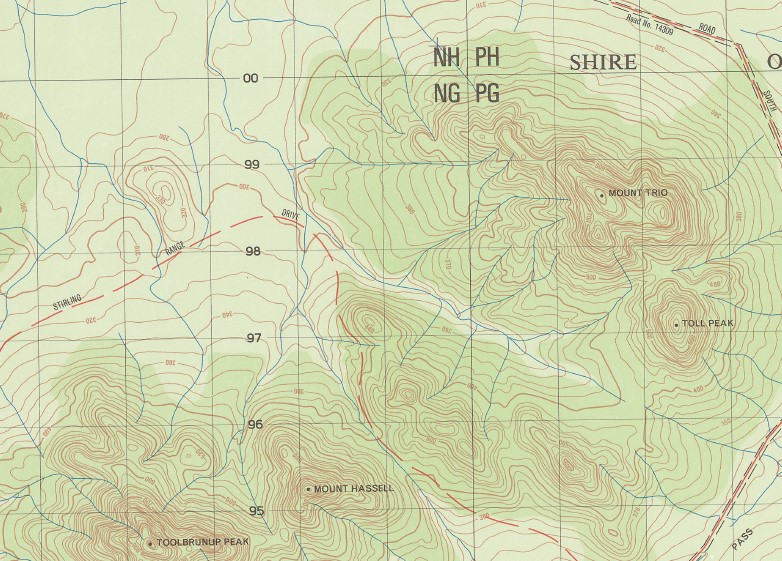
Chester Pass 1-50000 Topographic Map 2529-3 WA
$14.95
Description:
Chester Pass 1-50000 Topographic Map 2529-3 WA Print on Demand
Locations within this Map
Part of the Stirling Rages National Park 1985 edition map
Amelup Amelup Spring Cambawarra Camel Lake Nature Reserve Chester Pass Coyanarup Peak Gold Holes Kyanorup Eminence Mabinup Creek Moingup Spring Mount Hassell Mount Success Mount Trio Ongarup Creek Paper Collar Clays Paper Collar Creek Pillenorup Swamp Rhonda Vale Salt Creek Stirling Range Stirling Range National Park Toll Peak Toolbrunup Peak Warrungup Wedge Hill Yungermere Peak Papa Colla Creek Warrungup Hill Coyanarup Castle Peak Toolbrunup Yungermere
| Name: | Chester Pass |
| Publisher: | Geoscience Australia (Australian Government) |
| Scale: | 1:50000 |
| Latitude Range: | 34° 15.0′ S – 34° 30.0′ S |
| Longitude Range: | 118° 0.0′ E – 118° 15.0′ E |
| Projection / Datum: | Universal Transverse Mercator, GDA94 or WGS84 |
| Approx Print Size: | 0.56m X 0.56m |
| Publication Date: | 1-Jun-85 |
Read More


