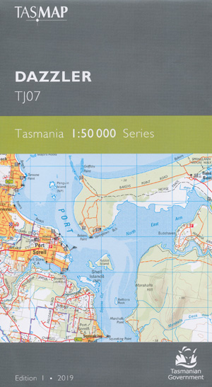
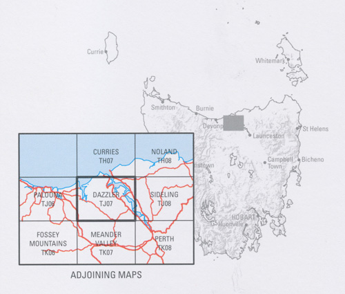
Dazzler 1-50,000 Topographic Map Tasmap
$13.95
1 in stock
Description:
Dazzler 1-50,000 Tasmap Topographic Map
Locations within this Map
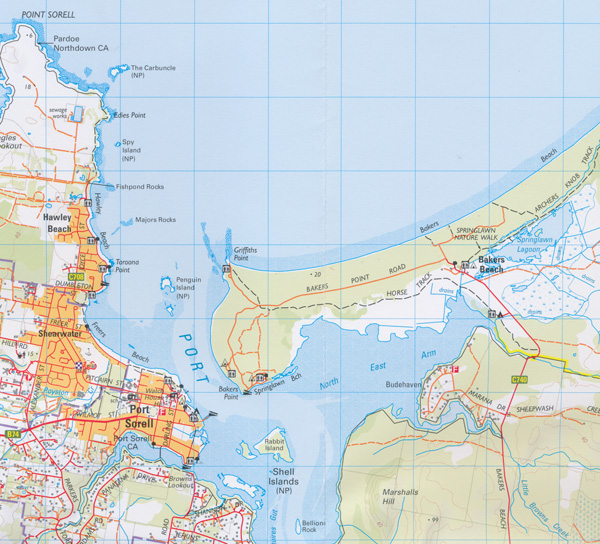
Forest Gate Panatana Banksia Rise Larooma Evergreen Rubicon Estate Westward Ho Bendermere Fairhaven Caringal Greenhythe Whirlpool Lodge Craigburn Rema Hazelwood Constant Springs Hillwoodville Kawana Seaview Riverview Rhyll Torrington Marraway High View Padouk Taronga Leam Elphin Grove Rookery The Roma Don Roamin Karingal Walhalla Den Balla Everest Los Angelos Wisedale Loch Sloy Sunbury Farnham Hillvue Glen Rose Rosslyn Wyndringham Grasmere Pantrees Maryland Glenwood Park Jennyfield Beaconsfield Beauty Point Exeter George Town Gravelly Beach Lanena-Blackwall Port Sorell Paper Beach Kelso Aintrees Creek Anchor Point Andersons Creek Appin Creek Archers Knob Drumstick Islet Drunkards Creek Drys Sugarloaf Duke Creek Eagle Gorge Eagle Point Eagle Point Beach Eaglehawk Gully East Arm East Sassafras Edies Point Arthurs Head Asbestos Range Ashmans Point Atkinsons Creek Bakers Beach Bakers Point Bald Tier Barnes Hill Barretts Lookout Barretts Point Batman Bridge Beaconsfield Plantation Beaconsfield Reservoir Bell Bay Bell Bay Line Bell Bay Station Bellions Rock Big Bay Blackmans Creek Blackwall Blades Hill Blyth Creek Boats Crew Point Bonnie Beach Bradleys Beach Bradys Lookout Bradys Lookout State Reserve Branchs Creek Branchs Creek Plantation Brands Creek Brandy Creek Brandy Pond Brickmakers Point Bridgenorth Briggs Creek Briggs Regional Reserve Browns Creek Browns Lookout Bruins Pond Bryants Bay Budehaven Bull Island Cabbage Tree Hill Cimitiere Point Clarence Point Clog Toms Creek Cobblestone Creek Coppermine Creek Cottons Hill Crescent Shore Cummings Creek Currong Reserve Dalgarth Hill Dans Hill Dans Hill Conservation Area Davis Cove Dazzler Range Deceitful Cove Devils Elbow Deviot Dirty Bay Doctors Flats Donovans Bay Egg Island Egg Island Creek Egg Island Point Examiner Rock Exeter Golf Course Exeter Showground Farradys Creek Felminghams Creek Fenton Creek Finger Point Fishpond Rocks Flag Creek Flowers Hill Flowery Gully Flowery Gully Cave Foresters Hill Four Mile Creek Fourteen Mile Creek Frankford Franklin Rivulet Freers Beach Freshwater Creek Grass Island Great Dragon Great Mary Ann Creek Greens Creek Griffiths Point Grindelwald Garden Island Garrow Rock Gaunts Hill Gem Rock George Town Golf Course George Town Station Glengarry Goaty Hill Gowans Creek Gum Scrub Creek Gwins Sugarloaf Harford Hawley Beach Hillwood Holwell Holwell Falls Holwell Gorge Holwell Gorge State Reserve Hospital Point Howell Reservoir Ilfraville Inspection Head Ironstone Hills Jack Whites Creek Jarmans Bay Johnston Creek Johnstons Flats Jubb Creek Jubilee Park Kangaroo Rivulet Kayena Keeles Cutting Kellys Lookout Kelso Bay Kermode Creek Kid Island Lades Tongue Land O’Cakes Creek Lanena Lauriston Reservoir Lawrences Bluff Leviathan Hill Lightfoot Bay Little Badger Head Little Black Sugarloaf Little Branchs Creek Little Browns Creek Little Devils Elbow Little Dragon Little Mary Ann Creek Little Supply River Little Swan Point Little Wonder Pond Lockwoods Point Loira Londonderry Creek Long Reach Macquarie Rivulet Mahoneys Creek Majors Rocks Marsh Island Marshalls Creek Marshalls Hill Marshalls Point Masseys Creek Matthews Creek Middle Arm Middle Arm Conservation Area Middle Arm Creek Middle Island Middle Island Conservation Area Middle Point Miserable Islet Monarch Hill Monomeeth Reserve Moriarty Reach Mount Careless Mount Vulcan Mowbray Point Murphys Hill Narawntapu National Park Native Point Native Point Nature Reserve Newmans Bay North East Arm Notley Fern Gorge Notley Gorge State Reserve Notley Hills Oak Bluff Observatory Hill Orari Bank Orlando Creek Panatana Rivulet Parkers Ford Parrot Creek Peaked Hill Pease Creek Penguin Island Pipeclay Bay Point Effingham Point Rapid Point Sorell Point Vision Porpoise Rock Port Dalrymple Port Sorell Conservation Area Port Sorell Golf Course Porters Flats Portview Hill Poyston Creek Rabbit Island Ragged Islet Ralstons Hill Ratcliffes Point Redbill Point Redbill Point Conservation Area Redwood Bay Redwood Islet Reids Rock Retreat Cove Richmond Hill River Tamar Roaring Magg Hill Robigana Rocky Point Rookery Creek Rose Bay Rose Bay Park Rosevears Rowella Rowleys Beach Rubicon Hills Rubicon Reserve Rubicon River Conservation Area Ruffins Bay Salisbury Creek Salisbury Hill Saltpan Point Sandy Beach Sawyers Point Saxons Creek Scotchmans Point Scotties Shore Scotts Hill Second Sands Settlers Hills Shag Head Shag Rock Shearwater Shearwater Golf Course Sheep Tail Point Sheepwash Creek Sheepwash Hills Shell Islands Sideling Creek Sidmouth Sidmouth Conservation Area Simmonds Hill South East Arm Specimen Creek Spring Bay Spring Hill Springlawn Beach Springlawn Lagoon Spy Island Squeaking Point Squires Gut Staggs Creek Stewarts Hill Stockyard Hills Stone Quarry Bay Stony Brook Stony Rises Stringybark Hill Sugar Creek Supply Bay Supply Mill Bridge Supply River Swan Bay Swan Point Taroona Point Tatana Private Nature Reserve The Carbuncle The Rookery The Tump Tippogoree Tippogoree Hills Tunks Bridge Tunks Creek Vanishing Cave Virginstow Plantation Volunteer Creek Volunteer Hill Wallaby Creek Watch House Hill West Arm West Arm Conservation Area West Bay West Frankford West Tamar Council Whirlpool Reach Williams Creek Wilmores Bluff Windmill Point Windred Creek Wings Flats Winkleigh Wolverine Shoal Wurra Wurra Hills Yellow Marsh York Cove York Town York Town Rivulet Yorktown Historic Site Andersons Creek Forest Reserve Appin Forest Bayview Jetty Beauty Point Wharf Bell Bay Wharf Big and Little Plain Blackwood Hill Blyths Dock Bowens Jetty Bradleys Anchorage Brandy Creek Bridge Bream Creek Brumbys New Country Comalco Wharf Coppermine Creek Forest Reserve Cottons Creek Dalgarth Forest Reserve Dark Hollow Point Deviot Jetty Digneys Corner Dorchester Drys New Country East Head Emu Plain Ferry Wharf Four Mile Creek Bridge Fourteen Mile Creek Bridge Franklin Rivulet Bridge Franklin Rivulet Forest Reserve Greens Ford Half Tide Rock Hamiltons Creek Hillwood Jetty Inspection Head Wharf James Hill Leonardsburgh Little Wonder Dam Longridge Hill Lorymers Ford Mount Albany Mount Asbestos Mount Careless Forest Reserve Mount Edgecombe Mount Ossa Mount Pelion North Head Oyster Banks Parramatta Creek Bridge Peaked Hill Forest Reserve Point Flinders Rampers Pass Roaring Magg Hill Forest Reserve Rubicon River Bridge Salisbury Saxons Creek Bridge Settlers Range Sharp Peak She Oak Hill Soldiers Point Specimen Hill Stony Brook Bridge Supply River Bridge Tanker Wharf The Dazzler The Dragon The Gorge The Knoll The Valley Tippogoree Hills Forest Reserve Veteran Common Virginstow Forest Reserve Woody Sugarloaf Wybia Spit Wyetts Tram Georgetown Point Sorrell Port Sorrell Lauriston Creek Middle Bank Muddy Creek North East Bay Brown Creek Anderson Creek Small Creek The Dazzier Drumstick Island Redwood Island Whirlpool Rock Branch Creek High Rock Rubicon River Green Creek Deep Creek Miserable Island Franklin River Sassafras East Saxon Creek Stony Creek Tatana
| Name: | Dazzler |
| Publisher: | Tasmanian State Government |
| Scale: | 1 : 50000 |
| Latitude Range: | 41° 6.02′ S – 41° 22.29′ S |
| Longitude Range: | 146° 31.3′ E – 147° 0.0′ E |
| Format: | Folded Map |
| Approx Print Size: | 0.6m X 1.06m |
| Publication Date: | 2019 |
ISBN 9318923027587