
Esperence 1-250,000 Topographic Map
Price range: $15.95 through $30.95
Description:
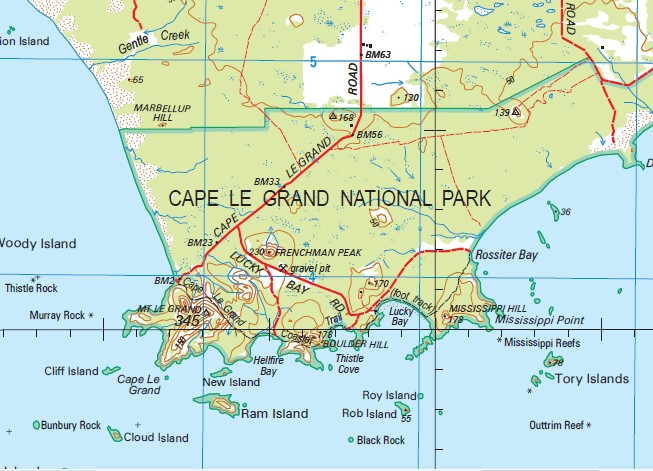
This 1-250,000 topographic map is part of the series that covers the whole of Australia at a scale of 1:250 000 (1cm on a map represents 2.5 km on the ground) and comprises 513 maps. This is the largest scale at which published topographic maps cover the entire continent. Each standard map covers an area of 1.5 degrees longitude by 1 degree latitude or about 150 kilometres from east to west and 110 kilometres from north to south. There are about 50 special maps in the series and these maps cover a non-standard area. Typically, where a map produced on standard sheet lines is largely ocean it is combined with its landward neighbour. These maps contain natural and constructed features including road and rail infrastructure, vegetation, hydrography, contours (interval 50m), localities and some administrative boundaries. The topographic map and data index shows coverage of the sheets. Product Specifications Coverage: The series covers the whole of Australia with 513 maps. Currency: Ranges from 1995 to 2009. 95 of maps have a reliability date of 1994 or later. Coordinates: Geographical and either AMG or MGA (post-1993) Datum: AGD66, GDA94, AHD. Projection: Universal Traverse Mercator (UTM) Medium: Paper, flat and folded copies.
Esperance Gibson 10 Mile Lagoon 11 Mile Beach 13 Mile Beach 6 Mile Hills 9 Mile Beach Adina Adlinga Akeringa Alexander Bay Alexander Hill Alexander Point Alexander River Amaroo Ansley Park Anster Farms Archipelago of the Recherche Aroona Bail Rock Bakaara Balanada Baleine Park Balfron Ballians Bandy Creek Bangalla Bannitup Lake Barely Island Barney Hill Baroona Farm Baudin Peak Bay Rock Baylemup Lake Bayliss Rock Bayou Beagle Reefs Beaumont Beaumont Bin Beaumont Island Belches Reefs Bemersyde Ben Island Benje Benjenup Lake Bindene Bishop Rock Bishops Road Farm Black Boy Creek Black Island Black Rock Blue Haven Blumanns Boolenup Lake Boonari Bostock Swamp Boulder Hill Bow Park Boxer Island Boyatup Boyatup Swamp Brecon Brenco Brigadoon Broomstick Hill Broughton Island Brown Reef Bukenerup Lake Bunbury Rock Burrubunna Burton Rocks Button Island Butty Harbour Butty Head Cabbykail Creek Cabbykail Well Caitup Caitup Downs Callenup Campbell-Taylor Group Canard Island Canning Island Canowindra Cap Island Cape Le Grand Cape Le Grand National Park Capps Island Carolyn Downs castle Rock Castletown Causeway Channel Cave Island Cheetup Hill Cheetup Lake Cherry Well Chadwick Chantilly Park Chapmans Point Charley Island Cheyne Point Circle Valley Circle Valley Farm Cliff Island Cloud Island Cluster Rock Clyde Hill Coates Reef Colina Collier Condingup Condingup Golf Course Condingup Lake Condingup Peak Condingup Primary School Cook Rock Coolinup Swamp Coramup Creek Coramup Hill Coramup Park Corbett Island Corless Farms Cornijup Cornwall Island Coronet Hill Cranmore Downs Creak Island Crystal Lake Cull Island Currumulka Dailey River Dajan Dalrymple Rock Dalyup Dalyup Agricultural Area Dalyup Park Dalyup River Dalyup River Pioneer Reserve Dalyup River West Dampier Rock Dart Reefs Dauphin Park Davy Island Dempster Head Dempster Heights Park Devils Rock Dicken Reef Diggers Rest Dingo Rock Dinner Camp Dodd Rock Dolphin Rock Doombup Doombup Agricultural Area Doombup Creek Doombup Lake Douglass Patch Doust Doust Swamp Draper Island Duchess Downs Duke Creek Duke of Orleans Duke of Orleans Bay Dunn Rocks Dunns Dwadiup Spring Elanora Elroy Em-A-Lee Downs Epasco Escape Rock Esperance Aerodrome Esperance Baptist Church Esperance Bay Esperance Downs Research Station Esperance Golf Club Esperance Hospital Esperancho Ewans Lake Fairmoor Ferguson Reefs Figure of Eight Island Finger Island First Tank Fleming Grove Foam Rocks Forrest Island Fourth Beach Frederick Island Frednavale Free Island French Reef Frenchman Peak Fur Rock Fury Rock Gentle Creek Geovon Gerbryn Gerby Ghost Reef Giant Rocks Gibson Soak Gig Rocks Glen Hartley Swamp Glen Valley Glenmaurie Glenumbral Gnamma Valley Godman Island Gorya Gorya Downs Gould Island Grace Darling Playground Grass Patch Grass Patch Primary School Greenacres Gunton Island Hammer Head Hannett Crossing Hargate Park Harvest Reef Hastings Island Hawes Hill Heart Echo Lake Heathlor Downs Hector Rock Hellfire Bay Hendy Island Hidala High Island Highland Park Homeacres Hood Island Hope Island Hosslen Howe Island Howick Howick Hill Hughes Step Hugo Island Hull Island Humilaria Reef Inshore Island Jabulani Jeffrey Lagoon Jemmalong Jenabillup Jenabillup Creek Jimberlana West Jims Oven John Island Kainton Kalabity Moorna Kalinda Park Karingal Karyrie Kateup Creek Kau Rock Kennedy Beach Kentmont Downs Kermadec Island Kermadec Rocks Kimbarra Downs Kimberley Island Kintyre Kogody Konamauri Koppio Downs Kuloomba Kurrumboola La Perouse Rock La Prairie Lake Caitup Lake Carbul Lake Gore Lake Halbert Lake Mortijinup Lake Nambarup Lake Perks Lake Warden Lake Warden Farm Lake Williamup Lalor Park Langvale Leg of Lamb Bank Lennoch Park Libke Island Lichen Island Limpet Rock Linkletters Place Lion Island Little Devil Little Island Little Monjingup Lake Lock Rock Long Island Loretta Downs Lorinna Lorraine Island Lovers Beach Low Rock Lowana Lucky Bay Lukenda Lynlea Mackenzie Island Macsfield Magistrate Rocks Maikurra Mainbenup Swamp Mallee Downs Manasah Marbellup Creek Marbellup Hill Maroomba Downs Mart Islands Mart Rock Marylands Matthew Rock Median Rock Melijinup Melijinup Lake Menbinup Spring Merivale Merivale Farm Merlyn Middle Rock Miegunyah Mississippi Hill Mississippi Point Mississippi Reefs Moby Dick Mondrain Island Monjingup Monjingup Lake Monjingup Reserve Moonadowns Moonta Morning Star Mortup Hill Mount Beaumont Mount Belches Mount Burdett Mount Edward Mount Hannett Mount Hawes Mount Heywood Mount Howick Mount Le Grand Mount Merivale Mount Ney Mount Ridley Mullet Lake Mungliginup Creek Mungliginup Hill Mungliginup Rockhole Murra Murra Murray Downs Murray Rock Murroa West Farm Museum Park Myrup Myrup Agricultural Area Nares Island Neridup Neridup Swamp New Island Newman Niblick Hill No. 14 Tank No. 15 Tank No. 20 Tank No. 4 Tank North Bungaree North Twin Peak Island Nulsen Nulsen Primary School Oake Marsh Farm Oakley Observatory Island Observatory Point Oceanview Farms Oink N Baa Olimarena Orleans Farms Outtrim Reef Overland Park Parmango Pasco Island Pavement Rock Peak Downs Pearson Islands Petarli Picnic Cove Pine Hill Pink Lake Pink Lake Country Club Pleasant Valley Plumpudding Beach Portal Rock Pot Rock Pratt Barlow Reefs Quahlea Quallilup Lake Rabbit Island Rainbow Downs Ram Island Rangitoto Ratio Downs Rawson Reef Recherche Archipelago Nature Reserve Recherche Rock Red Lake Red Lake Townsite Nature Reserve Remark Island Rhoda Lea Ridgelands Right Whale Rock Ringwood Roath Park Rob Island Rossiter Bay Rovade Rowanville Roy Island Rsl Memorial Park Rug Rock Saddleback Hill Sail Rock Salmon Beach Sandy Hook Island Santa Fe Scaddan Scaddan Country Club Scaddan Primary School Scatterbreak Reef Seal Rock Sealion Rock Second Wind Shao Lu Share Reef Shark Lake Sheoak Hill Shiloh Shiralee Shirralee Siedda Sinclair Skinny Dip Bay Slipper Island Smith Rock South Twin Peak Island Sparkle Hill Speddingup Spray Reef Square Rock St Germain Park Station Island Station Lake Steep Rocks Stevens Lakes Stewart Reef Stockyard Creek Stokes Bank Strathdaly Style Rock Sulphur Reefs Sunday Patch Sunk Rocks Sunny Brook Swan Lagoon Sweep Rock Swell Rocks Table Island Tagon Harbour Tagon Point Tagon Reef Tagon Rock Tallaringa Tank No. 10 Tank No. 11 Tank No. 12 Tank No. 13 Tank No. 3 Tank No. 43 Tank No. 44 Tank No. 5 Tank No. 6 Tank No. 7 Tank No. 8 Tank No. 9 Tarblong Lake Tatiara Taylor Boat Harbour Taylor Island Taylor Rock Teano Telina Downs Termination Island The Beef Machine The Causeway The Duke The Grass Patch Farm The Growing Concern The Oaks The Valley The Yates Thistle Cove Thistle Rock Thomas Island Time Rock Tizard Island Tommy Windichs Grave Tory Islands Trinity Rock Triple Rock Truslove Tuesday Rock Tunney Island Twiggys Landing Twilight Bay Twilight Beach Twin Rocks Victor Park Victoria Harbour Walker Reef Wambesi Wanderin Wapenamanda Ward Bank Warrawoona Warriup Waterwitch Rocks Wattle Bank West Beach West Channel West Group Westall Island Whale Rock Wharton Wharton Beach Wharton Island Wheatfield Lake Whistling Rock White Lake Willawayup Wilson Island Windabout Windabout Lakes Windaree Windormungi Wingaree Wireless Hill Wits End Wittenoom Downs Wittenoom Hill Wittenoom Hills Wongutha Woodup Swamp Woody Island Woody Lake Wyland Heights Wylie Bay Wylie Head Wyndee Wynona Downs Wyong Yielima Park York Islands York Rock Yowadda Yungarup Hill Zeehan Circle Valley Siding Styles Rock Esperance Shire Sheaoak Hill Treslove Truslove Lagoon Treslove Lagoon Florabel Hill Speddingup Siding Flemming Grove Jennabillup Creek Benjeberrjemup Lake Lake Condingup Gage River Salt River Mambenup Boylemup Lake Little Monjingup Lake Gidon Lake Gage Six Mile Hill Boyadup Yerangatup Collier Siding Lake Tarblong Rossiter Head Mount Hannet Bungidup Lake Spencer Lake Cook Rocks Cheetup Swamp Blackboy Creek Tagon Bay Buttys Head Bens Island Butty Cove Bayliss Rocks Yangarup Hill Gull Island Charnley Island Frenchmans Peak Belches Reef Mandooburnup Mississippi Bay Twin Peak Islands Twin Peaks Marts Island Cape Le Grande Hendy Isle Wedge Island Round Island Pearson Island LaPerouse Rock Brown Reefs Little Islet
| Name: | Esperance Special |
| Publisher: | Geoscience Australia (Australian Government) |
| Scale: | 1:250000 |
| Latitude Range: | 33° 00.0′ S – 34° 30.0′ S |
| Longitude Range: | 121° 30.0′ E – 123° 0.0′ E |
| Projection / Datum: | Universal Transverse Mercator, GDA94 |
| Approx Print Size: | 0.67m X 0.67m |
| Publication Date: | 27-Jul-11 |