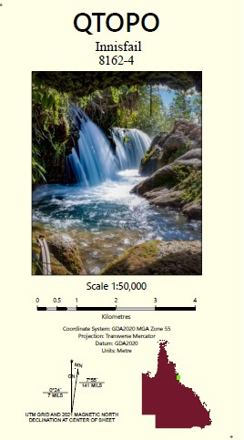
Innisfail 1-50,000 Topographic Map Queensland
Price range: $15.95 through $25.95
Description:
Print on Demand
Locations within this Map
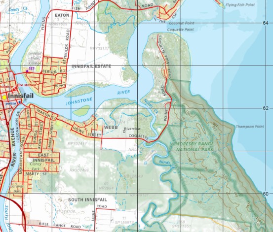
Riverview Innisfail Mourilyan Silkwood Wangan Moresby Mundoo Old Silkwood Armit Creek Bamboo Creek Banana Island Barley Creek Barneys Point Basilisk Range Berryman Creek Boobah Creek Boobah Creek South Branch Boundary Creek Bradshaw Island Bresnahan Island Brown Range Camp Point Cheeki Creek Coconut Point Coquette Point Cowley Beach Cowley Creek Cowley Creek South Branch Daru Creek Double Point Eel Creek Ercegs Creek Esmeralda Hill Ethel Hill Etty Bay Flying Fish Point Georgie Hill Glady Inlet Goodman Point Goondi Hall Point Hall Rock Hayter Point Hilda Hill Humbug Reach Hutchison Island Innisfail Harbour Jessie Island Johnstone River Junction Creek Kent Island Mount Leeper Lily Island Lindquist Island Little Moresby Creek Liverpool Creek Lockyer Creek Log Bridge Creek Maizie Island Meaburn Rock Miks Gully Mistake Creek Moresby Range Moresby River Mourilyan Creek Mourilyan Harbour Ninds Creek Ninds Creek West Branch North Bamboo Creek North Barnard Islands Number One Creek Number Two Creek Olive Rocks One Mile Creek Perry Rock Polka Corner Ramleh Robinsons Beach Rocky Point Saltwater Creek Sandy Creek Scheu Creek Shaws Corner Sisters Islands South Bamboo Creek South Barnard Islands South Johnstone River Spiers Rock Stephens Island Stewart Creek Swampy Creek Tawalla Creek Thompson Point Walter Creek Warrubullen Zahra Creek Bulguru Swamp Barnard Island Group National Park Carello Palm Swamp Conservation Park Etty Bay Road Conservation Park Kurrimine Beach National Park Moresby Range National Park Warrina Conservation Park Mount Julia Moresby Range Resources Reserve Mount Archer Resources Reserve Boogan Coconuts Comoon Loop Cowley Cullinane East Innisfail Eaton Goolboo Goondi Bend Goondi Hill Innisfail Estate Lower Cowley Martyville McCutcheon Mighell New Harbourline No. 5 Branch Sandy Pocket South Innisfail Stockton Webb Victory Creek Nind Creek Mind Creek North Johnstone River North Branch Johnstone River Gladys Inlet Geraldton Johnstone River South Branch Mundoc Mount Leiper South Johnstone Niggerhead Goodman Rock Hayten Point Heyter Point Inarlinga Warrbullen Mountain Brown Sisters Island Sisters Islet
| Name: | Innisfail 8162-4 |
| Publisher: | Queensland Government |
| Scale: | 1:50000 |
| Latitude Range: | 17° 30.0′ S – 17° 45.0′ S |
| Longitude Range: | 146° 0.0′ E – 146° 15.0′ E |
| Projection / Datum: | Universal Transverse Mercator, GDA 94 |
| Approx Print Size: | 0.56m X 0.56m |
You may also like…
-
Innisfail 1-50,000 Topographic Map 8162-4 QLD
Price range: $14.95 through $24.95Select options This product has multiple variants. The options may be chosen on the product page -
Millaa Millaa 1-50000 Topographic Map 8062-4 QLD
Price range: $14.95 through $24.95Select options This product has multiple variants. The options may be chosen on the product page