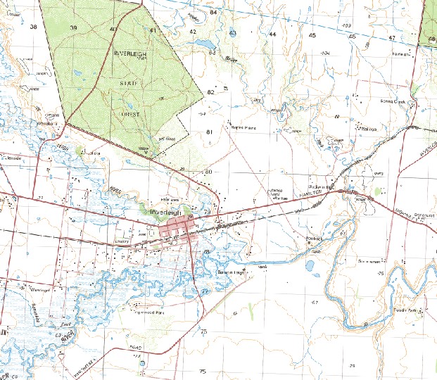
Inverleigh 1-50000 Topographic Map 7721-4 VICTORIA 1990 Edition
$14.95
Description:
Inverleigh 1-50,000 Topographic Map 77214 VICTORIA 1990 Edition Print on Demand
Locations within this Map
Beulah Glenleigh Leigh Estate Roxby Park Barwon Vale Callemondah Airlie Strathmere Ellenbrae Bannockburn Inverleigh Moriac Teesdale Andersons Bridge Bakers Bridge Bannockburn Police Station Bannockburn Primary School Bannockburn Telephone Exchange Barrabool Primary School Bayview Bruces Creek Buckley Primary School Carrah Carrung-E-Murnong Gherineghap Gheringhap Gheringhap-Maroona Railway Gnarwarre Gnarwarre Primary School Hindhaughs Creek Inverleigh Police Station Inverleigh Primary School Lake Dubban Lake Lake Wollard Lake Modewarre Lownde Bridge Modewarre Morgans Bridge Moriac Primary School Mount Moriac Mount Moriac Primary School Mount Moriac Public Hall Mount Pollock Murgheboluc Murgheboluc Public Hall Native Hut Creek Pettavel Basin Pillouds Bridge Pollocksford Bridge Ravens Creek Russells Bridge Sandy Creek Stony Creek Sutherland Creek Primary School Taylor Gully Teesdale Primary School Teesdale Service Basin Wabdallah Leigh River Warrambine Creek Buckley Pettavel
| Name: | Inverleigh |
| Publisher: | Geoscience Australia (Australian Government) |
| Scale: | 1:50000 |
| Latitude Range: | 38° 0.0′ S – 38° 15.0′ S |
| Longitude Range: | 144° 0.0′ E – 144° 15.0′ E |
| Projection / Datum: | Universal Transverse Mercator, GDA94 or WGS84 |
| Approx Print Size: | 0.56m X 0.56m |
| Publication Date: | 1-Jun-90 |


