
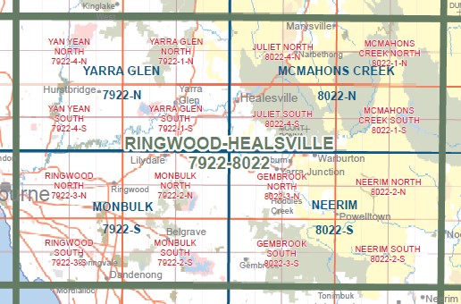
Juliet North 1-25,000 Vicmap Topo Map 8022-4-N
Price range: $12.00 through $26.00
Description:
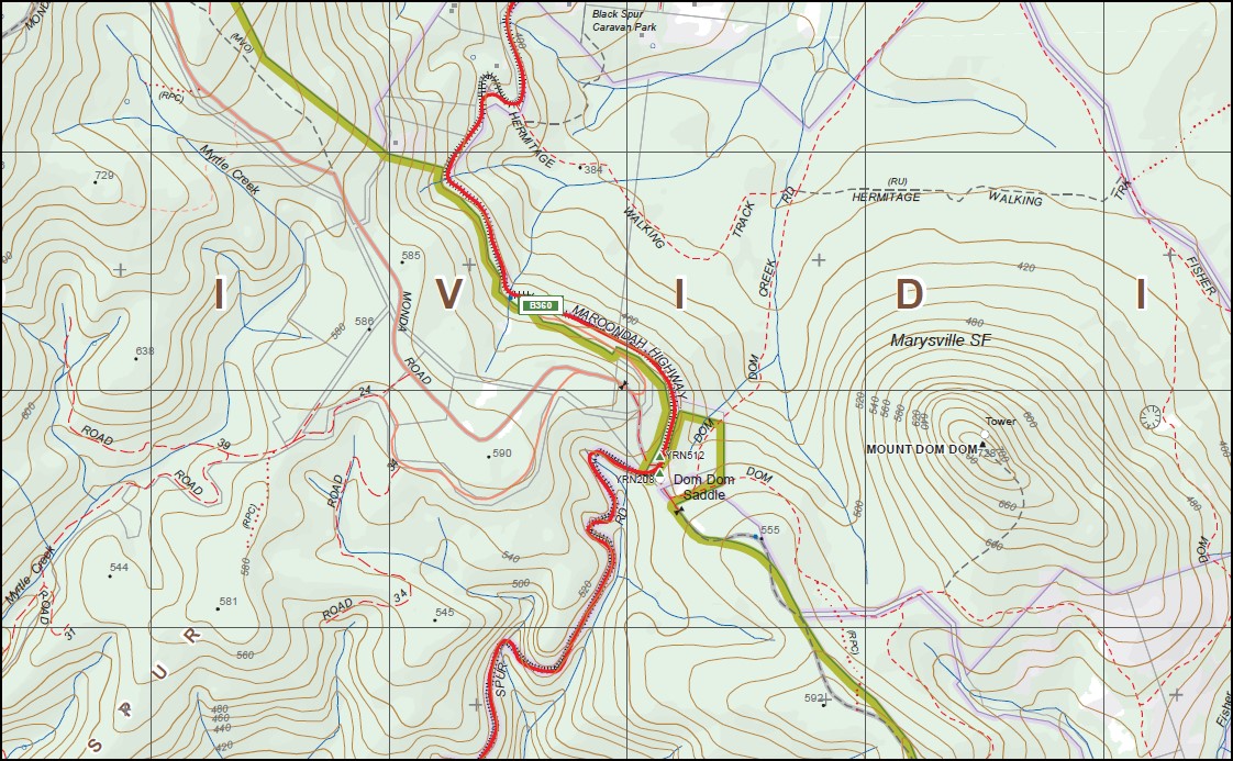
Juliet North 1-25,000 scale Vicmap Topographical map 80224N is used for Walking, 4WD, Fishing, Camping, Motorcycle, both On and Off Road, Gold Prospecting and for those simply going for a family weekend drive.
This is a new series of 1-25,000 scale maps, all sections of Victoria are covered by these maps.
Topographical maps show not only Contours of the Terrain but Walking Tracks, Sealed and Unsealed Roads, Rivers, Creeks, Lakes, Historical Points of Interest, Old Mine Sites MBTG and National and State Park areas.
Main Features of this map includes:
Part of the Bicentenial Track
Marysville, Mount Tanglefoot, Mount Saint Leonard, Siberia Junction, Saint Fillans, Narbethong, Mount Dom Dom, Dom Dom Saddle, Archer Lookout, Mount Strickland, Silvia Falls and Cascades, Toolangi State Forest, Corrigans Cascades, Bingley View, Meyers Creek Falls, CONDONS Track, mbtg, the very north of Maroondah Reservoir, Mathinna Falls, Mount Monda mbtg, Camp Spur, MOUNT MURRINDINDI, Black Range State Forest, Fernshaw, Carters Gap, Mount Gordon, Granton Gap, Acheron River, Marysville State Forest, Feiglins Bridge, OShannassy River Natural Catchment Area, Wilks Creek, Keppel Lookout, Three Tower Lookout, Andersons Mill Camping Ground
You may also like…
-
McMahons Creek 1-50,000 Vicmap
Price range: $12.00 through $26.00Select options This product has multiple variants. The options may be chosen on the product page -
Juliet South 1-25,000 Vicmap Topo Map 8022-4-S
Price range: $14.00 through $26.00Select options This product has multiple variants. The options may be chosen on the product page