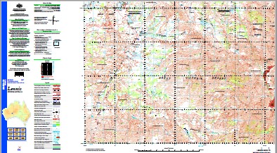
Lennis 1-250,000 Topographic Map
$15.95 – $30.95
Description:
Print on Demand’
Locations within this Map
Cameron Hill Cooper Creek Cooper Hills Faulkner Hill Fig Tree Gnamma Hole Hanns Tabletop Hill Henning Tank Lennis Hills Milne Rock Mount Irving Point Bowzer-Bower Point Lilian Point Mclean Point Reetzs Point Sandercock Point Trim Point Williams Point Wood Round Hill Ryans Bluff Sherriff Range Sulphur Knob Sydney Yeo Chasm Sydney Yeo Range Sykes Bluff Trim Creek Woods Gnamma Hole Woods Pass Fetherstonhaugh Hill Gun Creek Henning Rockhole Point McLean Hann Tabletop Gypsum Lake Ryan Bluff Tabba Pan Stone Knife Point Reetz Point Irwin Point Lillian
| Name: | Lennis |
| Publisher: | Geoscience Australia (Australian Government) |
| Scale: | 1:250000 |
| Latitude Range: | 27° 00.0′ S – 28° 00.0′ S |
| Longitude Range: | 126° 0.0′ E – 127° 30.0′ E |
| Projection / Datum: | Universal Transverse Mercator, GDA94 |
| Approx Print Size: | 0.44m X 0.67m |
| Publication Date: | 1-Jun-02 |
Read More


