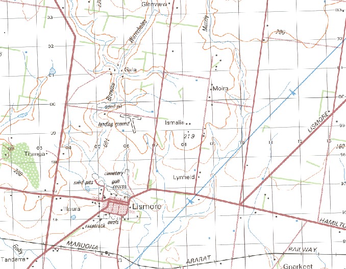
Lismore 1-50000 Topographic Map 7522-2 VICTORIA 1986 Edition
$14.95
Description:
Lismore 1-50,000 Topographic Map 75222 VICTORIA 1986 Edition Print on Demand
Locations within this Map
Banongill Mount Widderin Banoncill East Maneroo Hazeldene Miegunyah Mernda Naringal Coniston Alderton Allambee Leighton Gala Moira Moonya Titanga Colullah Koonangurt Milton Lynfield Tandarra Illoura Berrybank Strathmere Patanga Ettrick Goonderoo Lismore Berrybank Fire Station Berrybank Public Hall Borriyalloak Bradvale Hall Bradvale Public Hall Mundy Gully Galla Gnarkeet Gnarkeet Creek Haunted Gully Lake Tooliarook Camping Ground Lismore Fire Station Lismore Hospital Lismore Police Station Lismore Post Office Lismore Primary School Mannibadar Fire Station Mannibadar Public Hall Mannibadar Telephone Exchange Mingay Fire Station Mingay Hall Mount Bute Telephone Exchange Mount Kinross Mundy Gully Creek Murrays Gully Naringhil North Salt Creek Tooliorook Tooliorook Lake Mannibadar Bradvale Willowvale Mingay Mount Bute Lismore Station Lake Tooliorook
| Name: | Lismore |
| Publisher: | Geoscience Australia (Australian Government) |
| Scale: | 1:50000 |
| Latitude Range: | 37° 45.0′ S – 38° 0.0′ S |
| Longitude Range: | 143° 15.0′ E – 143° 30.0′ E |
| Projection / Datum: | Universal Transverse Mercator, GDA94 or WGS84 |
| Approx Print Size: | 0.56m X 0.56m |
| Publication Date: | 1-Jun-86 |


