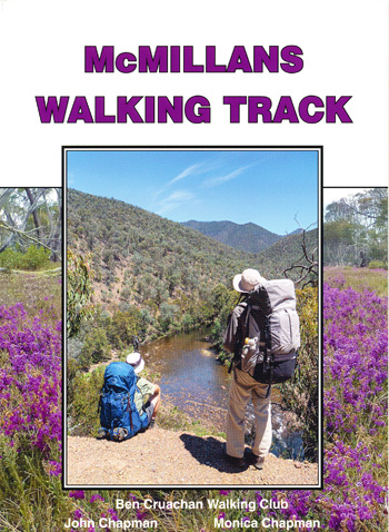
McMillans Walking Track Chapman
$24.95
4 in stock
Description:
McMillans Walking Track Chapman
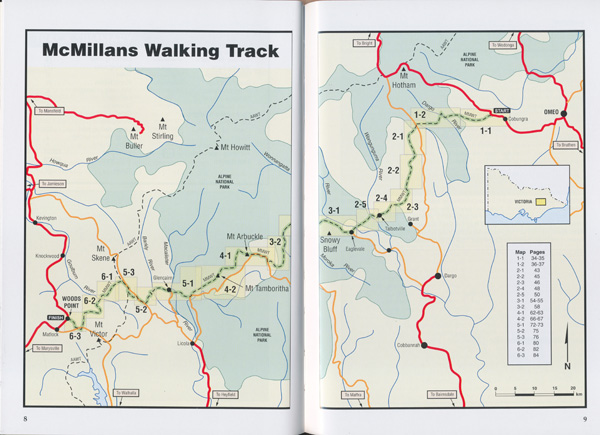
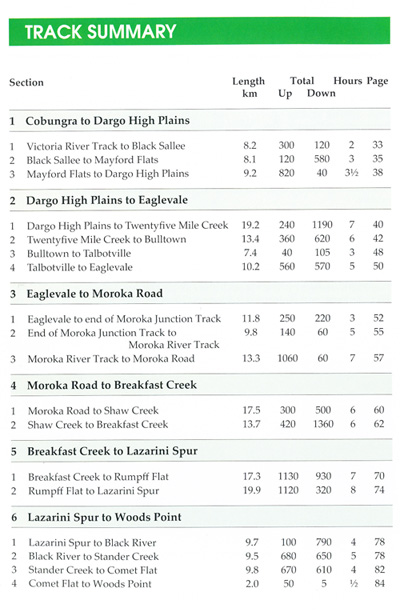
The book has 88 pages, the track has been divided into 6 sections with the start and end of each section having two-wheel-drive access. There are 17 topographic maps.
In 1864, Angus McMillan cut a series of walking tracks that linked the goldfields of Gippsland. The track fell into obscurity until 1983 when John Smith and some other volunteers from the Ben Cruachan Walking Club (BCWC) rediscovered the track from Omeo to Woods Point and set about clearing it. BCWC has maintained its interest in the track and are still maintaining it. They also run an end-to-end walk along it every two or three years.
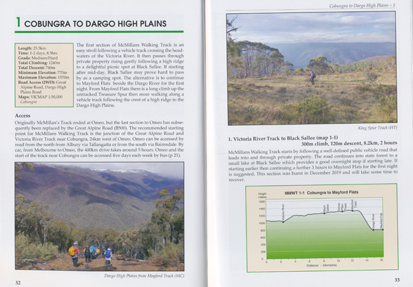
McMillans Walking Track is 210km long and is located on the southern side of the alps in eastern Victoria. The walk takes up to 14 days and can be done as through walk carrying all the supplies for the whole trip or it can be arranged to be met by conventional vehicles every 2 or 3 days. With a 4 wheel drive, groups can be met every night except one.
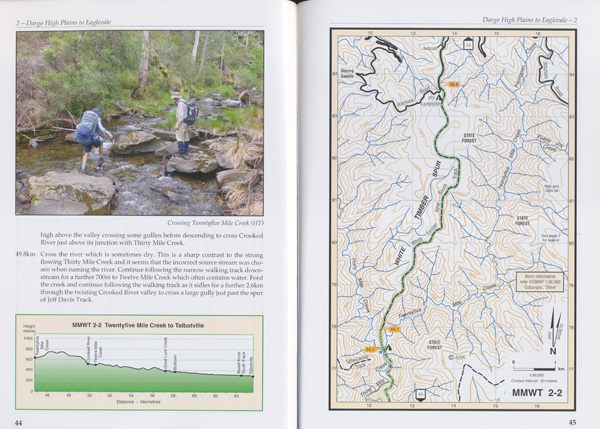
This is an ideal leadup walk to the Australian Alps Walking Track. It has a lot of similarities with some alpine walking, forests, steep climbs and descents. The major difference with the AAWT is there are 10 river crossings, 7 of which must be waded. The track itself is also varied ranging from vehicle tracks, walking tracks and some untracked sections. Bushfires are a regular event in the alps and after fire regrowth is prolific so some overgrown sections should be expected as it can be some time between track clearings.
ISBN 9781920995201
Published November 2020
You may also like…
-
Australian Alpine Walking Track Map Set 2
Price range: $425.00 through $625.00Select options This product has multiple variants. The options may be chosen on the product page -
Australian Alpine Walking Track Map Set 1
Price range: $390.00 through $600.00Select options This product has multiple variants. The options may be chosen on the product page