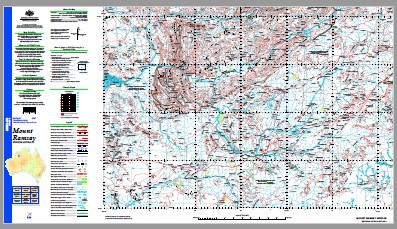
Mount Ramsay 1-250,000 Topographic Map
$15.95 – $30.95
Description:
Print on Demand
Locations within this Map
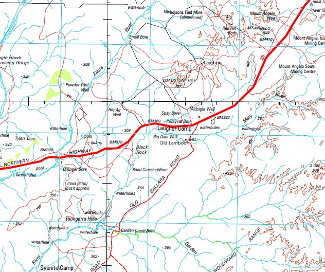
16 Mile Bore 3 Mile Bore 3 Mile Soak 3 Mile Spring 4 Mile Creek 4 Mile Dam 8 Mile Bore 9 Mile Yard A2 Bore Algae Creek Angelo Microwave Repeater Station Barramundi Pool Barramundi Range Bellicks Bore Berrangi Bridge Big Bore Big Dam Bore Big Dam Well Black Hills Yard Black Rock Black Soil Bore Black Spur Blackfellow Creek Blackfellow Creek Yards Blackfellow Spring Blood Yard Blue Bush Yard Bohemia Downs Bolton Bore Boundary Dam Bugle Gap Bullock Bore Bullock Hole Butter Spring Calders Yard Camel Dam Cameron Dam Cameron Yard Camerons Dam Campbell Spring Casey Falls Cave Spring Christine Well Collett Cliffs Colombo Hills Crowhurst Gorge Dawson Downs Waterhole Dawson Downs Yard Dead Horse Bore Dead Horse Creek Dead Horse Yard Devil Bore Devil Gorge Dickie Bore Dillinger Bore Dillinger Microwave Repeater Station Dockrell Creek Drill Bore Duchess Dam Dusty Bore Eagle Hawk Crossing Gorge Eastman Bore Egan Dam Egan Range Eldridge Bore Emanuel Range Emu Bore Emull Bore Eronga Yard Esaw Bore Fig Tree Pool Fig Tree Yard Fish Pool Forman Creek Frog Bore Galeru Gorge Galeru Gorge Community Ganinyi Community Garden Creek Garden Creek Bore Gidgia Creek Gidgia Plains Girriyoowa Community Glenister Knolls Gliddon River Gnewing Bore Goat Paddock Googardah Community Gorden Creek Gorge Pool Grimpy Creek Guppy Hills Hangman Creek Hangman Well Harms Creek Haughton Range Hay Bore Hells Gate Henrys Bore Hibberson Bluff Hilfordy Creek Homestead Bore Horse Spring Hill Horse Spring Range Horseshoe Range Hot Air Well Hugh Hill Hull Range Illawah Waterhole Janet Creek Johnston Creek Johnston Yard Jones Spring Junction Soak Junda Bore Kellys Pass Kilowa Yard Kims Dam Kuniandi Range Kupartiya Community Laidlaw Range Lally Creek Lamboo Landrigan Cliffs Landrigan Creek Larrawa Larrawi Bore Larrawi Yard Laugher Camp Laugher Creek Laura River Lawford Range Lawford Spring Leons Dam Leopold River Lewis Bore Lewises Bore P.A. Liga Creek Lilly Lagoon Lily Hole Bore Limestone Well Lindner Hill Little Gold River Lloyd Hill Loadstone Hill Looma Galeru Group Community Louisa Downs Louisa River Louisa Yard Lubbock Range Luck Range Lumbar Creek Maddox Hills Mangrove Bore Margaret Gorge Margaret River Margaret River Repeater Station Margaret River Station Aerodrome Mary Pool Mary River Mary River Community Mary Yard Matheson Bluffs Mcally Bore Mcally Hills Mcclintock Range Mcgowans Bore Mcintyre Knolls Mckinnon Creek Mcwhae Ridge Me No Savvy Spring Me No Savvy Yard Midnight Yard Millard Creek Mimbi Community Mimbi Creek Minnie Pool Monte Bore Moola Bulla Moongardie Community Morgans Grave Mosquito Creek Mount Amherst Mount Amhurst Mount Angelo Mount Angelo North Mount Angelo South Mount Angelo Well Mount Ball Mount Bertram Mount Carmel Mount Carson Mount Christine Mount Cross Mount Cummings Mount Dent Mount Dockrell Mount Dockrell Well Mount Elma Mount Fairbairn Mount Frank Mount George Mount Hawick Mount Heartbreak Mount Huxley Mount Jean Mount Krauss Mount Phillip Mount Pierre Mount Ramsay Mount Talbot Mount Winifred Mueller Ranges Mulari Spring Nardji Cave Neville Gorge Ngoonjuwah Community Ngumpan Cliff Ngumpan Community Ngumpan Microwave Repeater Station Ngunjiwirri Community Nicholson Plains Nipper Bore No. 1 Bore No. 7 Yard North Hull Range O’Donnell River O’Donnell Yard Old Bohemia Old Bohemia Valley Old Homestead Well Old Lamboo One Palm Tree Gorge One Tree Bore One Tree Hill Onslow Peak Oollumarra Soak Paddock Bore Paddys Spring Paddys Valley Painted Rocks Palm Spring Creek Pannikin Springs Paperbark Spring Pavement Hill Peko Peters Bore Pick and Shovel Bore Piker Hills Pillar Hill Pineapple Bore Pinnacle Spring Police Lagoon Pond Spring Poonta Bore Pothole Bore Powder Spring Powder Yard Pussycat Bore Ramsay Range Rattigan Rocks Red Billabong Bore Red Bluffs Red Hill Bore Red Mule Dam Road Crossing Bore Rockhole Camp Rockhole Yard Rocky Hole Creek Rocky Microwave Repeater Station Rocky Spring Ross Hill Saddlers Creek Sandstone Bore Sansue Bore Shady Bore Singout Spring Snake Creek Soda Spring Soda Spring Creek Soldier Bore Sparke Range Spay Bore Spring Creek Stansmore Pool Station Creek Stein Creek Stockyard Crossing Syenite Camp Syphon Spring Tank Bore Taylor Lookout Teapot Bore Teichert Hills The Black Rocks The Junction The Window Thursday Creek Toongarra Hole Top Spring Top Spring Yard Track Dam Tufa Spring Waggon Pass Watery River Watson Dam Watson Waterhole White Dam White Hill White Hill Bore White Quartz Hills Willy Willy Creek Willy Willy Well Winnipeg Dam Wirara Creek Wolfe Bore Womera Spring Wooden Yard Wyloo Soak Wyloo Yard Wyloo Yards Yeeda Bore Yiyili Community Barramundy Range Burramundi Range Burramundy Range Stony River Curden Creek One Tree Palm Gorge Four Mile Dam Mueller Range Gidgia Plain Louisa Creek Scotts Dam Rockhole Creek Koonjee Park Koongie Park Homestead The Black Rock Bald Hill ODonnell River Nellie River Sandy River Barron State Range Horse Creek Palm Spring Springs Plains Kurinyjiyan Ganinyi Mount Tean Mount Tzan Yiyili Willie Willie Creek McClintock Range Ngumpan Moongardie Ngunjiwirri Mount Dockerell Willy Willy Willie Willie Willy Willy Battery Gorge Creek Kupartiya Mungoo Waterhole
| Name: | Mount Ramsay |
| Publisher: | Geoscience Australia (Australian Government) |
| Scale: | 1:250000 |
| Latitude Range: | 18° 00.0′ S – 19° 00.0′ S |
| Longitude Range: | 126° 0.0′ E – 127° 30.0′ E |
| Projection / Datum: | Universal Transverse Mercator, GDA94 |
| Approx Print Size: | 0.44m X 0.67m |
| Publication Date: | 1-Jun-03 |


