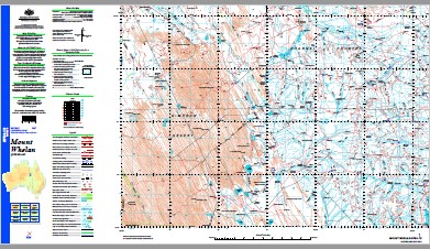
Mount Whelan 1-250,000 Topographic Map
$15.95 – $30.95
Description:
Print on Demand
Ablon Abudda Lakes Adie Creek Mount Alfred Allawonga Allawonga Springs Alnagata Amaroo Lake Amaroo Anderson Hole Creek Athis Balcary Barrington Peak Bellbird Creek Bengeacca Big Jewlerry Waterhole Big Weaner Waterhole Binbiacca Waterhole Bingera Creek Birds Hole Waterhole Birumby Creek Boulogne Brecknock Browns Creek Brumby Waterholes Bullock Creek Bullock Waterhole Calais Camp Flat Creek Carlo Carmarthen Charles Hole Creek Charles Waterhole Mount Coley Cookeygerima Springs Coolibah Creek Cooramarine Yard Cootadoo Waterhole Cottonbush Creek Creake Dalbeattie Deadmans Creek Dieppe Dingo Yard Docking Dry Creek Duck Point Waterhole Eight Mile Yard Eighteen Mile Creek Ethabooka Ethabooka Springs Field River Gap Creek Mount Gerald Gridyea Creek Halls Waterhole Mount Harriet Herbert Downs Herbert Downs Water Facility Hit And Miss Claypan Humpy Creek Idamea Mount Idamea Ilanama Swamp Ina Jewlerry Kaiabarkaloo Creek Kangaroo Creek Mount Kate Kendall Creek Kunnamuka Swamp La Touche Creek Latouche Mount Latouche Lester Creek Lignum Waterhole Little Jewlerry Waterhole Little Weaner Waterhole Longchamps Lucy Lagoon Macrossan Waterhole Marked Tree Waterhole Marne McGregor Waterhole Melancholy Waterhole Melun Minniritchie Creek Mirrica Springs Montara Waterhole Mount Coley Creek Mulligan Creek Mylrea Lake Namabooka Nanterre New Carlo Springs Nobber Number Four Creek Old Carlo Springs Old Coochybung Yard Paravituari Paravituari Waterhole Parawitula Creek Passy Peanunga Springs Pembroke Picton Pikes Creek Pinchimanna Springs Policeman Creek Policeman Waterhole Pollys Lookout Prickly Bush Creek Pulchera Pulchera Lake Pulchera Waterhole Pundijah Creek Ration Creek Ringstead Ripunthala Creek Rocky Creek Rocky Waterhole Rocky Yard Sandy Creek Sherbrook Sherbrook Creek St Cloud St Denis Stallion Paddock Creek Sturt Sugarloaf Hill Sun Hill Sylvester Sylvester Creek Talaera Springs Tank Waterhole Tarley Mount Tarley The Knob The Sisters Tobin Mount Tobin Toko Range Toomba Gorge Toomba Range Top Wheeler Waterhole Trianon Twenty Mile Creek Twynholm Tyrone Ulbenderry Waterhole Velicy Virginia Wandera Waterhole Watchie Creek Wells Hill Wheeler Creek Wheeler Waterhole Whelan Mount Whelan Whitewood Yard Wongitta Waterhole Lake Wongitta Yarrandilla Waterhole Yarrandilla Yards Amaroo Diamantina Shire Sturt Diamantina Shire Sturt Boulia Shire Amaroo Boulia Shire Toko Ranges La Touche River La-Touche Creek Dingo Hill Brown Creek Mount Coley Tank Cravens Peak Twin Hills Whitewood Tanks Coochiebung Tank Two Hills New Carlo Spring Hilary Dam New Carlow Well New Carlo Watchie Bore Bellevue Bore Deadman Creek The Nob Number Four Bore Number Five Bore Mount Tarly Number Two Bore
| Name: | Mount Whelan |
| Publisher: | Geoscience Australia (Australian Government) |
| Scale: | 1:250000 |
| Latitude Range: | 23° 00.0′ S – 24° 00.0′ S |
| Longitude Range: | 138° 0.0′ E – 139° 30.0′ E |
| Projection / Datum: | Universal Transverse Mercator, GDA94 |
| Approx Print Size: | 0.44m X 0.67m |
| Publication Date: | 1-Jun-02 |


