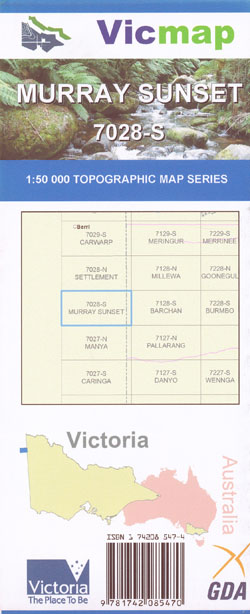
Murray Sunset 1-50,000 Vicmap
Price range: $12.00 through $24.00
Description:
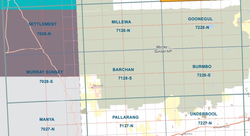
THIS IS NOT A MAP COVERING THE ENTIRE MURRAY SUNSET NATIONAL PARK
PLEASE LOOK AT THE INDEX IMAGE
Murray Sunset 1-50,000 scale Victorian Topographical map 7028S is used for Walking, 4WD, Fishing, Camping, Motorcycle, both On and Off Road, Gold Prospecting and for those simply going for a family weekend drive.
Topographical maps show not only Contours of the Terrain but Walking Tracks, Sealed and Unsealed Roads, Rivers, Creeks, Lakes, Historical Point of Interest, Old Mine Sites and both National and State Park areas.
Main Features of this map includes:
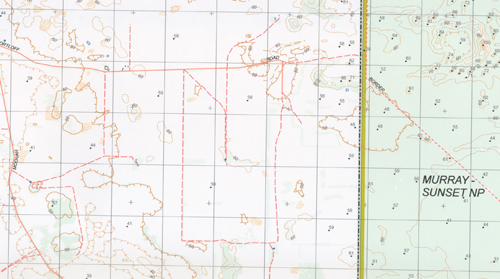
From the Victorian Border into South Australia
The Edge of the Murray Sunset National Park, Boltons, Peebinga, Mootatunga, Kringin
THIS IS NOT A MAP COVERING THE ENTIRE MURRAY SUNSET NATIONAL PARK
PLEASE LOOK AT THE INDEX IMAGE
ISBN 9781742085470
Read More
You may also like…
-
Barchan 1-50,000 Vicmap
Price range: $12.00 through $24.00Select options This product has multiple variants. The options may be chosen on the product page -
Goonegul 1-50,000 Vicmap
Price range: $12.00 through $24.00Select options This product has multiple variants. The options may be chosen on the product page -
Millewa 1-50,000 Vicmap
Price range: $12.00 through $24.00Select options This product has multiple variants. The options may be chosen on the product page -
Burmbo 1-50,000 Vicmap
Price range: $12.00 through $24.00Select options This product has multiple variants. The options may be chosen on the product page