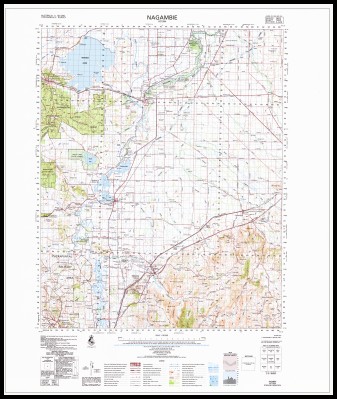
Nagambie 1-100,000 Topographic Map 1987 GA
$14.95
Description:
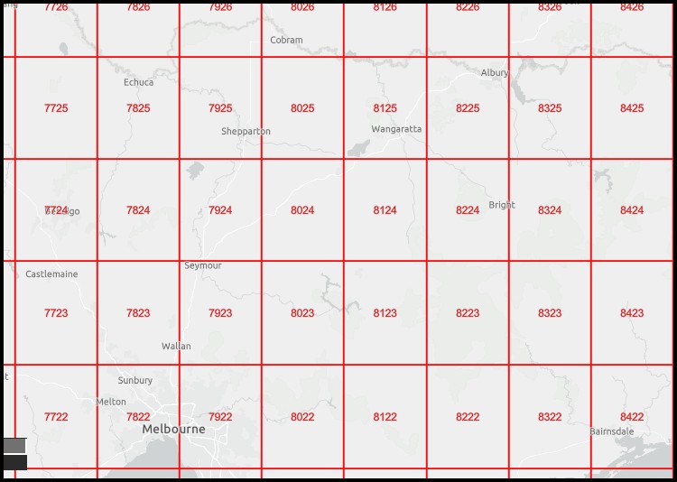
Nagambie 1-100,000 Topographic Map 7924 GA Print on Demand Edition 1987
Locations within this Map
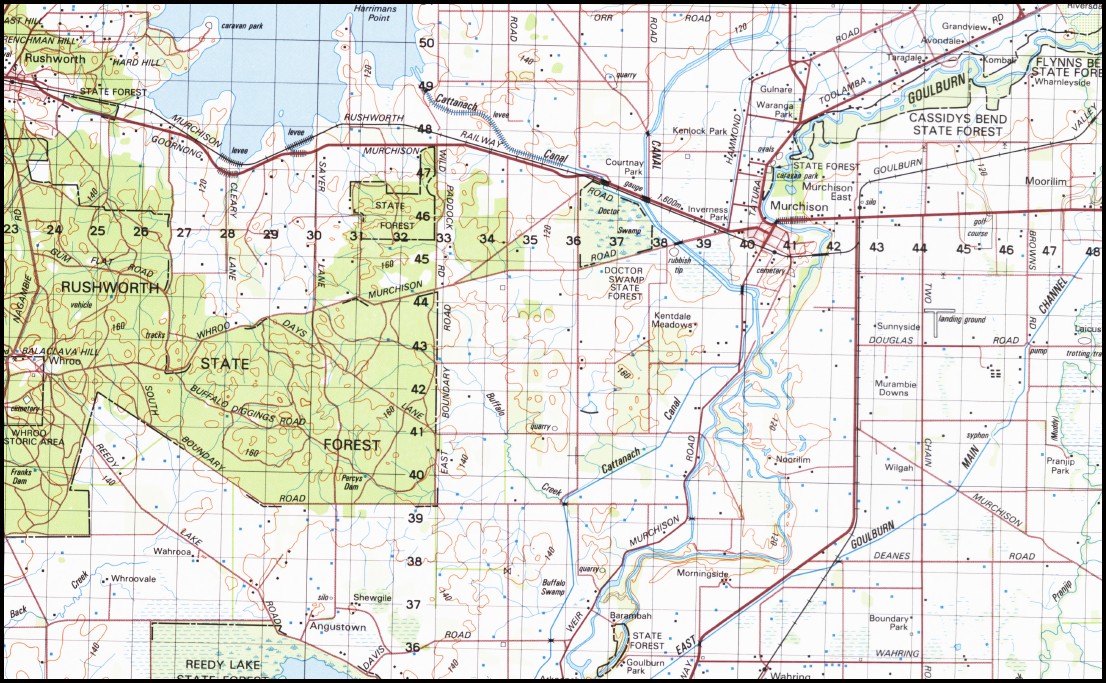
The Grange Coorlong Naturi Kargell Park Waverly Grange Boomaroo Coondella Riverview Castle Bend Clairwood Rockwood Meadows Midhill Glenholme Paringavale Ridgewood Riverview Stud Binda Vale Namoi Boglashin Lady Bank Parkview Noorilim Park Glenara Dorilla Park Avondale Grandview Strathalbyn Riversdale Rosenath Gulnare Mallanbool Taradale Uralla Kombali Coolagatta Sunnyville Brandon Park Glenlee Waranga Park Moorilim Park Nogoa Downs Kenidale Meadows Mundoona Goodwind Abbington Hazelmere Lowana Monygong Noorilim Pranjip Park Berridale Whroovale Wahrooa Morningside Greybrook Clarewood Shewgile Barambah Goulburn Park Boundary Park Caroola Springfield Arkoonah Greenacres Gum Grove Millswyn Allambie Caralyn Erena Park Castle Park Wandeon Westercraigs Booroondal Bunganail Graemar Greenbank Pine Grange Drysdale Polloch Boxgrove Narrawa Gilgai Maranoa Underwood Barong Melrose Park Yallambie Gundamain The Nook Stud Riverside Barwood Park Inglebar Woorak Alandale Moormbool Estate Ruoemoh Chateau Tahbilk Waterbend Sweet Meadows Islay Vale Rondavel Bundanoon Killeen Woodlands Homelea Spring Park Goldern Heart Emohruo Stretton Vale Craiglands Sunnyside Bayunga Chatsworthpark Aberfeldie Laurel Grove Broxbourne Jarvis Bald Rock The Falls Midhurst Rose Glen Burnside Mangalore Park Hyde Park Westbrook Park Chatswood Belmont Coo-Inda Wattle Glen Connik Lodge Ardroy Bayunga South Ludlow Park Kahala Fairview Rosedale Farm Glen Appen Winterfold Allanvale Ranch Rosemont Kurra Jong Coolalie Wolbunya Avenel Estate Balthayock Whitegate Lake View Alexandria Park Upton Karep Innisfail Kemar Devon Park Glenogil Ponkeen Northwood Park Stud Garryowen Brantwood Mittagong Engedi Ganoora Glen Avis Booroola Erinvale Ranchipo Coilalodge Coila Lodge Tegwani Stratheard Bungarra Mount Alexina Falcon Vale Nalinga Kestral Vale Bungle Boori Marling Park Dawnston Park Greenvale Talgai Karalee Avenel Murchison Nagambie Puckapunyal Rushworth Longwood Arcadia Arcadia Fire Station Arcadia Primary School Avenel Primary School Avenel Telephone Exchange Four Mile Creek Bailieston Bailieston Fire Station Bailieston Primary School Balaclava Battery Dam Balaclava Hill Balaclava Mines McKenzie Hills Baldwins Bridge Baxters Island Bazeley Island Belfast Hill Berrys Green Big Hill Bishops Mitre Rock Blacksmiths Dam Boggy Creek Branjee Branjee Creek Branjee Fire Station British and Foreign Gully Bryant Hill Buffalo Creek Buffalo Diggings Dam Buffalo Swamp Bunding Creek Burnt Creek Burtons Hurdle Callen Range Camerons Well Creek Camerons Dam Campbells Bend Reserve Cantys Rock Goulburn Waranga No. 2 Channel Charlies Hill Cheong Dam Chinamans Bend Chinamans Hill Colonels Range County Creek Creighton Creighton Hills Crottys Knob Dalcom Dam Dargalong Dead River Della Island Devon Hill Dhurringile Hall Dhurringile Primary School Dhurringile Prison Dhurringile Rehabilitation Centre Dhurringile Telephone Exchange Diamond Hill Gravel Creek Doctors Swamp Dolly Brae Dunlop Hill Eight Mile Creek Emu Hill Ewing Fairview Hill Fenced-In Dam Fire Hill Flat Rock Franks Dam Fraser Ridge Frenchmans Hill Garden Pick Hill Glass Square Golden Point Gully Good Morning Hill Goulburn Valley Highway Goulburn Valley Railway Goulburn Weir Goulburn Weir Backwater Grahams Hill Granite Hill Green Hill Green Island Growlers Hill Guilds Hill Half Way Dam Hallwells Island Hard Hill Hawkes Creek Heaths Island Huggards Gully Hughes Creek Hill Humbug Huttons Backwater Internment Camp 1 Internment Camp 13 Internment Camp 2 Jacobsons Outlook Jones Dam Karramomus Karramomus Public Hall Kinchella Hills Kirwans Bridge Kobyboyn Ranges Kong Meng Hill Kuhnle Point Lake Nagambie Lancaster Primary School Larkin Hills Larkman Gully Larrys Hut Creek Little Branjee Creek Lobbs Island Locksley Locksley Fire Station Locksley Hall Locksley Recreation Reserve Long Gully Longwood Community Centre Longwood Fire Station Longwood Primary School Lookout Hill Lorenz Hill Lovers Hill Lyon Hill Main Gully Malakoff Hill Mangalore Mangalore Airport Mangalore Flora Park Miepol Miepoll Fire Station Miepoll Hall Mitchell Molka Molka Fire Station Monea Monea North Monea South Monica Mount Moorilim Fire Station Moorilim Primary School Morsons Island Mount Anne Mount Bernard Mount Rose Mount Tenneriffe Mount Tenneriffe Trig Muddy Creek Muddy Waterhole Creek Murchison East Murchison Fire Station Murchison Golf Course Murchison North Murchison Police Station Murchison Primary School Murdocks Hill Nagambie Fire Station Nagambie Mechanics Hall Nagambie Police Station Nagambie Primary School Nagambie Sports Ground Nagambie Telephone Exchange Nine Mile Creek Northwood Northwood Hill Nuggety Hill Old Arcadia School One Tree Hill Parramatta Gully Parsons Gully Percy Dam Perrys Hill Ponkeen Creek Poor Mans Gully Porcupine Hill Pranjip Pranjip Creek Pranjip Creek Anabranch Puckey Dam Razorback Reedy Creek Reedy Lake Rowells Hill Ruffy Ruffy Fire Station Rushworth Fire Station Rushworth Magistrates Court Rushworth Secondary College Rushworth Police Station Rushworth Primary School Rushworth Shire Hall Sailors Gully Sandy Creek Scotchmans Gully Scrub Hill Shellback Gully Shelton Smith Range Specimen Hill Squatters Dam Stony Creek Strathbogie Shire Stuart Murray Canal Surface Hill Gully Survey Creek Tabilk Tarcombe Teddy Bear Island Tehan Hill Tenneriffe The Peak The Salt Lake Tobin Hill Tubbs Hill Turners Island Undera Primary School Upton Fire Station Upton Hill Wahring Waranga Waranga Reservoir Waranga Creek Waranga Memorial Hospital Waranga Western Main Channel Warfe Hill Wharing Fire Station Wharing Telephone Exchange Whroo Whroo Reservoir Wicket Hill Wild Dog Gully Winding Creek Wirrate Fire Station Woodhouse Wormangal Wormangal Creek Toolamba Castle Creek Karramomous North Karramomus North Waranga Basin Hammond Station Moorilim Miepoll Faithfuls Creek Doctor Swamp Angustown Creightons Creek Nathalia Bailieston East Goulburn Shire Wormangle Creek Crieghton Wirrate Wattle Vale Londwood Old Longwood Longwood East Deegay Ponds Mitchellstown Mitchells Creek Majors Creek Major Creek Hawkers Creek Hughes Creek Mangalore West Grave Creek Discovery Creek
| Name: | Nagambie 7924 |
| Publisher: | Geoscience Australia (Australian Government) |
| Scale: | 1:100,000 |
| Latitude Range: | 36° 30.0′ S – 37° 00.0′ S |
| Longitude Range: | 145° 0.0′ E – 145° 30.0′ E |
| Projection / Datum: | Universal Transverse Mercator, GDA94 |
| Approx Print Size: | 0.56m X 0.56m |
| Publication Date: | Edition 1987 |
You may also like…
-
Arcadia 1-50,000 Vicmap
Price range: $12.00 through $24.00Select options This product has multiple variants. The options may be chosen on the product page -
Longwood 1-50,000 Vicmap
Price range: $12.00 through $24.00Select options This product has multiple variants. The options may be chosen on the product page -
Bendigo 1-250,000 Topographic Map GA
Price range: $15.95 through $27.95Select options This product has multiple variants. The options may be chosen on the product page -
Nagambie 1-25,000 Vicmap Old Edition
Select options This product has multiple variants. The options may be chosen on the product page