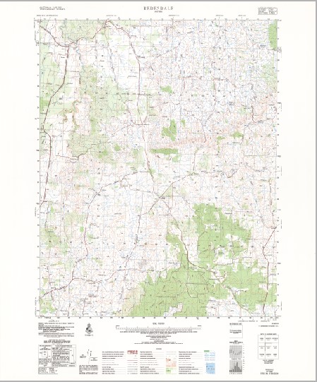
Redesdale 1-50,000 Topographic Map 7823-4 VICTORIA 1981 Edition
$14.95
Description:
Redesdale 1-50,000 Topographic Map 7823-4 VICTORIA 1981 Edition Print on Demand
Locations within this Map
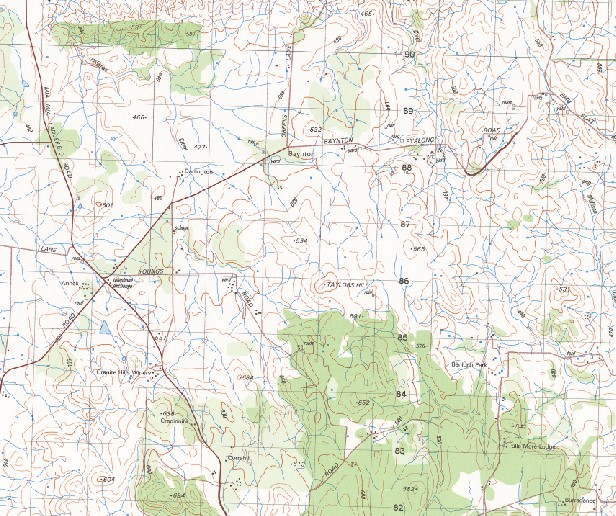
Woodlands Back Creek Barfold Public Hall Baynton Baynton Primary School Baynton Public Hall Baynton Telephone Exchange Bells Hill Big Hill Creek Breakneck Hill Carlsruhe Cobaw Cobaw Range Connors Bridge Emberton Falvey Hill Glenhope Govetts Bridge Griffin Hill Hayes Hill Mealings Creek Kellys Hill Kennedy Bridge Knights-Granite Hills Winery Langley Langley Telephone Exchange Long Gully McHarg Ranges Mia Mia Creek Mia Mia Telephone Exchange Mission Hill Mitchells Falls Monument Hill Mount St Mary Mountain Creek O’Connors Hill Pastoria Fire Station Pipers Creek Pohlmans Creek Rattrays Bridge Redesdale Redesdale Public Hall Redesdale Recreation Reserve Redesdale-Mia Mia Primary School Skinners Hill Spring Plains Stone Jug Creek Sugarloaf Hill Taylor Hill The Sisters Theaden Hill Todds Creek Weekaway Recreational Camp Mia Mia Barfold Jews Harp Creek Sidonia Benloch
| Name: | Redesdale |
| Publisher: | Geoscience Australia (Australian Government) |
| Scale: | 1:50000 |
| Latitude Range: | 37° 00.0′ S – 37° 15.0′ S |
| Longitude Range: | 144° 30.0′ E – 144° 45.0′ E |
| Projection / Datum: | Universal Transverse Mercator, GDA94 or WGS84 |
| Approx Print Size: | 0.56m X 0.56m |
| Publication Date: | 1-Jun-81 |
You may also like…
-
Pyalong 1-50,000 Vicmap
Price range: $12.00 through $24.00Select options This product has multiple variants. The options may be chosen on the product page -
REDESDALE NORTH 1-25,000 Vicmap Topographic Map 7823-4-N
Price range: $14.00 through $26.00Select options This product has multiple variants. The options may be chosen on the product page -
Castlemaine Woodend 1-100,000 Vicmap 7723 7823
Price range: $12.00 through $24.00Select options This product has multiple variants. The options may be chosen on the product page -
REDESDALE SOUTH 1-25,000 Vicmap Topographic Map 7823-4-S
Price range: $14.00 through $26.00Select options This product has multiple variants. The options may be chosen on the product page