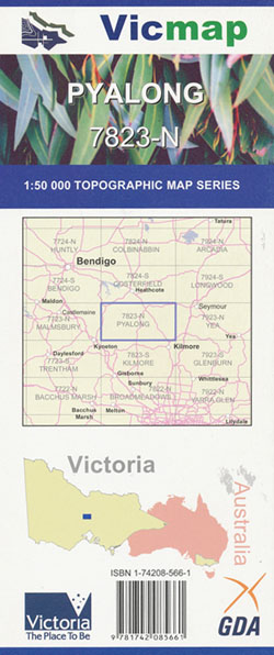
Pyalong 1-50,000 Vicmap
Price range: $12.00 through $24.00
Description:
Pyalong 1-50,000 scale Vicmap Topographical map 7823N is used for Walking, 4WD, Fishing, Camping, Motorcycle, both On and Off Road, Gold Prospecting and for those simply going for a family weekend drive.
Topographical maps show not only Contours of the Terrain but Walking Tracks, Sealed and Unsealed Roads, Rivers, Creeks, Lakes, Historical Points of Interest, Old Mine Sites mbtg and National and State Park areas.
Main Features of this map includes:
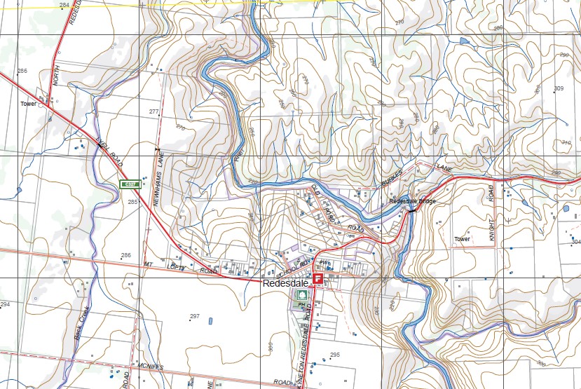
Redesdale, Langley, Tooborac, Goldie North, Theaden Hill, Taylor Hill, Mandorang, Hayes Hill, Glenoural, Langley, Govetts Bridge, Mount St Mary, Sidonia, Baynton, BREAKNECK Hill, Pastoria, O’CONNORS Hill, Cobaw State Forest, SKINNERS Hill, GRIFFIN Hill, MONUMENT Hill, Weekaway Recreational Camp, Benloch, FALVEY Hill, Nulla Vale, mbtg, Redesdale, Hayes Hill, EMBERTON BR, Mitchells Falls, Queens Falls, BARFOLD GORGE GR, Mia Mia, Duigan Flight Memorial, Glenhope, McHargs Range, Pohlman Creek, Baynton East, SPRING PLAINS NCR
Pyalong, GLENAROUA, TOOBORAC, SPRING PLAINS NCR, MUNDY Gully Track, MOUNT KOALA, Tooborac State Forest, Tooborac Hill, PUCKAPUNYAL COMMONWEALTH AREA, GARDINERS CREEK SSR, PYALONG HILL, CHAPMAN HILL, Bylands Creek, GREENSHIELDS, Hill, Vickery Hill, MOLISON CREEK SSR, HEYWOOD Hill, mbtg, Goldie North, MORANDING, Nulla Vale, Wines Bridge, CROUGHS Hill, Tantaraboo, Hayles Crossing, Mollisons Memorial, Crawfords Bridge, High Camp, Gannons Bridge, Mollison Creek, KURKURUC CREEK SSR, HAMILTONS CREEK SSR, MOUNT PIPER, Cameron Creek Bridge
ISBN 9781742085661
You may also like…
-
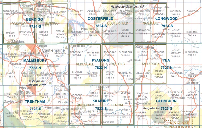
Kilmore 1-50,000 Vicmap Topographic Map 7824-S
Price range: $14.00 through $26.00Select options This product has multiple variants. The options may be chosen on the product page -
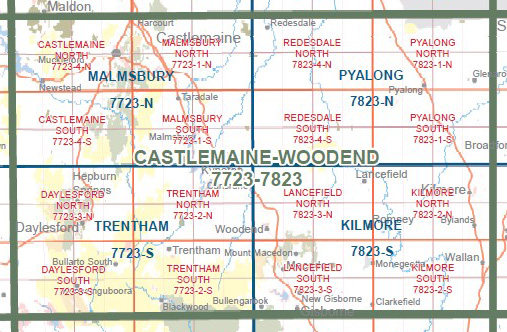
REDESDALE SOUTH 1-25,000 Vicmap Topographic Map 7823-4-S
Price range: $14.00 through $26.00Select options This product has multiple variants. The options may be chosen on the product page -
Castlemaine Woodend 1-100,000 Vicmap 7723 7823
Price range: $12.00 through $24.00Select options This product has multiple variants. The options may be chosen on the product page -
REDESDALE NORTH 1-25,000 Vicmap Topographic Map 7823-4-N
Price range: $14.00 through $26.00Select options This product has multiple variants. The options may be chosen on the product page -
Malmsbury 1-50,000 Vicmap Topographic Map
Price range: $12.00 through $24.00Select options This product has multiple variants. The options may be chosen on the product page -
Bendigo 1-50,000 Vicmap
Price range: $12.00 through $24.00Select options This product has multiple variants. The options may be chosen on the product page -
Yarra Glen 1-50,000 Vicmap
Price range: $12.00 through $24.00Select options This product has multiple variants. The options may be chosen on the product page -
Longwood 1-50,000 Vicmap
Price range: $12.00 through $24.00Select options This product has multiple variants. The options may be chosen on the product page -
PYALONG NORTH 1-25,000 Vicmap Topo Map 7823-1-N
Price range: $14.00 through $26.00Select options This product has multiple variants. The options may be chosen on the product page -
Trentham 1-50,000 Vicmap
Price range: $12.00 through $24.00Select options This product has multiple variants. The options may be chosen on the product page -
PYALONG SOUTH 1-25,000 Vicmap Topo Map 7823-1-S
Price range: $14.00 through $26.00Select options This product has multiple variants. The options may be chosen on the product page -
Yea 1-50,000 Vicmap
Price range: $12.00 through $24.00Select options This product has multiple variants. The options may be chosen on the product page