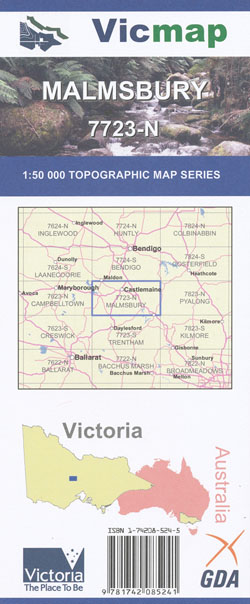
Malmsbury 1-50,000 Vicmap Topographic Map
Price range: $12.00 through $24.00
Description:
Malmsbury 1-50,000 scale Victorian Topographical map 7723N is used for Walking, 4WD, Fishing, Camping, Motorcycle, both On and Off Road, Gold Prospecting and for those simply going for a family weekend drive.
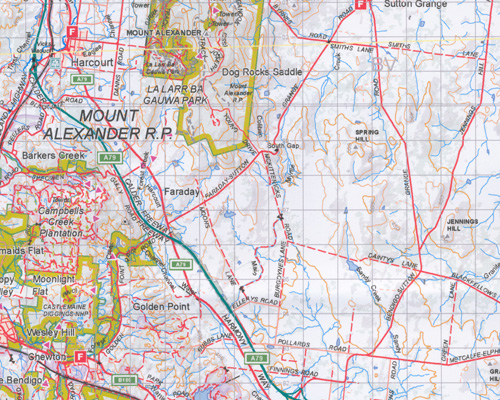
Topographical maps show not only Contours of the Terrain but Walking Tracks, Sealed and Unsealed Roads, Rivers, Creeks, Lakes, Historical Point of Interest, Old Mine Sites mbtg and both National and State Park areas.
Main Features of this map includes:
Chewton, Metcalfe, Harcourt, Mount Alexander southern half, La Larr Ba Gauwa Park, part of the Castlemain Gold Diggings, Golden Point, Donkey Gully, Fryers Range, McCoy Reservoir, Sporing Hill, Elphinstone, Golden River Scenic Reserve, Coliban River, Jennings Hill, Mount Lofty BR, MBTG, Coliban Falls, Emberton BR, Metcalfe NCR, mbtg, Malmsbury, most of Kyneton, Taradale, Drummond, Malmsbury Reservoir, the edge of Fryerstown, Fryers Range, Fryers Ridge, parts of the Upper Loddon State Forest, Bell Topper Hill, Lauriston, Drummond North, Pattens Hill, Liberty Flat, North and South Kyneton Mineral Springs, Turpins Falls, Metcalfe East, Langley, Hodges Bridge, Black Hill, Woodleigh Heights, numerous old gold diggings
Castlemaine, Iredale, Newstead, Green Gully, Maldon HR, Tarrengower, Mount Tarrengower, Maldon Mountain Bike Park, Mantons Gully, Perkins Reef, Carmans Tunnel, ANZAC Hill, O’Connors Track, Walmer South NCR, Muckleford Creek Bridge, Walmer SF, Reillys Track, mbtg, Harcourt BR, Castlemaine Diggings NHP, Barkers Creek, Milkmaids Flats, Youngmans Track, Wattleflat Recreation Reserve, Muckleford BR, Sawmill Road Bridge, Boundary Track, Centre Track, Muckleford SF, Muckleford NCR, Dunns Reef, Red White & Blue Track, Dunns Reef Track, Kaweka NCR, Hodges Channel, Moonlight Flat, Happy Valley, Leanganook Track, mbtg, Clinkers Hill BR, Ten Foot Hill, Poverty Gully Reserve, The Monk, Poverty Gully Channel, Union Hill Mine, The Monk Track, Campbells Creek, Ranters Gully Channel, McKenzie Hill, Diamond Gully BR, Woodmans Bridge, Muckleford South BR, South German, mbtg, Welshmans Reef, Brassey Mine, Cairn Curran Resevoir, Joyces Creek, Butlers Creek, Mount Consultation, Guildford BR, Skeens Gully, Mopoke Creek, Sandon SR, Zig Zag Track, Butlers Creek, mbtg, Guildford, Yandoit, Franklinford, Clydesdale, Sandon State Forest, Wattle Gully Gold Mine,Yandoit Hills, Strangeways, Rise and Shine, Pickpocket Diggings, Glamorgan Reef, Jim Crow Creek, Castlemaine Digging National Heritage Park, Upper Loddon State Forest, Vaugh Mineral Springs, Glenluce Springs, Lawson Springs. Southern Section of Mount Alexander Forest Reserve
ISBN 9781742085241
You may also like…
-
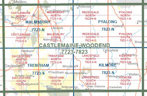
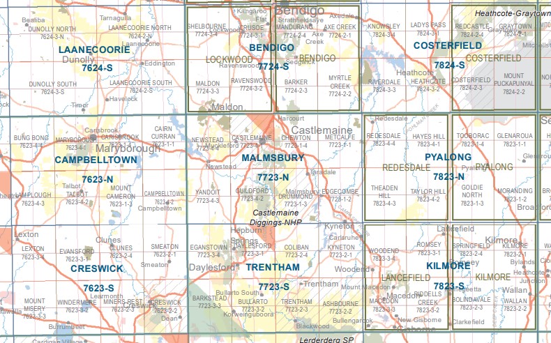
Castlemaine Woodend 1-100,000 Vicmap 7723 7823
Price range: $12.00 through $24.00Select options This product has multiple variants. The options may be chosen on the product page -
Creswick 1-50,000 Vicmap
Price range: $12.00 through $24.00Select options This product has multiple variants. The options may be chosen on the product page -
DAYLESFORD SOUTH 1-25,000 Vicmap Topo 7723-3-S
Price range: $14.00 through $26.00Select options This product has multiple variants. The options may be chosen on the product page -
Kilmore 1-50,000 Vicmap Topographic Map 7824-S
Price range: $14.00 through $26.00Select options This product has multiple variants. The options may be chosen on the product page -
MALMSBURY NORTH 1-25,000 Vicmap Topo Map 7723-1-N
Price range: $14.00 through $26.00Select options This product has multiple variants. The options may be chosen on the product page -
MALMSBURY SOUTH 1-25,000 Vicmap Topo Map 7723-1-S
Price range: $14.00 through $26.00Select options This product has multiple variants. The options may be chosen on the product page -
Daylesford North 1-25,000 Vicmap Topo 7723-3-N
Price range: $14.00 through $26.00Select options This product has multiple variants. The options may be chosen on the product page -
Daylesford North 1-25,000 Vicmap Topo Map 7723-3-N
Price range: $14.00 through $26.00Select options This product has multiple variants. The options may be chosen on the product page -
Campbelltown 1-50,000 Vicmap Topo Map 7623-N
Price range: $14.00 through $26.00Select options This product has multiple variants. The options may be chosen on the product page -
Trentham 1-50,000 Vicmap
Price range: $12.00 through $24.00Select options This product has multiple variants. The options may be chosen on the product page -
Bendigo 1-50,000 Vicmap
Price range: $12.00 through $24.00Select options This product has multiple variants. The options may be chosen on the product page -
Castlemaine South 1-25,000 Vicmap Topographic Map
Price range: $14.00 through $26.00Select options This product has multiple variants. The options may be chosen on the product page