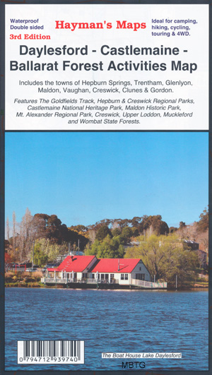
Daylesford Castlemaine Ballarat Map Hayman
$14.95
Description:
Daylesford Castlemaine Ballarat Map Hayman
Waterproof Printed on Plastic Paper
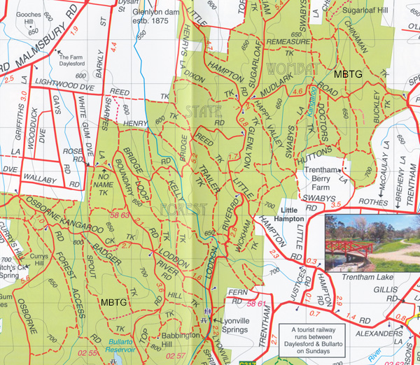
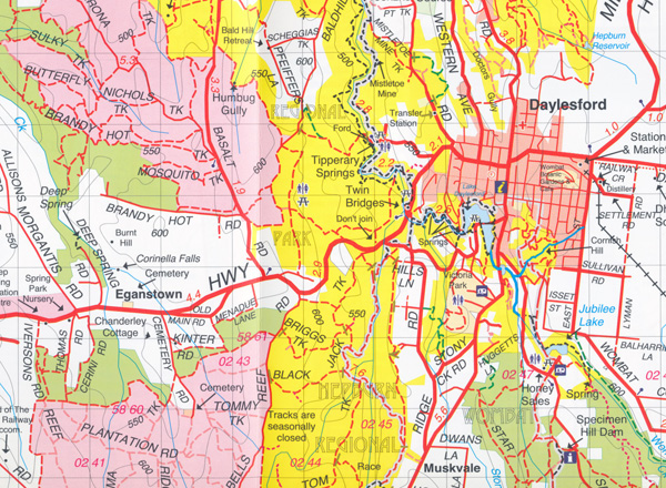
This map extends from Ballarat in the south to north of Castlemaine, it follows the Midland Highway and provides a thorough coverage of the surrounding forests. The map was extensively field checked during a 12 month period.
Includes the towns Daylesford, Castlemaine, Ballarat, Hepburn Springs, Trentham, Glenlyon, Creswick
Parks and reserves include Hepburn and Creswick Regional Parks, Castlemaine National Heritage Park, Maldon Historic Park, Mount Alexander Regional Park, Creswick, Upper Loddon, Fryers Ryde Nature Conservation Park, Sandon State Forest, Muckleford and Wombat State Forests.
- Scale: 1:50 000
- Suitable for use with GPS
- Extensive 4wd tracks coverage
- Walking tracks and campsites
- Map Size: 100cm x 70cm approx
- Colour with contours, photographs & notes
2nd Edition 2023
ISBN 794712939740
Parks, reserve and state forest boundaries are shown and roads and tracks have been plotted using GPS mbtg mapping technology.
You may also like…
-
Trentham 1-50,000 Vicmap
Price range: $12.00 through $24.00Select options This product has multiple variants. The options may be chosen on the product page -
Daylesford North 1-25,000 Vicmap Topo 7723-3-N
Price range: $14.00 through $26.00Select options This product has multiple variants. The options may be chosen on the product page -
Creswick 1-50,000 Vicmap
Price range: $12.00 through $24.00Select options This product has multiple variants. The options may be chosen on the product page -
Malmsbury 1-50,000 Vicmap Topographic Map
Price range: $12.00 through $24.00Select options This product has multiple variants. The options may be chosen on the product page -
Barmah Shepparton Deniliquin Adventure Map Haymans
Price range: $12.95 through $25.00Select options This product has multiple variants. The options may be chosen on the product page -
Cohuna Echuca Gunbower Map Hayman
Price range: $12.95 through $25.00Select options This product has multiple variants. The options may be chosen on the product page -
Wombat State Forest 4WD Map Meridian Edition 5
Price range: $14.95 through $26.96Select options This product has multiple variants. The options may be chosen on the product page -
Creswick South 1-25,000 Vicmap Topo Map 7623-2-S
Price range: $14.00 through $26.00Select options This product has multiple variants. The options may be chosen on the product page