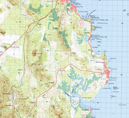
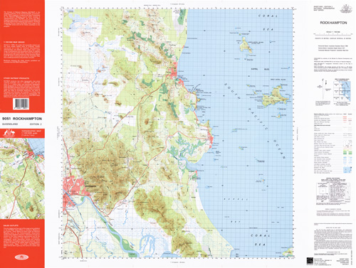
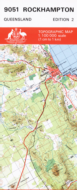
Rockhampton 1-100,000 Topographic Map
Price range: $15.95 through $30.95
Description:
Locations within this Map
Rangle Wood Fitzroy Vale Greendale Svendsen Cawarral Emu Park Keppel Sands Rockhampton Yeppoon Bangalee Barmaryee Kinka Mulambin Parkhurst Yeppen Adelaide Park Arch Rock Archer Archer Park Mount Archer Arthurs Point Athelstane Range Mount Athelstane Mount Atherton B K Creek Back Creek Bald Rock Balnagowan Balnagowan Dam Barmoya Barmoya East Mount Barmoya Beachton Mount Bedwell Lake Bell Mount Berserker Berserker Range Mount Birkbeck Black Mountain Blacksoil Gully Bluff Point Bluff Rock Bondoola Botany Point Broadmount Bronzewing Sand Brumms Cove Bunyip Point Cabbage Tree Creek Cabbage Tree Hill Cabby Creek Camp Creek Camp Hill Rock Canton Creek Capricorn Coast castle Bellas Cattle Point Causeway Lake Cawarral Creek Centre Bank Mount Chalmers Mount Chapple Charcoal Waterhole Mount Cobberra Cocoanut Point Conical Rocks Considine Bay Constitution Hill Cooberrie Cooee Bay Coolcorra Coorooman Coorooman Creek Corduroy Creek Corroboree Island Creek Rock Crescent Lagoon Crescent View Daly Creek Despair Creek Devils Elbow Mount Dick Dinky Point Divided Island Dobbyn Waterhole Double Head Duckpond Lagoon East Bank Edinda Mount Ellida Emu Point Entrance Rocks Eureka Flat Expectation Creek Fairview Gully Farnborough Fields Fig Tree Creek Fisherman Beach Fishermans Bay Fishing Point Flat Rock Flat Top Range Four Mile Creek Frenchmans Creek Frenchmans Gully Frogmore Lagoon Gavial Gavial Creek Girt Island Glenmore Glenmore Junction Golden Shore Grays Hill Great Keppel Island Green Lake Gridiron Halfway Island Hannah Rock Hawk Point Hedlow Creek Mount Hedlow Herbert Hewittville Humbug Point Humpy Island Ironpot West Branch Creek Ironpot Creek Ironpot Mountain Jacks Crossing Jardine Lagoon Jennet Creek Jim Crow Mountain Jones Creek Joskeleigh Kalka Kawana Kemp Beach Keppel Keppel Bay Keppel Islands Keppel Outlook Mount Kilner Kinka Beach Koongal Lakes Creek Lammermoor Beach Leaholme Ledge Point Limestone Creek Livingstone Mount Lizard Long Gully Lovandee Creek Mount Macdonald Mackenzie Sand Man And Wife Rocks Lake Mary Meadow Flats Miall Island Middle Channel Middle Island Monkey Point Mother Macgregor Island Mount Jim Crow National Park Mount Nicholson Mountain View Mulambin Beach Mulambin Creek Mount Munga Wappa Murchison Nankin Creek Nerimbera New Zealand Gully North Keppel North Keppel Island North Passage North Rockhampton North West Bank O’Shanesys Creek Olive Outer Rocks Pacific Creek Palm Creek Pandanus Cove Pandoin Peak Hill Peak Island Pelican Island Pelican Rock Pine Mountain Pinnacle Point Plain Creek Polywog Creek Port Curtis Junction Prospect Creek Pumpkin Creek Pumpkin Island Quartz Rock Ready Lagoon Red Hill Reedy Lake Reedy Lake Creek Mount Risien Roberts Banks Rocklands Rocky Cone Mountain Rocky Point Ross Creek Ross Range Rosslyn Rosslyn Head Round Rock Sandy Creek Scrubby Creek Sea Hill Sea Hill Point Serpentine Lagoon Shoal Bay Shoalwater Creek Sleipner Mount Sleipner Sloping Island Small Sandy Creek Split Rock Splitters Creek Spring Creek Spring Head Mount Standish Station Creek Statue Bay Statue Rock Stony Creek Swamp Creek Swampy Lagoon Sykes Rock Tanby Tanby Point Tea Tree Gully The Badger The Rocks The Sandhills Thompson Point Thozet Thozet Creek Town Tungamull Creek Twenty Mile Creek Upper Flats Warner Point Wave Point Wedge Island West Arm Hill Mount Wheeler Mount Wiseman Woodlands Woods Point Wreck Point Yeppen Yeppen Lagoon Yeppoon Creek Yeppoon Inlet Zilzie Point Parker Passage Rosslyn Bay Black Creek Tungamull Flat Top Range Resources Reserve Keppel Bay Islands National Park Keppel Sands Conservation Park Limestone Creek Conservation Park Mount Archer National Park Moores Creek Mount Archer Rockhampton City Norman Gardens Port Curtis Rockhampton City Rockhampton City The Common Barlows Hill Zilzie The Keppels Taroomball Taranganba Sandringham Rockyview Pacific Heights Nankin Mulara Meikleville Hill Bungundarra Cobraball Coowonga Greenlake Hidden Valley Inverness Ironpot Livingstone Shire Lammermoor Causeway Lake Conservation Park Midgee Port Curtis Fitzroy Shire Pleasant Island Capricorn Coast National Park Allenstown Berserker Depot Hill Frenchville Park Avenue Outer Rock Man and Wife Rocks Kepple Isles Mount Black Cockscomb Hill Belmont Sandhills Sliepner Junction Sleipner Junction Alton Downs Junction Moore Creek Glenmore Road Junction Mount Sliepner Nankin Junction
| Name: | Rockhampton |
| Publisher: | Geoscience Australia (Australian Government) |
| Scale: | 1:100000 |
| Latitude Range: | 23° 00.0′ S – 23° 30.0′ S |
| Longitude Range: | 150° 30.0′ E – 151° 0.0′ E |
| Projection / Datum: | Universal Transverse Mercator, GDA94 |
| Approx Print Size: | 0.56m X 0.56m |
| Publication Date: | 1981 |