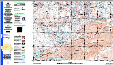
Rodinga 1-250,000 Topographic Map
$15.95 – $30.95
Description:
Print on Demand
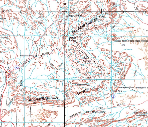
Santa Teresa 9 Mile Dam Adams Tank Alice Creek Alice Well Allambarinja Range Allambi Allambi Airfield Allora Bore Altalweynimma Waterhole Amonga Dam Arowie Waterhole Atherita Bore Atlalweynimma Waterhole Atoothenna Bore Bank Hole Waterhole Bill Dam Black Hill Bore Bloodwood Bore Bluebush Dam Bokhara Bore No 3 Boundary Dam Breaden Dam Brumby Hole Yard Brumby Springs Bulldust Bore Bundooma Camel Creek Camel Dam Camel Flat Bore castle Rock Chalmers Dam Chambers Pillar Chamber’s Pillar Historical Reserve Charlotte Range Christmas Bore Christmas Dam Christmas Dams Christmas Yards Claypan Dam Confusion Dam Cox Creek Cultivation Bore Danny Whites Yard Dead Horse Dam Deep Bore Deep Well Deep Well Bore Deep Well North Sr Bore Deep Well Range Desert Bore Desert Hill Dewars Tank Dingo Dam Dingo No 1 Gas Well Dingo No 2 Gas Well Dingo Tank Double Garden Waterhole Duck Swamp Yard Dud Bore Eaglenest Bore East Bore Eight Mile Yard Eighty Four Bore Ewaninga Rock Carvings Conservation Reserve Exoil Bore Exploration Bore Frances Creek Frances Well Ganley Bore Georges Dam Gloaming Dam Gum Tree Creek Gumtree Bore Gumtree Hills Gypsum Bore Gypsum Dam Hale Halfway Dam Halfway Yard Hayes Springs Hayes Well Hells Gate Bore Hugh Hugh River Trucking Yards Idracowra Ilnx Bore Indildra Claypan Interial Dam Jackawarra Creek Jackawarra Dam John Holland Bore Johnson Bore Johnstone Range Kangaroo Dam Kangaroo Well Kittsiquana Yard Kraegans Creek Kraegens Grave Laura Dam Limejuice Bore Long Waterhole Lookout Dam Ltyentye Apurte Community Education Centre Ltyentye Apurte Community Library Ltyentye Apurte Health Centre Macmillians Creek Magellan Bore Magnificence Bore Main Camp Main Camp Waterhole Marion Springs Maryvale Maryvale Hills Mereenie Bore Middle Bore Middle Bores Minnies Creek Mitchells Bore Morley Bore Morleys Swamp Dam Mount Brunonia Mount Burrell Mount Capitor Bore Mount Charlotte Mount Duff Mount Gloaming Mount Grevillea Mount Guenevere Mount Madigan Mount Ooraminna Mount Peachy Mount Peachy Bore Mount Pellinore Mount Polhill Mount Rodinga Mount Santo Mount Strawbridge Mount Trioda Mt Burrell Bore Mulga Claypan Never Never Dam New Year Dam Nine Mile Creek No 1 Bore No 2 Bore No 3 Bore No 5 Bore Nombra Bore North East Dam Oak Valley Old Station Dam Oldfields Dam Oliffe Creek Oliffe Range One Tree Hill Dam Oodratnamma Waterhole Ooraminna Ooraminna Dam Ooraminna Number 1 Oil Bore Ooraminna Range Ooraminna Waterhole Orange Creek Orange No 1 Gas Well Pacoota Bore Parakeelia Peak Pascoe Springs Percy Hill Phillipson Bore Phillipson Creek Picnic Bore Pillar Range Pinch Bore Pinnacle Hills Pituri Bore Polhill Prominent Pillar Pwerte Marnte Marnte Railway Bore Rainbow Valley Bore Rainbow Valley Conservation Reserve Rainbow Valley Tank Razorback Bore Rigaud Tower Robinson Dam Rockhole Bore Rodinga Rodinga Dam Rodinga Range Salt Springs Santa Teresa Aerodrome Santa Teresa Police Station Soakage Dam Soapy Bore Southern Cross Bore Star Bore Syphon Tank Titjikala Titjikala Health Centre Titjikala School Todd Dam Touchy Touch Bore Train Hills Twenty Seven Mile Dam Two Wells Bore Ulta Creek Vernas Gap Bore Waggon Road Dam Walkabout Bore Waterhouse Range Whinams Spring White Hill Dam White Hills Bore Whitehorse Tank Whitewood Bore Yam Bore Yam Creek Yuljardna Bore Barnham Spring Deep Well Station Phillipsons Creek Minnie Well Minnie Flat Top Hill Rodinga Siding Nine Mile Dam Tent Hill Chambers Pillar Historical Reserve Bundoomah Bundooma Siding Pascoe Spring Australia Commonwealth of Australia
| Name: | Rodinga |
| Publisher: | Geoscience Australia (Australian Government) |
| Scale: | 1:250000 |
| Latitude Range: | 24° 00.0′ S – 25° 0.0′ S |
| Longitude Range: | 133° 30.0′ E – 135° 0.0′ E |
| Projection / Datum: | Universal Transverse Mercator, GDA94 |
| Approx Print Size: | 0.44m X 0.67m |
| Publication Date: | 1-Jun-04 |


