Rome and Italy South Map ITMB
$24.95
2 in stock
Description:
Rome and Italy South Map ITMB
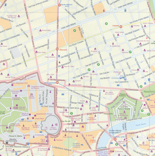
Increased the area of coverage significantly, using the Tevera River as a north-south axis. This places the Vatican and the ‘new’ city on the left side of the page, with the main shopping area, the Roman remains, the Colosseum, and the railway station on the right hand side. The map goes as far north as the ring road, so most former Olympic buildings are shown, and as far south as the Giancolense hospital complex, which is further than our competitors cover. Naturally, the map notes major touristic attractions, hotels, shopping areas, religious buildings, park and plazas, theatres, post offices metro lines and stations.
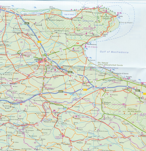
The second side of the map is equally fascinating. We believe that traditional city maps need to show more than just the city centre, as has been common practice for decades. Most travellers visit a city, even a major city like Rome for only a few days as part of a greater trip. For the past several years, we have been adding ‘hinterland’ surrounding area maps to our city maps so that end-use buyers don’t have to buy two maps to get around. Well, in the case of Rome, a map of all of southern Italy, including Sicily and Sardinia made sense to us, so we created a brand new and very detailed map covering Italy South.
It is essentially a driving map, using symbols to note touristic attractions, whether those be castles, historic churches, interesting towns, beaches, or the remains of Greek and early Roman settlement. This was a tremendous undertaking, which is why our map of Rome has been unavailable for several months. Printed on waterproof plastic, to thank our many supporters who seem to like our style of mapping.
ISBN 9781553417293