
San Antonio – Austin & Hill Country Rand McNally
$17.95
1 in stock
Description:
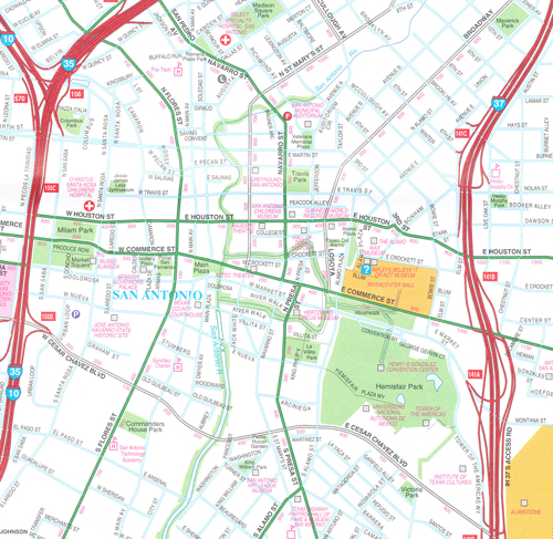
Rand McNally’s folded map for San Antonio Austin & the Hill Country is a must-have for anyone traveling in and around this part of Texas, offering unbeatable accuracy and reliability at a great price. Our trusted cartography shows all Interstate, U.S., state, and county highways, along with clearly indicated parks, points of interest, airports, county boundaries, and streets. The easy-to-use legend and detailed index make for quick and easy location of destinations. You’ll see why Rand McNally folded maps have been the trusted standard for years.
Full-color maps
Clearly labeled Interstate, U.S., state, and county highways
Indications of parks, points of interest, airports, county boundaries, downtown & vicinity maps
Major attractions & Golf Courses
Enlargements of Austin downtown, San Antonio downtown, Austin-Bergstrom Intl Airport, San Antonio Intl Airport.
Easy-to-use legend
Detailed index & Major Street Index
Communities Included: Burnett, Fredericksburg, Georgetown, Kerrville, Llano, Lockhart, New Branunfels, Round Rock, San Marcos, Seguin, Taylor
- Publisher : Rand McNally; Fol Map edition (April 16, 2014)
- Language : English
- Map : 2 pages
- ISBN-10 : 052800817
- ISBN-13 : 9780528008177
- Dimensions : 4.2 x 1 x 8.7 inches