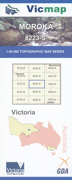
Tamboritha Moroka 1-50,000 Vicmap Old Edition
$14.00
Description:
OUT OF PRINT
Replaced by Moroka 1-50,000 Vicmap below, which will supplied if this map is ordered.
Moroka 1-50,000 covers the same are at the same scale

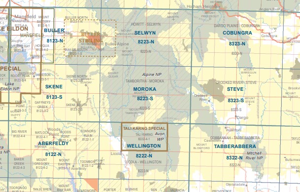
Moroka 1-50,000 scale Victorian Topographical map 8223S is used for Walking, 4WD, Fishing, Camping, Motorcycle, both On and Off Road, Gold Prospecting and for those simply going for a family weekend drive.
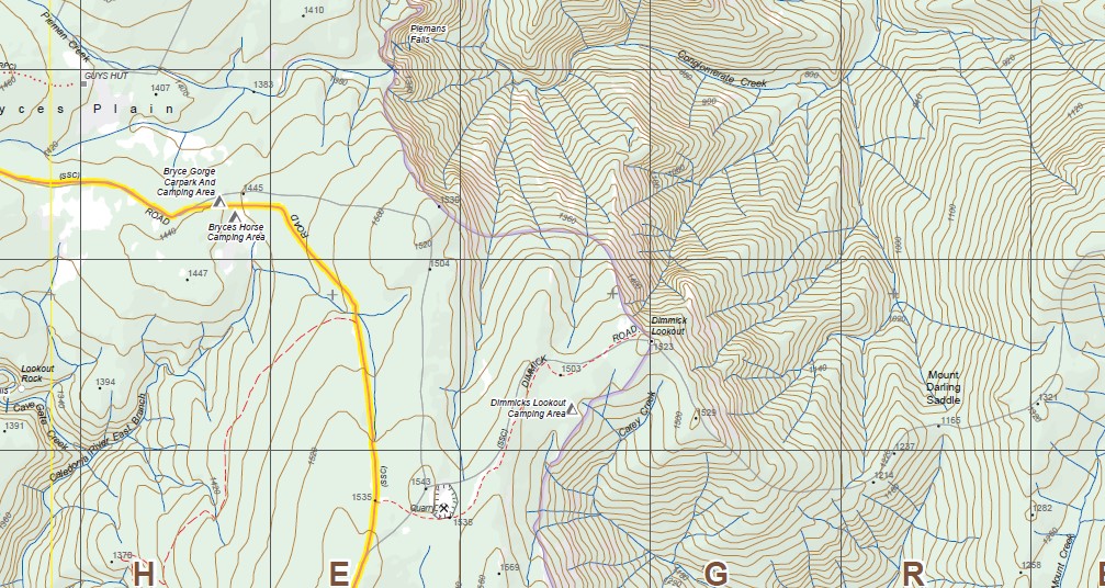
Topographical maps show not only Contours of the Terrain but Walking Tracks, Sealed and Unsealed Roads, Rivers, Creeks, Lakes, Historical Point of Interest, Old Mine Sites mbtg and both National and State Park areas.
Main Features of this map includes:
Mount Liger (The Crinoline), Mount Clear, Toms Cap, Wonnangatta River, Mount Tamboritha, Mount Arbuckle and Mount Reynard, Basalt Knob, Far Yard Saddle, Barkly River State Forest, Mount Lookout, Mount Von Guerard, Mount Larrit, Mount McAdam, The Sugarloaf Hill, Mount Cynthia Range, The White Ladies, Moroka Gorge and Falls, Mount Dawson, Mount Kent, Mount Short, Cromwell Knob, Barstards Neck, Minogues Lookout, Yellow Bull Gap, mbtg Mount Darling Snowy Bluff Wilderness Zone, Bryces Gorge, Conglomerate Creek Falls, Dimmick Lookout, Mount Lookout, Mount Reynard, Mount Arbuckle, Carey State Forest, McFarlane Saddle, part of McMillans Track, mbtg, Mount Clear, Mount Reynard, Mount Tamboritha, Mount Darling – Snowy Bluff Wilderness Zone, Bryces Gorge, Conglomerate Creek Falls, Dimmicks Lookout, Bryce Gorge Carpark And Camping Area, Snowy Range Camping Area, Bryce Gorge Carpark And Camping Area, Carey Spur, Mount Darling Saddle, Mount Darling, Mount Darling Gap, Mount Short, part of McMillans Track, Mount McAdam, Mount Larrit, part of the Wonnangatta Track, Herne Spur Track, Wombat Range Track, The White Ladies, Hibernia State Forest, Norton Flat, MOUNT VON GUERARD, Mount Hart, Cynthia Range Track,, Mount Liger (The Crinoline), Mount Clear, Toms Cap, Wonnangatta River, Mount Tamboritha, Mount Arbuckle and Mount Reynard, Basalt Knob, Far Yard Saddle, Barkly River State Forest, Mount Lookout, Mount Von Guerard, Mount Larrit, Mount McAdam, The Sugarloaf Hill, Mount Cynthia Range, The White Ladies, Moroka Gorge and Falls, Mount Dawson, Mount Kent, Mount Short, Cromwell Knob, Barstards Neck, Minogues Lookout, Yellow Bull Gap, mbtg Mount Darling Snowy Bluff Wilderness Zone, Bryces Gorge, Conglomerate Creek Falls, Dimmick Lookout, Mount Lookout, Mount Reynard, Mount Arbuckle, Carey State Forest, McFarlane Saddle, part of McMillans Track
Jamieson River North Branch, Part of the Upper Goulburn State Forest, The Knobs, Saltlick Saddle, Barkly River State Forest, Mountain Ash Spur, McAlister Spur and part of the McAlister River, High Cone, Square Top, Mount Clear, Toms Cap, Macalister Area Remote and Natural Area, Brindle Bull Gap, Yellow Bull Gap, Caledonia River Middle Branch, BUTCHER COUNTRY SPUR, Barstards Neck, Minogues Lookout, East Caledonia Reference Area (no public access), mbtg, Tamboritha, Mount Tamborita, Little Tamboritha, Tamboritha Saddle, Basalt Knob, Far Yard Saddle, Horrell Plain and Top, Reynard, Part of the McAlister River, Macalister Area Remote and Natural Area, Crinoline Walking Track, Mount ligar, Crookayan, part of McMillans Walking Track, Mount Reynard, Buragwonduc, Carey State Forest, Calendonia Spur, Thomastown Camping Area, Mcmichael Hut And Camping Area
You may also like…
-
Moroka 1-50,000 Vicmap
Price range: $12.00 through $24.00Select options This product has multiple variants. The options may be chosen on the product page -
Tali Karng Special 1-25,000 Vicmap Topographic Map
Price range: $14.00 through $26.00Select options This product has multiple variants. The options may be chosen on the product page