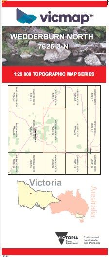
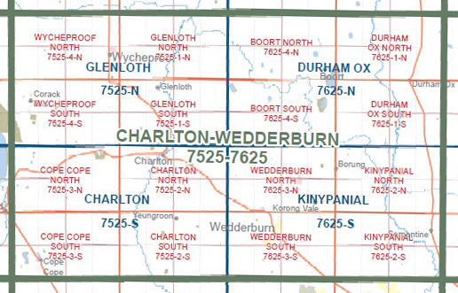
WEDDERBURN NORTH 1-25,000 Vicmap Topo Map 7625-3-N
Price range: $14.00 through $26.00
Description:
WEDDERBURN NORTH 1-25,000 Vicmap Topographic Map 76253N NOW PRINT ON DEMAND is used for Walking, 4WD, Fishing, Camping, Motorcycle, both On and Off Road, Gold Prospecting and for those simply going for a family weekend drive.
This is a new series of 1-25,000 scale maps, all sections of Victoria are covered by these maps.
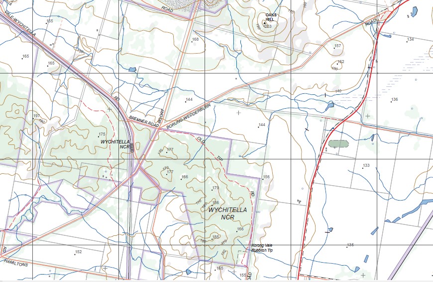
Topographical maps show not only Contours of the Terrain but Walking Tracks, Sealed and Unsealed Roads, Rivers, Creeks, Lakes, Historical Points of Interest, Old Mine Sites and National mbtg and State Park areas.
Main Features of this map includes:
BUCKRABANYULE, WOOSANG H45 BR, WYCHITELLA NCR, BEGGARY Hills, Skinners Flat Reservoir, Ktm Mine, MOUNT KERANG RANGE, GLOSSODIA Hill, Wychitella, Woolshed Flat, Railway Reservoir, Korong Vale Reference Area (no public access), Korong Vale, MOUNT EGBERT, Borung
You may also like…
-
KINYPANIAL NORTH 1-25,000 Vicmap Topo 7625-2-N
Price range: $14.00 through $26.00Select options This product has multiple variants. The options may be chosen on the product page -
KINYPANIAL SOUTH 1-25,000 Vicmap Topo 7625-2-S
Price range: $14.00 through $26.00Select options This product has multiple variants. The options may be chosen on the product page -
WEDDERBURN SOUTH 1-25,000 Vicmap Topo Map 7625-3-S
Price range: $14.00 through $26.00Select options This product has multiple variants. The options may be chosen on the product page -
Kinypanial 1-50,000 Vicmap
Price range: $12.00 through $24.00Select options This product has multiple variants. The options may be chosen on the product page