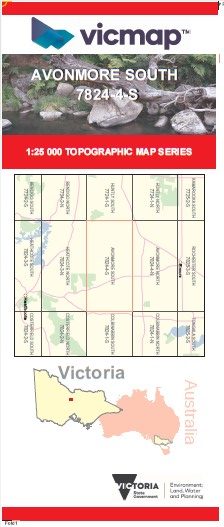
AVONMORE SOUTH 1-25,000 Vicmap Topo Map 7824-4-S
Price range: $14.00 through $26.00
Description:
AVONMORE SOUTH 1-25,000 Vicmap Topographic Map 78244S Now Print On Demand is used for Walking, 4WD, Fishing, Camping, Motorcycle, both On and Off Road, Gold Prospecting and for those simply going for a family weekend drive.
This is a new series of 1-25,000 scale maps, all sections of Victoria are now covered by these maps, including maps over the South Australian and NSW Borders.
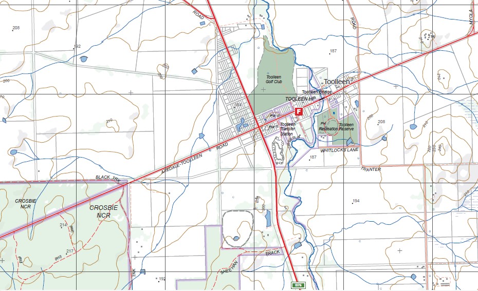
Topographical maps show not only Contours of the Terrain but Walking Tracks, Sealed and Unsealed Roads, Rivers, Creeks, Lakes, Historical Points of Interest, Old Mine Sites mbtg and National and State Park areas.
Main Features of this map includes:
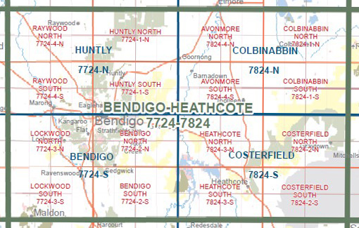
Covers the old series 1-25,000 Vicmaps BARNADOWN and Toolleen
Toolleen, BARNADOWN, CAMPASPE RIVER, Fosterville Gold Mine, ELLESMERE BR, Russell Bridge, MOUNT SUGARLOAF NCR, O’Dwyers Bridge, Joyces Bridge, Muskerry, Noel Tuohey Bridge, CROSBIE NCR, Mulvehills Bridge, Myola, Toolleen Mine (Disused), MOUNT CAMEL, Cornella
You may also like…
-
BENDIGO HEATHCOTE 1-100,000 Vicmap 7724-7824
Price range: $14.00 through $26.00Select options This product has multiple variants. The options may be chosen on the product page -
AVONMORE NORTH 1-25,000 Vicmap Topo Map 7824-4-N
Price range: $14.00 through $26.00Select options This product has multiple variants. The options may be chosen on the product page -
COLBINABBIN SOUTH 1-25,000 Vicmap Map 7824-1-S
Price range: $14.00 through $26.00Select options This product has multiple variants. The options may be chosen on the product page -
COLBINABBIN NORTH 1-25,000 Vicmap Map 7824-1-N
Price range: $14.00 through $26.00Select options This product has multiple variants. The options may be chosen on the product page