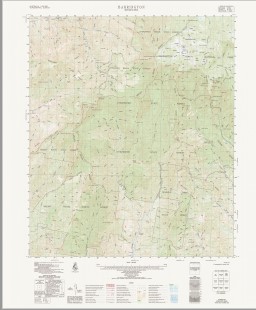
Barrington 1-50000 Topographic Map 9133-1 NSW 1982 Edition
$14.95
Description:
Barrington 1-50,000 Topographic Map 91331 NSW 1982 Edition Print on Demand
Locations within this Map
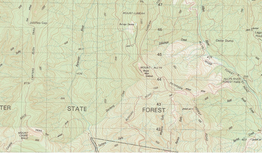
Mount Allyn Allyn Allyn Range Allyn River Araluen Creek Aeroplane Hill Badger Creek Bald Hill Bald Knob Bald Knob Creek Barrington Barrington Falls Mount Barrington Basden Falls Basin Creek Ben Bullen Beranghi Creek Bibburah Creek Big Gully The Big Hole Big Jack Mountain Big Losy Mountain Big Lousy Mountain Big Rock Billagal Creek Bobs Swamp Bobs Ridge Bobs Crossing Bluey Creek Bluey Gully Blue Gum Gully Blue Gum Flat Black Swamp Binnowee Gully Binalong Creek Bolenoon Creek Boonabilla Boonabilla Creek Broad Gully Broadwater Island Broocoloot Bald Brookers Creek Brumlow Creek Mount Cabre Bald Camira Creek Caneens Gap Careys Peak Carrabolla Carrow Carrow Brook Mount Carrow Carters Brook Cedar Dump Chichester State Forest Cobbys Bluff Cobbys Falls Cobbys Gully Cockcrow Cockcrow Creek Cockcrow Mountain Cockys Bog Gully Cones Brush Gully Coopers Gully Cooreen Gully Corang Gully Corker Mountain Cross Creek Davis Creek Derribong Creek Eagle Hill Eccleston Eccleston Public School Edwards Creek Edwards Plain Edwards Swamp Elbow Creek Emu Creek Eremeran Point Fal Brook Fal Pinnacle Far Eastern Creek Far Eastern Falls Garden Gully Gillwinga Creek Giwarra Gully Governors Lookout Gubburra Creek Mount Gunama Gundaroo Creek Howes Creek Jolliffes Gap Jump Creek Jump Spur Junction Pools Karawa Gully Kenneths Gully Cabre Bald Cobbys Creek The Corker Dungletood Eckford Downs Howes Gully Kindimidi Creek Kulmaren Gully Kungie Gully Kungie Rock Kurranulla Creek Ladies Well Lagoon Pinch Landslip Gully Left Branch of Barrington River Left Hand Creek Liebeg Little Losy Mountain Little Lousy Mountain The Long Ridge Loders Ridge Losy Mountain Mount Lumeah Main Creek Malumla Gully Mount Malumla Malumla Range Massey River Masseys Creek Masseys Creek State Forest Meehans Peak Meehans Peak Gully Micabil Gully Middle Branch of The Barrington River Mount Allyn Lookout Mount Lousey Mount Royal Mount Royal Creek Mount Royal State Forest Mulgowrie Creek Mulwala Creek Mumfords Creek Myrtle Gully Myuna Creek Narara Gully Narrow Bottom Narrow Bottom Gully The Narrows Nattai Creek Niambar Gully Norrow Oakey Gully Oaky Creek Oaky Gully O’Gradys Hut Oldcastle Mount Paterson Mount Patterson Peugeot Point Pieries Peak Pieries Point Pieries Ridge Piery Ridge Pinnaburra Creek The Pinnacle Pippita Gully Pituri Creek Rattly Ground Right Hand Creek Rocky Crossing Rocky Knob Lookout Rosamond Royal Sandy Flat Sawpit Gully Saxby Creek Saxby Swamp Scouts Alley Sempills Creek Sheepstation Creek Shell Brook Simmone Creek Smiths Mount Sneaky Pinch South Arm of Stewarts Brook Spring Creek North Arm of Stewarts Brook Stony Point Tarrawonga Creek Tathara Gully The Jump The Spring Timbarra Gully Trangie Creek Tweedie Creek Tyawan Gully Wallaby Hill Wallen Mount Wattle Ridge Weemata Creek Whiporie Gully Mount William Williams Falls Williams Spring Wombat Creek Woodbury Creek Woolar Gully Dillaburra Creek Yelgun Gully Youngville Doon Double Falls Diggers Creek Bungarie Creek Burraga Swamp Blue Gum Flora Reserve Barrington Tops Tops To Myalls Heritage Trail Upper Allyn Woolooma Stewarts Brook Malvern Mount Cockcrow Shellbrook
| Name: | Barrington |
| Publisher: | Geoscience Australia (Australian Government) |
| Scale: | 1:50000 |
| Latitude Range: | 32° 00.0′ S – 32° 15.0′ S |
| Longitude Range: | 151° 15.0′ E – 151° 30.0′ E |
| Projection / Datum: | Universal Transverse Mercator, GDA94 or WGS84 |
| Approx Print Size: | 0.56m X 0.56m |
| Publication Date: | 1-Jun-82 |
You may also like…
-
Barrington Tops 1-25,000 NSW Topographic Map
Price range: $16.95 through $28.95Select options This product has multiple variants. The options may be chosen on the product page -
Barrington Tops and Wollemi National Parks Map Hema
-
Chichester 1-25,000 NSW Topographic Map
Price range: $16.95 through $28.95Select options This product has multiple variants. The options may be chosen on the product page