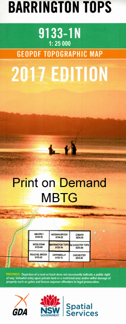
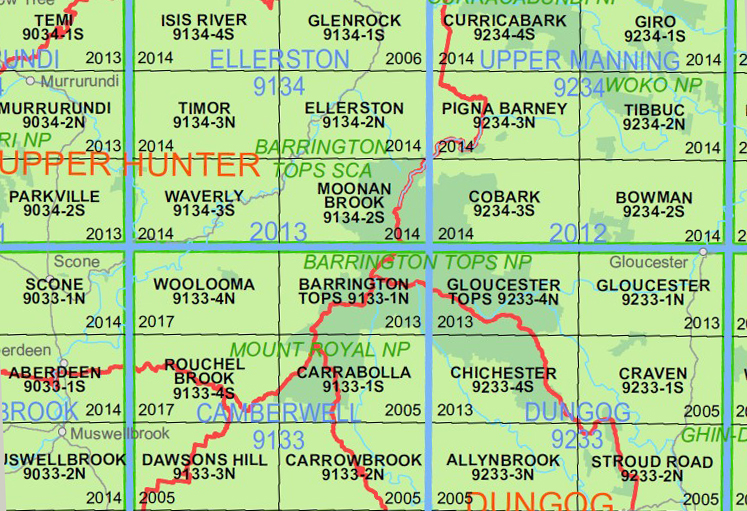
Barrington Tops 1-25,000 NSW Topographic Map
Price range: $16.95 through $28.95
Description:
Barrington Tops 1-25,000 NSW Topographic Map
9133-1-N Print on Demand
Barrington Tops 91331n 1-25,000 scale NSW Topographical map is used for Walking, 4WD, Fishing, Camping, Motorcycle, both On and Off Road, Gold Prospecting and for those simply going for a family weekend drive.
Topographical maps show not only Contours of the Terrain but also Walking Tracks, Sealed and Unsealed Roads, Rivers, Creeks, Lakes, Historical Point of Interest, Old Mine Sites and National and State Park areas.
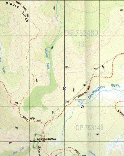
map includes the following localities: Allyn Range Allyn River Aeroplane Hill Bald Hill Barrington Barrington Falls Mount Barrington Basden Falls Ben Bullen Bibburah Creek Big Gully The Big Hole Big Jack Mountain Big Losy Mountain Big Lousy Mountain Big Rock Bobs Swamp Bobs Ridge Bobs Crossing Bluey Creek Bluey Gully Blue Gum Gully Blue Gum Flat Black Swamp Binalong Creek Brumlow Creek Caneens Gap Careys Peak Carters Brook Cedar Dump Chichester State Forest Cobbys Bluff Cobbys Falls Cobbys Gully Cockcrow Cockcrow Mountain Cockys Bog Gully Cones Brush Gully Coopers Gully Corang Gully Corker Mountain Eagle Hill Edwards Creek Edwards Plain Edwards Swamp Elbow Creek Emu Creek Eremeran Point Far Eastern Creek Far Eastern Falls Garden Gully Gillwinga Creek Giwarra Gully Governors Lookout Mount Gunama Jolliffes Gap Junction Pools Karawa Gully Kenneths Gully Cobbys Creek The Corker Eckford Downs Kindimidi Creek Kulmaren Gully Kungie Gully Kungie Rock Lagoon Pinch Landslip Gully Left Branch of Barrington River Left Hand Creek Little Losy Mountain Little Lousy Mountain The Long Ridge Losy Mountain Mount Lumeah Meehans Peak Meehans Peak Gully Micabil Gully Middle Branch of The Barrington River Mount Allyn Lookout Mount Lousey Myrtle Gully Oakey Gully Oaky Creek Oaky Gully O’Gradys Hut Oldcastle Mount Paterson Mount Patterson Pinnaburra Creek Pippita Gully Right Hand Creek Rocky Crossing Rocky Knob Lookout Sandy Flat Sawpit Gully Saxby Creek Saxby Swamp Scouts Alley Sempills Creek Sheepstation Creek South Arm of Stewarts Brook Spring Creek North Arm of Stewarts Brook Stony Point Tarrawonga Creek The Spring Timbarra Gully Tweedie Creek Tyawan Gully Wallaby Hill Wallen Mount Wattle Ridge Weemata Creek Mount William Williams Falls Williams Spring Wombat Creek Woolar Gully Yelgun Gully Doon Double Falls Diggers Creek Bungarie Creek Burraga Swamp Blue Gum Flora Reserve Barrington Tops Tops To Myalls Heritage Trail
| Scale: | 1:25000 |
| Latitude Range: | 32 00.0 S – 32 07.5 S |
| Longitude Range: | 151 15.0 E – 151 30.0 E |
| Approx Print Size: | 0.56m X 1.11m |
| Projection: | Transverse Mercator |
You may also like…
-
Cobark 1-25,000 NSW Topographic Map
Price range: $16.95 through $28.95Select options This product has multiple variants. The options may be chosen on the product page -
Moonan Brook 1-25,000 NSW Topographic Map
Price range: $16.95 through $28.95Select options This product has multiple variants. The options may be chosen on the product page -
Chichester 1-25,000 NSW Topographic Map
Price range: $16.95 through $28.95Select options This product has multiple variants. The options may be chosen on the product page