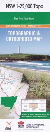
Bendemeer 1-25,000 NSW Topographic Map
$16.95 – $31.95
Description:
9136-3-S
Bendemeer 91363s 1-25,000 Scale NSW Topographical Map is usedfor Walking, 4WD, Fishing, Camping, Motorcycle, both On and Off Road, GoldProspecting and for those simply going for a family weekend drive.
Topographicalmaps show not only Contours of the Terrain but also Walking Tracks, Sealed andUnsealed Roads, Rivers, Creeks, Lakes, Historical Point of Interest, Old MineSites and National and State Park areas.
 Laminate and folded this NSW Topographical map, $12.00 see below.
This map includes the following localities: Glenunga Park Bonna Brooklyn Lumbla Avondale Foxley Riverside Spring Valley Jalna Bendemeer Dallas Mount View West Mount View Glen Rose Sweeps Gap Yangarra Carinya Glenmore Nirvana The Ranges Hanwood Mickys Farm Woodlands Nerstane Silverleaf Broula The Ranch Glenleigh Waranga Duneln Montana The Gunyah Hilltop Woodside Ferndale The Glen Green Hills Lahoma Blaaven Rutherglen Beebox Hill Bendemeer Common Bendemeer Creek Bettisons Gully Big Billy Mountain Bill Dick Peak Blue Pinch Blue Gully Blue Gully Swamp Black Jack Mountain Black Springs Browns Gully Cockburn Cockburn Park Cooee Creek Cooee Mountain Danglemah Danglemah Railway Station Dunduckety Creek Elbergs Gully Faints Gully Faints Hole Fern Gully First Moonbi Flagstaff Hill Gaol Creek Gulligal Mount Gulligal Inglis Jamiesons Creek Edwards Black Jack Laheys Creek Lighthouse Hill Log Gully Macdonald River Masons Gully Moonbi Moonbi Gap Moonbi Lookout Moonbi Range Moore Creek Dam Never Never Mountains New England New England Gully Oaky Creek Oaky Mountain Old Man Gully Perry Perrys Creek Perrys Ponds Pig Mountain Poison Swamp Creek Prices Hole Razorback Spur The Razorback Spur Second Moonbi Splitters Gully Spring Creek Station Creek Sugarloaf Mountain The Sugarloaf Western Branch of Little Oakey Creek Bullimballa Bullimbulla Mountain Butlers Gully Little Oakey Creek Oakey Creek Rose Valley Creek Bullimballa Mountain
| Scale: | 1:25000 |
| Latitude Range: | 30 52.5 S – 31 00.0 S |
| Longitude Range: | 151 00.0 E – 151 15.0 E |
| Approx Print Size: | 0.56m X 1.11m |
| Projection: | Transverse Mercator |

