Berlin and Eastern Germany Map ITMB
$24.95
2 in stock
Description:
Berlin and Eastern Germany Map ITMB
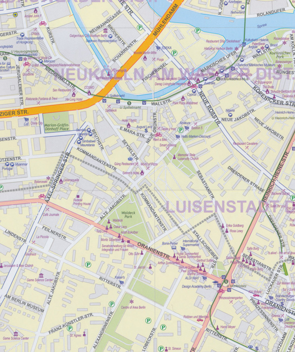
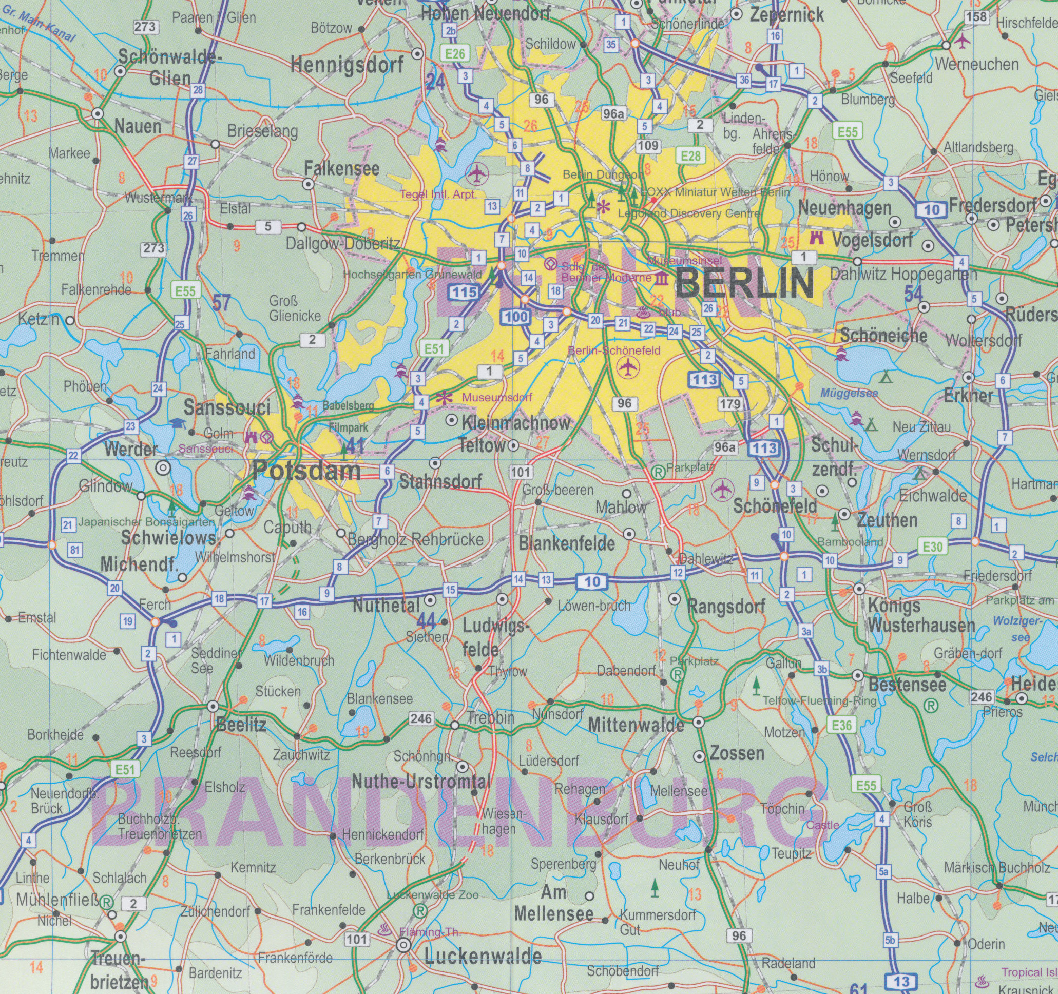
It is not often that we can come up with two completely different new maps on one sheet for areas that we have never done before. Berlin is a city growing in importance as it reassumes the mantle of being the capital of Germany. We have published this map to expand our range of city maps, and it does as much as one would expect. Main roads are shown in orange casing, secondary in pink, and local in white. Footprints demarcate major buildings and the map is covered with icons showing touristic attractions, hotels, and shopping areas. Rail lines and, of course, the S and U bahn lines are shown. To me, the strength of this map is the regional map of what used to be the DDR, or East Germany. After WW2, Germany was divided into military zones that morphed into East and West Germany over time.
Under Russian domination, East Germany was not open to travel for many years, so no travel maps were prepared. As communism collapsed and Germany was reunited, everyone had more important things to think about than a map for visitors, and authorities naturally wanted to “blur” the memories of decades of separation. As a result, there has never been a map of what used to be East Germany. There have been sectional road maps based on state boundaries, but these mean little to non Germans. This map shows Germany East to best advantage: walled towns, castles, nature reserves, roads.
ISBN 9781771290807