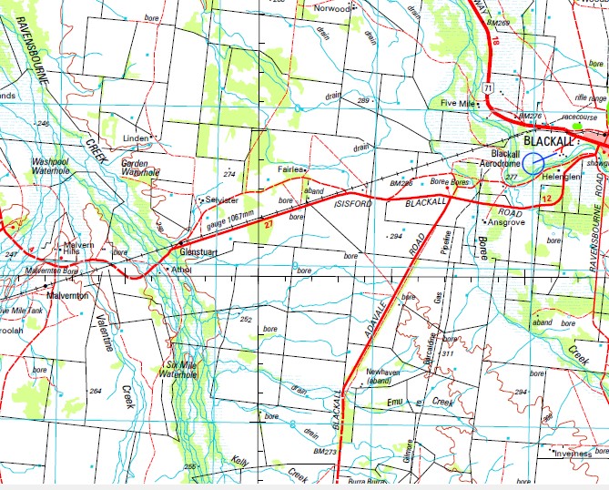
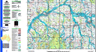
Blackall 1-250,000 Topographic Map
$15.95 – $30.95
Description:
Print on Demand
Somerset Portland Honan Downs Coolagh Mellew Allo-Omber Gaza Birkdale Mulgrave Mooney Valley Stratavon Greycroft Avington Mayfair Evora Barnstaple Portland Downs Mena Park Janet Downs Wakefield Ramsay Park Greenswoods Melrose Tamar Dumrossil Leitrum Isis Downs Prairie Downs Avondale Tarves Gowan Downs Clarendon Barwen West End Avonleigh Alice Downs Ventry Oma Mons Springfield Coreen Ruthven Thornleigh Norwood Woodbine Dunrobin Gidia Park Rutland Park Moorlands Five Mile Taramaway Limden Juray Fairlea Helenglen Wahroongan Neleh Downs Selvister Ansgrove Strathmeadows Rivington Malvern Hills Athol Blairgowrie Glen Afton Mariana Wooroolah Bilbah Downs Idalia Stud Springleigh Newhaven abandoned Talundilly Smith Lagoon Pemberley Benalla Lilyveil Inverness Lowana Milton Park Bloomfield Grey Mount Morundah New Deer Emmet Shed Eastwood Albilbah Flemington Emmet Downs Terrick Terrick Stud Tarbarah Allambie Bellevue Greenlaw Harden Mount New Haven Warringah Homebush Hombush Terrick Terrick Carlow Idalia Highlands Koondoo Lorne Peak Blackall Alice River Apurlu Athol Tank Water Facility Avington Waterhole Barcoo Barnstaple Creek Battery Battery Knob Mount Battery Belvoir Bend Waterhole Benlidi Berriedale Bonavista Bonnie Doon Bonnie Downs Creek Boodoo Creek Boon Boree Creek Boree Water Facility Bottletree Creek Boundary Creek Boundary Point Box Creek Bride Creek Brixham Creek Mount Brookes Brownings Waterhole Buccleuch Bull Creek Bullock Creek Mount Bullock Burra Burra Bore Butler Mount Calder Cameronia Creek Camomile Creek Camp Creek Carse Creek Cleanskin Creek Clipstone Conway Creek Crow Creek Mount Cullen Curran Dalkeith Deadlock Creek Doon Creek Double Corner Creek Double Top Douglas Ponds Creek Dulwich Eastwood Water Facility Eight Mile Creek Elbow Creek Mount Ellen Emmet Emmet Water Facility Emmett Emmroonga Water Facility Emu Creek Fanning Creek Flat Top Fort Douglas Four Mile Creek Garden Waterhole Gazer Creek Gidya Creek Gilgunyah Glenstuart Gowan Gowan Creek Gowan Range Granby Green Lagoon Harden Creek Mount Harden Hawarden Homebush Water Facility Hope Creek House Creek Huntingtower Isisford Jackson Creek Jingera Creek Kelly Creek Kelvin Creek Kenealy Kilman Waterhole Konupa Lauriston Law Lily Lagoon Little Cleanskin Creek Log Creek Lorne Mountain Macedon Range Maindample Malcolm Gap Mount Malcolm Malvern Malvernton Manners Margaret Creek Mount Margaret May More Waterhole Mayfair Creek McLeod Creek Mekaree Melton Merry Peaks Middle Creek Mingera Creek Minster Mistake Creek Mount Mistake Mitchell Monk Montes Moorefield Water Facility Moran Creek Mosquito Creek Mosquito Water Facility Mount Grey Mud Hut Creek Murrays Creek Myrtle Creek Nine Mile Waterhole Nob Norwood Creek Oakland Bore Observatory Hill One Mile Waterhole One Tree Hill Ossington Ossington Creek Overreach Overshot Creek Pemberley Creek Penny Knob Pershore Pershore Water Facility Pighole Creek Plane Creek Putney Ravensbourne Creek Mountain Red Redbank Creek Running Creek Saltwater Creek Sandy Creek Scrubby Creek Scrubby Mountain Seaford Mount Sentinel Shaft Creek Sheepyard Creek Six Mile Waterhole Skeleton Creek Mount Slowcan Mount Slowcombe Smith Creek Snake Creek Splitters Gully Spring Creek St Helena Creek Strathconan Surveyors Creek Swaylands Talundilly Creek Tank Creek Tarves Water Facility Telegraph Creek Terrick Terrick Waterhole Thalia Creek The Nob The Sisters Thornleigh Creek Toorina Creek Twenty Mile Creek Ungo Vacy Wakefield Water Facility Washpool Waterhole Watson Creek Mount Watson Weetwood Welbeck Welbeck Creek Welbeck Water Facility Well Creek Whisky Creek Whittingham Wild Horse Creek Wooroolah Creek Yanyang Range Yaraka Idalia National Park Moombria Dam Shaft Creek Six Mile Dam Saint Helena Bore Coolagh Waterhole Melton Bore Lagoon Creek Wakefield Bore Wakefield Tank Saint Helena Creek Donelly Tank Maitland Bore Douglas Ponds Boundary Hut Bore Hascombe Bore Foggy Tank Gowan Hills Prairie Dam Derry Bore Oma Waterhole Growston Tank Whisky Tank Reid Tank Woodbine Bore Adelina Tank Bullock Creek Bore Mosquito Tank Adelina Bore Gidya Park Corners Bore Concord Bore Blackall Shire Old Albilbah Old Albilbah Station Valentine Creek Gowan Out Station Boree Bore Wahroongah Crow Tank Woodside Bore Moran Bore Glenstuart Station Oaklands Bore Mount Mingera Mingera Mountain Malvernton Station Triangle Bore Five Mile Tank Alton Bore Blairgowrie Out Station Bradshaw Dam Jacksons Bore Stratford Dam Benlidi Station Derrimut Bore Hope Tank Smiths Lagoons Snake Creek Bore Mekaree Station Scotts Bore Myrtle Bore Minister Creek Pats Dam Eastwood Bore Dry Paddock Bore Athol Tank Ungo Station Major Tank Carse Dam Boree Dam Mistake Bore Two Mile Dam Meadow Bore Henley Bore Saltbush Dam Minor Bore Konupa Station Dysons Dam Gap Creek Mount Brooks Saltbush Bore Minor Dam Mount Harden Dam Lorne Opal Bore Eight Mile Dam Beefwood Dam One Mile Creek Homebush Bore Kellys Dam Cable End Bore Twelve Mile Dam Watson Dam Klama Park Yan Yang Range Mistake Dam Urialla Dam Alice Creek Idalia Bore Deep Creek Red Mountain Mount in Red
| Name: | Blackall |
| Publisher: | Geoscience Australia (Australian Government) |
| Scale: | 1:250000 |
| Latitude Range: | 24° 00.0′ S – 25° 0.0′ S |
| Longitude Range: | 144° 0.0′ E – 145° 30.0′ E |
| Projection / Datum: | Universal Transverse Mercator, GDA94 |
| Approx Print Size: | 0.44m X 0.67m |
| Publication Date: | 1-Jun-03 |


