
Auvergne 1-250,000 Topographic Map GA
Price range: $15.95 through $27.95
Description:
Auvergne 1-250,000 Topographic Map GA Print on Demand
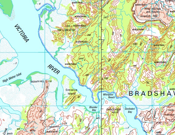
Timber Creek 50/73 Bore 51/73 Bore Alberts Waterhole Algies Bore Alligator Creek Alligator Hole Alligator Hole Yard Alligator Point Alligator Rock Hole Alligator Springs Waterhole Alligator Waterhole Alpha Creek Angalarri River Archies Bore Argument Camp Bore Augustus Hole Auvergne Auvergne Lagoon Auvergne Lagoon Creek Auvergne Landing Ground Back Creek Bail Me Up Creek Baines Baines River Ballyangle Waterhole Banana Hill Barrabarrac Creek Barrak Barrak Barramundi Dam Barramundi Yard Barramundie Pump Beasley Knob Bevans Bore Big Horse Boat Ramp Big Horse Camping Ground Big Horse Creek Big Knob Waterhole Billabong Waterhole Black Point Black Tank Turkey Nest Blagok Pool Blue Lily Lagoon Blunder Bay Bottle Glen Bottle Tree Bore Boundary Creek Bradshaw Bradshaw Field Training Area Bradshaws Tomb Brickies Rockhole Brolga Swamp Brown Duck Waterhole Bubble Bubble Bubble Bubble Spring Bucket Spring Bucket Springs Buffalo Hills Bore Buffalo Spring Bull Creek Bulla Bulla Camp School Bulla Health Centre Bulla Landing Ground Bullo Gorge Bullo River Bullo River Landing Ground Bundaberg Bore Burketown Waterhole Butler Creek Camballin Spring Campbells Bore Cedar Lagoon Yard Chinaman Creek Cockatoo Creek Cockatoo Lagoon Curiosity Peak Death Corner Dam Denises Turkey Nest Desmonds Passage Dick Creek Dingo Creek Doojum Drovers Rest Dry Yard Duckhole Bore East Baines Gorge East Baines River Emerald Spring Endeavour Hill Entrance Island Ernie Lagoon Fancy Creek Flapper Hill Bore Flapper Hill Turkeynest Flying Fox Creek Flying Fox Spring Flying Fox Swamp Forsyth Creek Barrage Four Mile Dam Georges Bore Gingers Hill Gipsy Creek Goanna Spring Goanna Waterhole Golden Gate Creek Goobaieri Bay Googlie Holes Green Swamp Green Swamp Bore Gregory Bore Gregory National Park Gregorys Tree Gurrandalng Camping Area Hayes Billabong Hazard Creek Hector Waterhole Hickey Dam High Water Inlet Holdfast Reach Hungry Billabong Yard Indian Hill Jarrnarm Camp Ground Kangaroo Point Karracumby Peak Keep Bore Keep River Keep River Gorge Keep River Landing Ground Keep River National Park Keep River Ranger Station Keep Yard Kennedy Creek Kims Yard King Billabong Tank King Billabong Yard Kirks Spring Kneebone Kneebore Landing Ground Kollendong Valley Lalngang Creek Legune Legune Landing Ground Leichhardt Paddock Leichhardt Tank Lily Creek Lily Waterhole Lindens Bore Little Horse Creek Little Policemans Waterhole Lloyds Creek Lobby Creek Long Grass Bore Low Bald Hill Mairanyi Yard Marks Dam Marralum Marralum Landing Ground Menzies Tank Milligan Lagoon Moglamyee Yard Moriarty Creek Mosquito Flat Mount Burnwul Mount Dempsey Mount Golla Golla Mount Lagani Mount Millik Monmir Mount Septimus Muruning Mussel Hole Yard Myatt Napp Springs Creek Nelson Point Bore Nesmit Tank Newcastle Range Nganalam Art Site Nias Dam No 1 Tank No 2 Bore No 2 Tank No 5a Bore No 7 Hungry Bore Nutwood Creek Oakes Creek Old Homestead Bore Old Station Tank Osmans Bore Packsaddle Creek Paperback Creek Paperbark Bore Peartree Creek Peartree Tank Pelican Creek Peter Creek Pinkerton Range Pint Pot Creek Police Hole Lagoon Policeman Waterhole Policemans Hole Racecourse Billabong Rainbow Bore Razorback Red Rock Dam Retribution Bore Riley Dam Ring Lagoon Ritchies Bore River Bore River Peak Ronan Park Rooster Creek Rosies Falls Saddle Creek Saddle Creek Dam Saltwater Creek Salty Bore Samantha Spring Sandy Creek Sandy Island Shoal Reach Skeahan Billabong Skinner Point Skull Creek Skull Creek Bore Snake Creek Snake Creek Yard Snows Bore Solo Bore Soubon Spring Spencer Range Spirit Hill Spirit Hill Bore Spirit Hill Station Landing Ground Steeles Bore Stony Creek Sweetwater Bore Swordfish Bore Syphon Spring T H Crossing T H Yard Teds Rest The Elbow Waterhole The Tombs Timber Creek Aerodrome Timber Creek Health Centre Timber Creek Police Station Timber Creek Police Station Museum Timber Creek School Torys Bore Town of Timber Creek Transit Hill Trudies Falls Turtle Point Dam Victoria River Weaber Range Weabers Bore Weaner Dam Weaner Turkeynest West Baines River Whirlpool Reach Whirlwind Plains Wombat Billabong Wombat Bore Yambarran Range Border Creek Knox Creek Moogarooga Creek Goobaeri Bay Leguna Yambarren Range Vambarra Mountains Vambarra Range Yambarra Range Mount Wollondain Border Springs Mount Gola Gola Mount Lagynix Angallari River Mairanyi Pool White Cliff Muligan Lagoon Pinkerton Ranges Rooster Lagoon Nuvergna Glenarra Creek Blackfellow Creek Beasleys Knob Skinner Waterhole Lady Creek Spring Creek
| Name: | Auvergne SD5215 |
| Publisher: | Geoscience Australia (Australian Government) |
| Scale: | 1:250000 |
| Latitude Range: | 15° 00.0′ S – 16° 0.0′ S |
| Longitude Range: | 129° 0.0′ E – 130° 30.0′ E |
| Projection / Datum: | Universal Transverse Mercator, GDA94 |
| Approx Print Size: | 0.44m X 0.67m |
| Publication Date: | 1-Jun-02 |