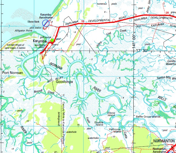
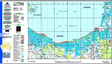
Burketown 1-250,000 Topographic Map
$15.95 – $30.95
Description:
Print on Demand
Magoura Yarrum Plain Creek Inverleigh Burketown Karumba Accident Inlet Albert River Alligator Island Alligator Lagoon Alligator Point Andiah Armraynald Armstrong Creek Armstrong Plain Armstrong Waterhole Point Austin Beaumonts Lagoon Bentinck Island Billygoat Lagoon Billys Creek Blue Bush Watercourse Bohemia Waterhole Bold Point Bookoor Brannigan Creek Brown Creek Buck Rock Buffalo Lake Buffalo Swamp Bulgaroo Swamp Bullock Waterhole Burial Reach Burke Point Burrowes Bynoe Bynoe Inlet Bynoe River Bynoe Waterhole Cadell Landing Carnarvon Carpenter Catherine Creek Cattle Creek Channon Creek Crooked Creek Crooky Creek Daroo Pocket Daviot Desmond Waterhole Dingo Waterhole Dinner Creek Disaster Inlet Dog Leg Lagoon Double Island Dring Duck Hole Elbow Bank Elbow Island Fareham Finucane Island Fitzmaurice Point Flinders River Fools Lagoon Fools Lagoon Creek Fowler Island Gaynor Gin Arm Creek Goose Lagoon Goothinga Gore Point Gumtree Point Half Moon Island Harris Creek Harris Lake Highclere Hobble Chain Creek Honeymoon Lagoon Horseshoe Bend Inscription Point Inspection Hill Investigator Road Jacks Pocket Jenny Lind Creek Johnnie Creek Jones Island Judy Lagoon Kangaroo Point Kateyford Kimberley Kitcheners Waterhole Komine L Creek Lagoon Creek Landsborough Inlet Larry Creek Last Hope Waterhole Leichhardt River Locust Rock M Creek M Lagoon M Waterholes Macdonald Point Magowra Magowra Creek Manrika Lake Maurice Catherine Lagoon Middle Point Millar Creek Millars Point Waterhole Millar Monars Pocket Mooboor Morning Inlet Mowing Nicholson River Nineteen Mile Creek Norman Norman River Oaktree Point Old Station Lagoon Olympus Pandanus Creek Pandanus Ridge Pasco Inlet Pear Tree Waterhole Poingdestre Creek Port Norman Punchbowl Creek Raft Point Reaphook Range Red Bluff Red Cliffs Redbank Creek Rocky Creek Rocky Lake Rocky Waterhole Russell Creek Harris Creek Saltwater Arm Saltwater Creek Sandy Creek Seventeen Mile Creek Shady Waterhole Six Miles Rocks Smithburne River Smiths Creek Spring Creek Station Waterhole Stockyard Creek Stokes Stokes Range Sweers Island Sweet Swamp Tea Tree Yards Tea-Tree Waterhole Teeswater Creek Teeswater Lagoon Teeswater Lake Tempe The Lake Thessaly Ti Tree Waterhole Timor Timor Lagoon Truganini Landing Tunion Twelve Mile Watercourse Two Mile Lagoon Uhrs Lagoon Van Diemen Inlet Victoria Rocks Walker Creek Wellesley White Cliff Williams Inlet Wills Wills Creek Woody Creek Woolshed Waterhole Yahwong Yellow Waterhole Carpentaria Normanton Gilbert River Van Diemens Inlet Njinjilki McDonald Point Brannigans Creek Outer Banks Kimberly Pascoe Inlet Walkers Creek Jenny Lynd Watercourse Stokes Point The Ballast Grounds Red Tank Lagoon Magoura Creek Flinders Waterhole Johnnies Plain Jerrys Lagoon Dinner Creek Bore Larrys Creek Plain Creek Dam Judys Lagoon Millers Point Waterhole Armraynald Bore Cobbold
| Name: | Burketown |
| Publisher: | Geoscience Australia (Australian Government) |
| Scale: | 1:250000 |
| Latitude Range: | 16° 57.0′ S – 18° 00.0′ S |
| Longitude Range: | 139° 30.0′ E – 141° 0.0′ E |
| Projection / Datum: | Universal Transverse Mercator, GDA94 |
| Approx Print Size: | 0.47m X 0.67m |
| Publication Date: | 1-Jun-03 |


