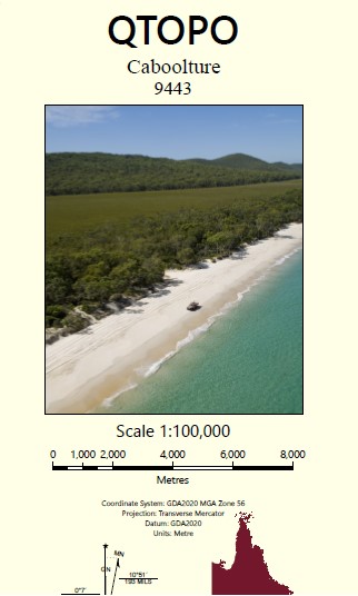
Caboolture 1-100,000 Topographic Map
Price range: $15.95 through $27.95
Description:
Caboolture 1-100,000 Topographic Map 9443 Now Print on Demand
Locations within this Map
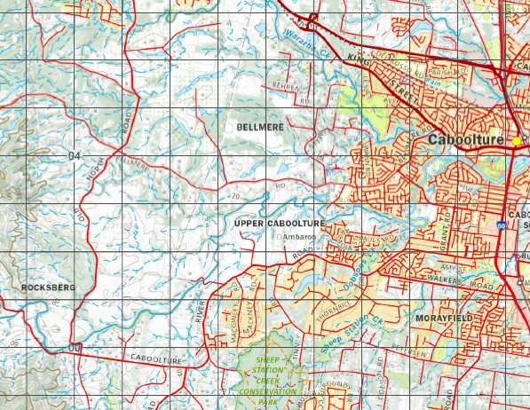
Loganview River View Bellevue Glenidol Guna-Doo Tree View Lawson Kiekut Carrawin Stud Greenwood Mataranka Roseleigh Farm Oakvale Bracalba Juruga Mons Man Ambaroo Silverton Hillview Farm Mount Byron Rosslea Downs Maylands Rivervale Lakeview Riverdale Langsdale Winton Vale Kebblestone Kanahie Glenwood Monreid Stud The Pines Talungra Robenlea Alverley Rockville The Cedars Hush Valley Illouera Glenhaven Rainy-Doo Charmouth Willow Glen Yallambie Yarral Yarral Windermere Parkdale Westerngale Glenbuntly Tanderra Alcheringa Copper Hill Stud Coominya Oatlands Cushleva Kupidabin Roseborough Lucerne Park Rathcool Attunga Pinevale Karrahbil Morilla Lasswape The Brooks Allandale Harrodglen Brightview Gorah View Range View Noogoora Ben Varden Burpengary Caboolture Dayboro Fernvale Lowood Morayfield Mount Nebo Narangba Samford Wamuran Albany Creek Antibidawa Creek Apel Inlet Armstrong Creek Atkinson Crossing Auchenflower Banks Creek Banks Creek Left Branch Banks Creek Middle Branch Banks Creek Right Branch Bauer Point Baxter Creek Beam Creek Beerburrum Creek Bellevue Bay Bergin Creek Bigges Crossing Bigges Peninsula Billies Bay Billies Crossing Black Snake Creek Bonney Gully Mount Boorran Boundary Gully Bowman Branch Creek Bray Park Brightview Weir Brisbane Forest Park Mount Brisbane Brough Point Browns Creek Buaraba Creek Bull Creek Bungo Creek Bunya Bunya Crossing Bunyaville Burnett Bush Paddock Creek Butcher Shop Creek Byron Byron Creek Byron Gully Cabbage Tree Creek Cabbage Tree Creek East Branch Cabbage Tree Range Caboolture River South Branch Cameron Crossing Camp Mountain Canning Carl Creek Carrs Island Carver Hill Cashs Crossing Catarrh Creek Cedar Creek Centipede Creek Central Gully Changing Mountain Clear Mountain Conroys Cove Conroys Point Constitution Hill Mount Coot-Tha Copley Gully Cormorant Bay Costello Gully Crowe Point Culvert Creek Cundoot Creek D’Aguilar Range Mount D’Aguilar Dakabin Dandys Knob Dandys Range Davis Bay Dawson Creek Deception Point Deep Creek Delaney Creek Mount Delaney Dianas Bath Dixon Dobsons Crossing Dorrington Drapers Crossing Dry Creek Dundas Durundur Hill East Ithaca Creek Eatons Crossing Eatons Hill Elimbah Eliza Creek England Creek England Creek Left Branch England Creek Right Branch Mount England Enoggera Enoggera Hill Enoggera Reservoir Fahey Range Faheys Crossing Fairnie Brook Fairnie Lawn Ferny Grove Ferny Gully Finneys Hill Fish Creek Five Mile Creek Five Mile Water Flagstone Creek Forbes Creek Friedrich Peninsula Gap Creek Gaythorne Glennies Crossing Mount Glorious Gold Creek Gold Creek Reservoir Goong Creek Mount Goonneringerringgi Gordons Crossing Grovely Harris Point Hays Crossing Hernandia Hill Hill End Hills Lagoon Hills Peninsula Hine Peninsula Horse Mountain House Mountain Range Indooroopilly Ironside Ithaca Creek Ithaca Falls J C Slaughter Falls Jacky Creek Jollys Lookout Joyners Jubilee Kayes Rock Keperra Kholo Kilcoy Creek Kilner Creek Kipper Creek Kobble Creek Kobble Creek North Branch Kobble Creek South Branch Mount Kobble Kroll Peninsula Lake Kurwongbah Laceys Creek Lagoon Creek Lawnton Mount Lawson Leitchs Crossing Litherlands Crossing Little Mount Brisbane Lockyer Creek Logan Creek Logan Inlet Loganview Point Loughran Peninsula Love Creek Mackenzie Creek Magpie Creek Malts Gully Lake Manchester Marshall Island May Creek Mount McConnel McFarlanes Pocket McGraths Bay McKey Hill Mount Mee Mermaid Mountain Middle Creek Middle Inlet Mount Miketeebumulgrai Mitchelton Moioo Bay Moioo Creek Monreid Point Moodlu Moombra Bay Mosquito Creek Mount Samson Creek Mount Samson Range Murrumba Island North North Neurum Creek Northbrook North Brook Northbrook Creek Northbrook Inlet Mount O’Reilly O’Shea Creek O’Sheas Flat Oakey Flats Oaky Creek Oaky Creek North Branch Oaky Creek South Branch One Mile Creek Oxford Park Paddy Gully Paddys Inlet Page Gully Pakleppa Point Parker Patricks Crossing Peewee Bend Petrie Picnic Mountain Pine Pine Creek Pine Hill Plain Creek Platypus Cliffs Mount Pleasant Pryde Creek Quinns Crossing Rainworth Raynbird Creek Redman Creek Reedy Creek Robenlea Point Rockville Point Rosalie Rose Creek Round Mountain Rush Creek Sahl Samford Creek Mount Samson Samsonvale Lake Samsonvale Sandy Creek Savages Crossing Sawyer Creek School Gully Scrubby Gully Shaw Gully Sheep Station Creek Sheep Station Creek East Branch Sheep Station Creek West Branch Sheep Station Inlet Sideling Creek Silverton Creek Sim Jue Creek Mount Sim Jue Simpsons Falls Six Mile Creek Somerset Dam Lake Somerset Mount Somerset South Wararba Creek Split Yard Creek Splitters Creek North Branch Splitters Creek South Branch Splityard Creek Dam Spring Creek St John St Johns Wood Stanley Gully Stanley Island Stanley River Stony Creek Strattons Creek Tarampa Taringa Taylor Range Tea Tree Creek Tea Tree Inlet Tenison Woods Mountain Terrors Creek The Basin The Bishops Paddock The Bulls Knob The Knobby The Pinnacle The Prickly Ridges The Saddleback The Summit The Wash Pool Tillouren Creek Toowong Toowong Creek Toowong Reach Tulungra Inlet Tulungra Promontory Uhrs Creek Varleys Cove Varleys Hill Wararba Wararba Creek Warner Wash Pool Knoll Watson Peninsula West Ithaca Creek Wettenhall Whiteside Whitfield Point Witton Creek Wivenhoe Wivenhoe Hill Lake Wivenhoe Wolfs Creek Wongam Creek Wyangy Creek Yebri Creek Yellow Creek Youngs Crossing Zillman Creek Zillmans Crossing Mount Hancock Tooloorum Range Wonga Creek Annand Range Mount Baxter Strathpine Byron Creek Conservation Park Freshwater National Park Sheep Station Creek Conservation Park Waraba Creek Conservation Park O’Briens Point Gregors Creek Torwood Banks Creek Brisbane City England Creek Brisbane City Lake Manchester Brisbane City Brookfield Kenmore Hills Mount Mee State Forest Bunyaville Forest Reserve Samford Forest Reserve Clear Mountain Forest Reserve 1 Clear Mountain Forest Reserve 2 Enoggera Forest Reserve Mount Glorious Forest Reserve Samsonvale Forest Reserve Mount Elphinstone Ashgrove Bardon The Gap Brisbane City Bridgeman Downs Upper Brookfield Deer Reserve National Park Alderley D’Aguilar National Park Everton Park McDowall Upper Kedron Chapel Hill Banks Creek Somerset Regional Council Brightview Somerset Regional Council Bryden Clarendon Cooeeimbardi Crossdale England Creek Somerset Regional Council Fairney View Hazeldean Lake Manchester Somerset Regional Council Patrick Estate Rifle Range Vernor Westvale Wivenhoe Pocket Arana Hills Bellmere Brendale Caboolture South Cashmere Cedar Creek Moreton Bay Regional Council Closeburn Delaneys Creek Draper Campbells Pocket Everton Hills Ferny Hills Highvale Joyner Kallangur King Scrub Kurwongbah Moorina Mount Pleasant Moreton Bay Regional Council Ocean View Rocksberg Samford Valley Samford Village Upper Caboolture Wamuran Basin Wights Mountain Yugar Shine Gully Elimba Wanuran Bootawa Waraba Creek Leacy Creek Murrumba Armstrong Wivenhoe Dam Pad Gully Kobble DAguilar Range Samson Vale Pine River Dam Harrisons Pocket Sidling Creek Mount DAguilar DAguilar National Park Billies Creek Yugar Siding Mount OReilly Wongun Ithaca Fairneyview Fairney Brook Fairney Brook Creek Mount Coot-tha Park Mount Cootha Toowoong West End Tarampa Flat Saint Lucia
| Name: | 9443 |
| Publisher: | Queensland Government |
| Scale: | 1:100,000 |
| Latitude Range: | 27° 00.0′ S – 27° 30.0′ S |
| Longitude Range: | 152° 30.0′ E – 153° 0.0′ E |
| Projection / Datum: | Universal Transverse Mercator, GDA 94 |
| Approx Print Size: | 0.56m X 0.56m |