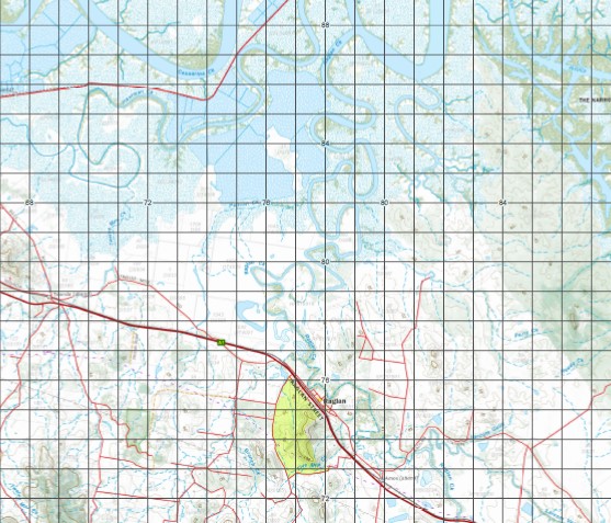
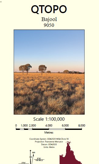
Bajool 1-100,000 Topographic Map
Price range: $15.95 through $30.95
Description:
Locations within this Map
Glendale Willbrook Yandes Bryntege Fernleigh Fern Hills Lucerne Vale Prior Park Langmorn Westly The Meadows Pomegranate Roma Roseneath Ayrdrie Mount Larcom Alligator Creek Alligator Passage Mount Alma Port Alma Ambrose Amos Archer Bajool Balaclava Balaclava Island Barramundi Creek Mount Bennett Bens Knob Besch Creek Beschs Hill Black Mountain Bloodwood Creek Bobs Creek Mount Bomboolba Botany Point Bottle Tree Hill Boulder Creek Boundary Creek Bracewell Branch Creek Bronzewing Sand Bull Creek Bullock Creek Bunyip Point Butchers Corner Camp Creek Cardigan Point Casuarina Casuarina Creek Casuarina Island Cattle Creek Cecil Cecilwood Cedar Vale Cedric Mountain Chersonese Point Clay Creek Cleveden Connor Creek Cook Creek Copper Creek Creekside Cunningham Waterhole Curlew Spit Dart Creek Datum Point Deas Thompson Dee Range Despair Creek Mount Despair Digger Creek Dingo Creek Dingo Gully Dinky Point Dranes Creek Dunlop Island Egg Island Egg Sand Eight Mile Creek Epala Mount Erebus Eulimbi Swamp Eupatoria Point Ewart Creek Expectation Creek False Point Fitzroy River Five Mile Creek Four Mile Creek Francis Sand Friday Creek Gayden Point Mount Gelobera Mount Gindiwarra Ginger Creek Glue Pot Creek Goat Hill Gonong Creek Grass Tree Creek Gravel Creek Gridiron Halfway Creek Mount Harper Haynes Spit Mount Helen Henry Creek Mount Holly Hook Sand Mount Hopeful Horrigan Creek Horseshoe Lagoon Humbug Point Humpy Creek Hut Creek Iguana Point Inkerman Creek Mount Isabel Jacks Island Jacobs Creek Kamiesh Passage Kangaroo Creek Kazatch Point Kelly Creek Mount Kelly King Solomon Spur King Waterhole Langmorn Creek Larcom Gully Larcom Vale Creek Ledge Point Limestone Creek Limestone Hill Little Horrigan Creek Little Scrubby Creek Machine Creek Mackenzie Island Mackenzie Sand Manton Manton Creek Marble Creek Marble Mountain Marmor Mount McCamley McGinley Creek McLean Creek Middle Channel Middle Creek Middle Sand Midgee Midgee Creek Mistake Creek Monday Creek Mosquito Island Mount Alma Range Mount Larcom Range Mud Island Nolan North Passage North Pimple Noys Corner Oaky Creek Obstruction Banks Ogg Creek Oswestry Rock Paddy Creek Pelican Creek Perry Creek Pile Point Pirate Point Plews Mount Plumtree Poison Creek Pomegranate Creek Prospect Creek Pugh Sand Raglan Raglan Cave Raglan Creek Redan Range Reedy Creek Roberts Banks Rocky Point Rocky Point Reach Rundle Rundle Beach Rundle Range Rundle Spit San Jose Sandfly Hillock Sandfly Island Satellite Channel Satellite Island Saurian Point Scorrier Hill Scrub Creek Scrubby Creek Scrubby Gully Sea Reach Serpentine Creek Shell Point Shelly Knob Shepherd Creek Shoal Islands Sisalana Six Mile Creek South Head Shoal South Hill Spring Creek St Arnaud Creek Station Creek Stockyard Creek Swan Creek Tait Island Tchernaya Creek Tea Creek Ten Mile Creek The Peak The Rocky Waterhole Thunder Island Toonda Toonda Waterhole Trough Springs Twelve Mile Creek Two Mile Creek Ulam Range Ulogie Ultimo Umbrella Gully Vallis Creek Wagtail Sands Mount Wendy West Arm Point Whip Creek Wilmot Lagoon Winding Reach Woods Point Zamia Knob Parker Passage Rundle Range National Park Rundle Range Resources Reserve Darts Creek The Narrows Mackenzie Island Conservation Park Port Curtis Camara Creek Carbrook Creek Dakkabin Creek Little Larcom Vale Creek Tarrawill Creek Whiptail Creek Pilba Gully Pyburra Gully Zebu Gully Broadmount West Arm Hill Sea Hill Point Midgee Sidings Egg Rock Flat Island Bob Creek Oakey Creek Archer Siding Balaklava Island Twelve Creek Amos Quarries Mount Camley Larcom Gelobera Range Bald Hill Pomegranite Creek Lancefield
| Name: | Bajool 9050 |
| Publisher: | Queensland Government |
| Scale: | 1:100000 |
| Latitude Range: | 23° 30.0′ S – 24° 00.0′ S |
| Longitude Range: | 150° 30.0′ E – 151° 0.0′ E |
| Projection / Datum: | Universal Transverse Mercator, GDA 94 |
| Approx Print Size: | 0.56m X 0.56m |