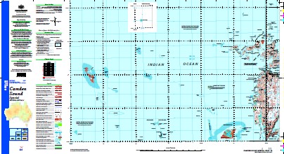
Camden Sound 1-250,000 Topographic Map
$15.95 – $27.95
Description:
Print on Demand
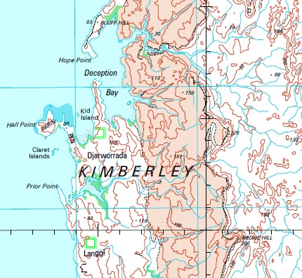
Beagle Reef Mavis Reef Adele Island Adele Island Shoal Albert Reef Atrina Island Barron Banks Battery Point Black Rocks Bluff Hill Booby Island Brue Reef Buckland Point Bumpus Island Byam Martin Island Calliance Reef Camden Sound Cape Mollien Challis Rocks Champagny Island Champagny Islands Churchill Reef Claret Islands Cockell Bank Cockell Reefs Conway Island Crabbe Island Cymo Island Darcy Island Deception Bay Degerando Island Denman Shoal Dingo Reef Djarumu Island Djarworrada Community Etisus Island Fox Shoal Fraser Inlet Freshwater Cove Frost Shoal Gibbings Reefs Hall Point Heywood Island Heywood Islands High Cliffy Islands Hope Point Hull Bank Jangawarnanya Creek Jangawarnanya Inlet Jolialgum Creek Jungulu Island Kannamatju Island Kid Island King Island Langgi Lena Reef Lizard Island Lorikeet Shoal Lucas Island Lulim Island Macleay Island Macleay Islands Marndungum Island Mcintyre Island Miawaja Island Montgomery Islands Montgomery Reef Needle Rock Ngalanguru Island Niblock Rocks Nicolle Reef North Breaker Numanbu Island Okenia Island Orange Shoal Osborn Reefs Parin Peninsula Prior Point Pyrene Island Rainbow Shoals Red Island Reyne Shoal Rice Rocks Rosella Shoal Sampson Inlet Scobell Rocks Slate Islands South Breaker South Entrance South Wailgwin Island Sweeney Patches Tasmanian Shoal The Breakwater Thorne Reef Violet Shoal Vulcan Island Vulcan Islands Wailgwin Island Wildcat Reefs Wilson Point Winjingaribatbatgun Spring Winmiri Wulajarlu Island Yawajaba Island White Island White Islet Lucas Islet Red Islet Vulcan Islets Dingo Shoal Beagle Cay Reef Beagle Bank Degerando Islet New Island New Islet Bumpus Islet Slate Islets Marvis Reef Kid Islet Claret Island Thorne Reefs Thorn Reef Gibbing Reefs McIntyre Islet
| Name: | Camden Sound Special |
| Publisher: | Geoscience Australia (Australian Government) |
| Scale: | 1:250000 |
| Latitude Range: | 15° 00.0′ S – 16° 0.0′ S |
| Longitude Range: | 123° 0.0′ E – 124° 30.0′ E |
| Projection / Datum: | Universal Transverse Mercator, GDA94 |
| Approx Print Size: | 0.44m X 0.67m |
| Publication Date: | 1-Jun-03 |


